
Muirhouses


Temporary Camp (Roman)
Site Name Muirhouses
Classification Temporary Camp (Roman)
Alternative Name(s) Drum; Holland Cottage; Antonine Wall
Canmore ID 49524
Site Number NT08SW 12
NGR NT 01662 80683
Datum OSGB36 - NGR
Permalink http://canmore.org.uk/site/49524


- Council Falkirk
- Parish Bo'ness And Carriden
- Former Region Central
- Former District Falkirk
- Former County West Lothian
NT08SW 12 0166 8067
For possible souterrain within the area of this camp, see NT08SW 91.
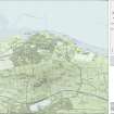
NT 016 807. At Muirhouses a small Roman temporary camp has been identified. The N side, about 425ft long with a central gate, a similar length on both E and W sides, and the two rounded northern angles, showed as faint lines in a cereal crop.
(Visible on CUCAP air photograph ACC 94).
J K St Joseph 1961.
NT 0166 8067. There is nothing visible of this camp on the ground.
Site surveyed at 1:2500 scale from air photograph.
Visited by OS (B S) 12 March 1974.
Additional aerial photographs taken by the RCAHMS in 1979.
(RCAHMS WL 2015-17).
Information from OS Archaeology Branch records [1979].
Scheduled as 'Antonine Wall, Roman temporary camp 105m NNW of Holland Cottage... the buried remains of a Roman temporary camp, visible on oblique aerial photographs as cropmarks of its perimeter ditch.'
[Dated to mid-2nd century AD, and associated with the construction of the Antonine Wall and of Carriden fort (NT08SW 7.00)].
Information from Historic Scotland, scheduling document dated 23 November 2010.
Aerial Photographic Interpretation (1961)
NT 016 807. At Muirhouses a small Roman temporary camp has been identified. The N side, about 425ft long with a central gate, a similar length on both E and W sides, and the two rounded northern angles, showed as faint lines in a cereal crop.
J K St Joseph 1961; Visible on CUCAP air photographs ACC 94.
Aerial Photography (1968)
Field Visit (12 March 1974)
NT 0166 8067. There is nothing visible of this camp on the ground.
Site surveyed at 1:2500 scale from air photograph.
Visited by OS (B S) 12 March 1974.
Note (1978)
Muirhouses NT016 807 NT08SW 12
Listed as a temporary camp.
RCAHMS 1978
(St Joseph, 1961, 122)
Aerial Photography (31 July 1979)
Aerial Photography (1979)
Additional aerial photographs taken by the RCAHMS in 1979.
Visible on RCAHMS air photographs WL 2015-17.
Aerial Photographic Transcription (9 March 1994)
An aerial transcription was produced from oblique aerial photographs. Information from Historic Environment Scotland (BM) 31 March 2017.
Publication Account (2008)
A 1:25000 scale map of the Antonine Wall was published by RCAHMS in 2008. The map shows the course of the Antonine Wall on a modern map base, including areas where the Wall is in public ownership or care and can be visited. The data had been collated as part of the project to prepare maps for the World Heritage Site nomination bid.
Magnetometry (October 2009)
NT 0166 8067 A magnetic survey of the northern part of the camp and its exterior undertaken in October 2009 revealed the camp entrance, the ditch and a strong semi-circular feature of c18m diameter close to the entrance. This last feature, which appears more fully circular in the corresponding aerial photograph, has an apparent internal bank/rampart. Several anomalies were detected immediately to the N of the camp, at least some of which are probably modern.
Richard Jones – Glasgow University
Publication Account (17 December 2011)
The camp at Muirhouses was first recorded from the air by St Joseph in 1960 (St Joseph 1961: 122), on fairly level ground just west of the village of Muirhouses. The Antonine Wall runs somewhere to the north of this camp, but its exact course here is unknown. The Roman fort of Carriden lies about 900m to the east.
The NNE side and parts of the WNW and ESE sides have been recorded through cropmarks. Although the SSW side has not been recorded, it is likely that Acre Road represents the perimeter on this side, as the road bends slightly to take in both likely corner angles. The camp measures around 162m from NNE to SSW by 137m transversely, enclosing an area of almost 2.2ha (5.4 acres). There is no definite trace of an entrance on the NNE side, but a possible entrance gap is located just north of the centre of the NNW side. St Joseph recorded a titulus in the centre of the NNE side in his planof the camp (RCAHMS St Joseph Collection: DC 39398), but this could not be confirmed in the air photographs.
R H Jones.

