Pricing Change
New pricing for orders of material from this site will come into place shortly. Charges for supply of digital images, digitisation on demand, prints and licensing will be altered.
Upcoming Maintenance
Please be advised that this website will undergo scheduled maintenance on the following dates:
Thursday, 9 January: 11:00 AM - 3:00 PM
Thursday, 23 January: 11:00 AM - 3:00 PM
Thursday, 30 January: 11:00 AM - 3:00 PM
During these times, some functionality such as image purchasing may be temporarily unavailable. We apologise for any inconvenience this may cause.
Kinneil
Fortlet (Roman)
Site Name Kinneil
Classification Fortlet (Roman)
Alternative Name(s) Antonine Wall
Canmore ID 48135
Site Number NS98SE 15
NGR NS 9774 8037
Datum OSGB36 - NGR
Permalink http://canmore.org.uk/site/48135
- Council Falkirk
- Parish Bo'ness And Carriden
- Former Region Central
- Former District Falkirk
- Former County West Lothian
NS98SE 15 9774 8037
See also NS98SE 82.00.
NS 977 803. Following discoveries of Roman pottery by Cumbernauld Hist Soc, excavation in 1978 and 1979 revealed the remains of a fortlet attached to the Antonine Wall.
It measures internally c18m E-W by c21m within a plough damaged, 3.0m wide, stone-based rampart. This was best preserved at the N gate and NE corner and it was bonded with the Wall. The upper ramparts of fortlet and Wall, of earth revetted by turf cheeks, were also of one build. The N gate was 3.5m wide with a rammed pebble road running through it; a single post-hole was located on its W side. Towards the E side was a stone culvert, some capstones of which remained in position. There was at least one defensive ditch, 1.8m wide and 70cm deep, located only on the S side; the berm here was c 9.5m wide.
L J F Keppie and J J Walker 1979; R Goodburn 1979.
NS 9774 8037. The excavation has been backfilled and there is no evidence of the fortlet on the ground.
Further trenching in June 1980 revealed the ditch system of two shallow ditches around three sides of the fortlet. There was no wing wall.
Visited by OS (M J F), 30 June 1980.
Following further excavations in 1981, which located internal evidence of two timber buildings and a 3m deep pit (Cannell and Radley 1981) the site has now been laid out for permanent display by Falkirk District Council as part of a country park (Information from F Murray, Falkirk Museum).
Site surveyed at 1:2500.
J Cannell and A Radley 1981; Visited by OS (J R L) 22 March 1982.
Scheduled (with NS98SE 82.00) as part of 'Antonine Wall and fortlet, 430m E to 850m WSW of Kinneil House... a stretch of the Antonine Wall surviving as a combination of buried deposits and visible earthworks located through aerial photography, geophysical survey and... excavation at several points along its line.'
Information from Historic Scotland, scheduling document dated 25 June 2010.
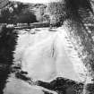
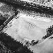
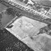
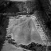
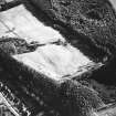
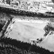
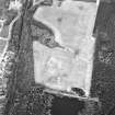
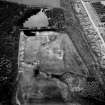
Aerial Photography (11 July 1951)
Aerial Photography (27 July 1963)
Aerial Photography (31 July 1975)
Excavation (1978 - 1979)
NS 977 803.
Following discoveries of Roman pottery by Cumbernauld Hist Soc, excavation in 1978 and 1979 revealed the remains of a fortlet attached to the Antonine Wall. It measures internally c18m E-W by c21m within a plough damaged, 3.0m wide, stone-based rampart. This was best preserved at the N gate and NE corner and it was bonded with the Wall. The upper ramparts of fortlet and Wall, of earth revetted by turf cheeks, were also of one build. The N gate was 3.5m wide with a rammed pebble road running through it; a single post-hole was located on its W side. Towards the E side was a stone culvert, some capstones of which remained in position. There was at least one defensive ditch, 1.8m wide and 70cm deep, located only on the S side; the berm here was c 9.5m wide.
L J F Keppie and J J Walker 1979; R Goodburn 1979.
The seventh fortlet (see also NS98SE 15 and NS57SW 50) to be discovered on the Antonine Wall was located and examined and was very similar to that at Seabegs (NS87NW 10). The upper ramparts of the fortlet and the Wall, of earth revetted by turf cheeks, were also built of one.
R Goodburn 1979.
Subsequent trial excavations in 1978-80 (Keppie and Walker 1981) proved the existence of Kenneil fortlet (NS98SE 15) at this location, attached to the Antonine Wall. A 30m length of the Antonine Wall was systematically stripped of topsoil. A further 11m of the Wall's S kerb only was exposed to the E of this. The Rampart was of normal construction for this sector, consisting of a foundation of dressed kerbstones infilled with rubble, set directly onto the natural clay and gravel and surmounted by a superstructures of brown-red clay loam revetted with turf or clay cheeks (see also Robertson, Scott and Keppie 1975). The Wall varied from 4.2m to 4.3m in width over the excavated length. Individual kerbstones, though widely varied in size, averaged 0.4m long at the exposed face, sitting 0.2m proud of the subsoil. There was a distinct lateral variation in the size and composition of the material used in the core (i.e. rubble fill consisted of large angular sandstone slabs to the W of the north gate and small boulders E of the gate), which indicates that it was derived from a number of different sources. Also a broken quern stone of native form was incorporated into the rubble core. There was no break in the stonework between the Antonine Wall and the E rampart of the fortlet. However, within the base of the Wall, there was an alignment of stones running at right angles from the N kerb towards the centre of the fortlet rampart on line with the S kerb of the Antonine Wall. The stones were arranged to form a fair or regular face along their western edge. This may indicate demarcation lines where there was a change in work gangs, also paralleled at other excavations (Keppie and Breeze 1981). Survival of the earth and turf or clay superstructure was fragmentary. E of the north gate, up to 0.4m of the superstructure survived, though slumping and disturbances had been severe. Finds sealed by the collapse superstructure of the Wall include quantities of Black-burnished ware and two amphora rims from beyond the N kerb. A quantity of butchered cattle bone and a decorated bronze harness strap junction were found in the disturbed material in the interior.
Three small trenches were placed across the S lip of the Ditch. None of these trenches were fully bottomed, excavation stopping when the position of the Ditch edge had been confirmed in each case. There is no sign of a causeway across the Ditch associated with the fortlet's N gateway. The berm between the Wall and Ditch varied from a narrow 4m in the E trench, to 8.4m in the W trench. Similarly as the berm broadens so the Ditch narrows.
G B Bailey and J Cannel 1996
A S Robertson, M Scott and L Keppie 1975; L J F Keppie and D J Breeze 1982; L J F Keppie and J J Walker 1981.
Field Visit (30 June 1980)
NS 9774 8037. The excavation has been backfilled and there is no evidence of the fortlet on the ground.
Visited by OS (M J F) 30 June 1980.
Field Visit (30 June 1980)
Further trenching in June 1980 revealed the ditch system of two shallow ditches around three sides of the fortlet. There was no wing wall.
Visited by OS (M J F) 30 June 1980.
Excavation (September 1980 - May 1981)
Further excavations in 1980 and 1981, located internal evidence of two timber buildings and a 3m deep pit (Cannell and Radley 1981).
Field Visit (22 March 1982)
Following further excavations in 1981, which located internal evidence of two timber buildings and a 3m deep pit (Cannell and Radley 1981) the site has now been laid out for permanent display by Falkirk District Council as part of a country park (Information from F Murray, Falkirk Museum).
Site surveyed at 1:2500.
Visited by OS (J R L) 22 March 1982
Ground Survey (22 March 1982)
Following further excavations in 1981, which located internal evidence of two timber buildings and a 3m deep pit (Cannell and Radley 1981) the site has now been laid out for permanent display by Falkirk District Council as part of a country park (Information from F Murray, Falkirk Museum).
Site surveyed at 1:2500.
Visited by OS (J R L) 22 March 1982
Photographic Record (6 August 1983)
Publication Account (1985)
In the Country Park at Kinneil House, a fortlet and a short stretch of the Antonine rampalt have been partially reconstructed. The fortlet was only discovered in 1977 and has subsequently been excavated, showing that the interior measured 21m from north to south by 18m transversely within a bank 3m thick. Like the Antonine Wall, the bank around the fortlet was built on a stone base, but, instead of being constructed entirely of turves, it had an earthen core revetted by turf.
There were two entrances, one on the north leading through the Antonine Wall, and a second on the south, connecting the fortlet to the Military Way (not visible). Within the interior, and now marked by short wooden uprights, there were the traces of post-holes, which formed two timber buildings used to house the garrison, as well as the remains of stout gateways at the two entrances. Outside the fortlet further protection was provided by a shallow ditch which abutted the Wall on the east and west.
Besides the better known and much larger faits attached to the rear of the Antonine Wall, there is also a series of smaller fortlets, to which Kinneil belongs. Some nine have been discovered so far but it is likely that they were originally placed at intervals of about 1.6km along the entire length of the Wall. Their precise function is not known but, on plan at least, they appear to be equivalent to the milecastles along Hadrian's Wall.
Information from ‘Exploring Scotland’s Heritage: The Clyde Estuary and Central Region’, (1985).
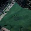
Magnetometry (27 May 2008 - 13 June 2008)
NS 97750 80380 (fortlet) – NS 98100 80500 (medieval church environs).
Fortlet area: The Antonine Ditch and Rampart have been detected by both techniques, but the anomalies become less coherent in the western half of the site; this ties in with excavation results which reported increased levels of damage to features (particularly the rampart) around the western half of the fortlet. The outline of the fortlet rampart can be partly traced in the resistance data and the surrounding ditch has produced relatively coherent magnetic anomalies. Although some anomalies of possible
interest are present within and immediately adjacent to the fortlet, poor definition makes an archaeological interpretation tentative.
Medieval church / village environs: The many phases of land use at this site (Roman, Medieval, Post Medieval, modern) have given rise to somewhat confusing geophysical results. The Antonine Ditch has been detected, but the anomalies are neither characteristic nor definitive. No anomalies consistent with the Rampart have been identified and their absence has made it impossible to clarify the exact line of the Wall at the eastern end of the site, where a possible deviation from the published line has been
suggested. An enclosure round the churchyard has been located, appearing most clearly in the magnetic results. Outside of this, several anomalies, primarily in the resistance data, may be associated
with medieval settlement, but could equally have been produced by more recent landscaping of the site.
C. Stephens
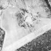
Resistivity (27 May 2008 - 13 June 2008)
NS 97750 80380 (fortlet) – NS 98100 80500 (medieval church environs).
Fortlet area: The Antonine Ditch and Rampart have been detected by both techniques, but the anomalies become less coherent in the western half of the site; this ties in with excavation results which reported increased levels of damage to features (particularly the rampart) around the western half of the fortlet. The outline of the fortlet rampart can be partly traced in the resistance data and the surrounding ditch has produced relatively coherent magnetic anomalies. Although some anomalies of possible
interest are present within and immediately adjacent to the fortlet, poor definition makes an archaeological interpretation tentative.
Medieval church / village environs: The many phases of land use at this site (Roman, Medieval, Post Medieval, modern) have given rise to somewhat confusing geophysical results. The Antonine Ditch has been detected, but the anomalies are neither characteristic nor definitive. No anomalies consistent with the Rampart have been identified and their absence has made it impossible to clarify the exact line of the Wall at the eastern end of the site, where a possible deviation from the published line has been
suggested. An enclosure round the churchyard has been located, appearing most clearly in the magnetic results. Outside of this, several anomalies, primarily in the resistance data, may be associated
with medieval settlement, but could equally have been produced by more recent landscaping of the site.
C. Stephens
Publication Account (2008)
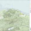
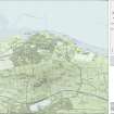
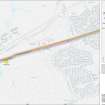
A 1:25000 scale map of the Antonine Wall was published by RCAHMS in 2008. The map shows the course of the Antonine Wall on a modern map base, including areas where the Wall is in public ownership or care and can be visited. The data had been collated as part of the project to prepare maps for the World Heritage Site nomination bid.
Excavation (2011)
NS 977 803 and NS 975 801 A series of trenches designed to pick up the spur road heading S from the fortlet at Kinneil found evidence for extensive landscaping in the late 18th century. Farther S, on the supposed line of the Military Way, excavation demonstrated that the known road was not Roman, but was also 18th century. It is now assumed that the Roman road lay adjacent to the Antonine Wall in this area.
Archive: Falkirk Museum
Funder: Falkirk Local History Society and EAFS
Falkirk Community Trust


