
Pricing Change
New pricing for orders of material from this site will come into place shortly. Charges for supply of digital images, digitisation on demand, prints and licensing will be altered.
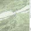
Garnhall


Temporary Camp (Roman)
Site Name Garnhall
Classification Temporary Camp (Roman)
Alternative Name(s) Garnhall 2
Canmore ID 45836
Site Number NS77NE 30
NGR NS 78011 77878
NGR Description Centre
Datum OSGB36 - NGR
Permalink http://canmore.org.uk/site/45836


- Council North Lanarkshire
- Parish Cumbernauld
- Former Region Strathclyde
- Former District Cumbernauld And Kilsyth
- Former County Dunbartonshire
NS77NE 30 78030 77900
There is a small, roughly circular cropmark within the area of this camp (see NS77NE 31 & 22).
Information from RCAHMS May 1981.
There is no surface trace of this camp across arable fields.
Visited by OS (JRL) 14 May 1981.
NS 780 779. Excavations revealed a 'V' profiled ring ditch 24m in internal diameter (28m external), immediately S of the Antonine Wall and inside this large temporary camp. Inside it, a post hole structure 4.1m sq was set on a lightly metalled clay platform and associated with four fragments of Roman glass, two of which were bangle fragments of Antonine date. The ring ditch slightly pre-dated the building of the Wall itself but the structure may be a signal/watch tower associated with it, since its location is the only position able to see, and so link, the forts of Castlecary and Westerwood. A metalled track led S from the internal structure to the Military Way.
Excavations to the W of the ring feature traced the intersection of the Wall with the temporary camp defences, the camp ditch had been cut through a layer of turf slip from the Wall and thus post dated it. The camp may therefore be Severan or associated with the later Antonine re-occupation. Just to the E of this, traces of a secondary stone platform were located.
In the field to the E of the main site, a further ring feature, visible as a surface feature, was found to be a relatively modern clay pit.
Elsewhere on the site, both the Antonine Wall and the Military Way were found in excellent preservation, with the road a little S of the OS line. Indeed, despite a long history of ploughing, up to four layers of turf were found on the Wall base in places and three culverts were located, one of which was completely intact, with its cap stones still in place.
Sponsor: University of Manchester, Soc Ants Scot.
D J Woolliscroft 1994.
NS 780 779 A small trench opened to the S of the site confirmed its identity as a Roman tower (Woolliscroft 1994) sitting just to the S of the Antonine Wall inside its own ring ditch and linked by a track to the Military Way to its S.
Sponsors: University of Manchester and Soc Ants Scot.
D J Woolliscroft 1995.
Further work identified the last four post-holes supporting a square tower and clarified the alignment of a metalled track linking it to the military way.
L J F Keppie 1996.
Aerial Photography (14 July 1955)
Aerial Photography (2 August 1956)
Aerial Photography (17 July 1961)
Field Visit (14 March 1981)
There is no surface trace of this camp across arable fields.
Visited by OS (JRL) 14 May 1981.
Note (1982)
Garnhall 2, Temporary Camp NS 780 779 NS77NE
This camp, which is situated immediately W of the site of Garnhall farmhouse, was identified from cropmarkings. Only 300m of the S side and some 90m of the W side, together with the rounded angle between them, have so far been recorded, but it appears likely that the camp extends to the N of the Antonine Wall and is therefore earlier than it.
RCAHMS 1982
(St Joseph 1965, 80)
Excavation (1994)
NS 780 779. Excavations revealed a 'V' profiled ring ditch 24m in internal diameter (28m external), immediately S of the Antonine Wall and inside this large temporary camp. Inside it, a post hole structure 4.1m sq was set on a lightly metalled clay platform and associated with four fragments of Roman glass, two of which were bangle fragments of Antonine date. The ring ditch slightly pre-dated the building of the Wall itself but the structure may be a signal/watch tower associated with it, since its location is the only position able to see, and so link, the forts of Castlecary and Westerwood. A metalled track led S from the internal structure to the Military Way.
Excavations to the W of the ring feature traced the intersection of the Wall with the temporary camp defences, the camp ditch had been cut through a layer of turf slip from the Wall and thus post dated it. The camp may therefore be Severan or associated with the later Antonine re-occupation. Just to the E of this, traces of a secondary stone platform were located.
In the field to the E of the main site, a further ring feature, visible as a surface feature, was found to be a relatively modern clay pit.
Elsewhere on the site, both the Antonine Wall and the Military Way were found in excellent preservation, with the road a little S of the OS line. Indeed, despite a long history of ploughing, up to four layers of turf were found on the Wall base in places and three culverts were located, one of which was completely intact, with its cap stones still in place.
Sponsor: University of Manchester, Soc Ants Scot.
D J Woolliscroft 1994.
Excavation (1994)
NS 780 779 A small trench opened to the S of the site confirmed its identity as a Roman tower (Woolliscroft 1994) sitting just to the S of the Antonine Wall inside its own ring ditch and linked by a track to the Military Way to its S.
Sponsors: University of Manchester and Soc Ants Scot.
D J Woolliscroft 1995.
Further work identified the last four post-holes supporting a square tower and clarified the alignment of a metalled track linking it to the military way.
L J F Keppie 1996.
Publication Account (2008)
A 1:25000 scale map of the Antonine Wall was published by RCAHMS in 2008. The map shows the course of the Antonine Wall on a modern map base, including areas where the Wall is in public ownership or care and can be visited. The data had been collated as part of the project to prepare maps for the World Heritage Site nomination bid.
Publication Account (17 December 2011)
The remains of two camps at Garnhall were discovered from the air by St Joseph, the first in 1952, with a second, nearby, recognised as a camp in the early 1960s (St Joseph 1955: 86; 1965: 80). A third camp lies nearby at Tollpark (St Joseph 1951a: 62). The camps lie to the south of the Antonine Wall, between the forts of Castlecary and Westerwood, near the farm at Garnhall.
The ground on which both camps lie slopes gradually from west to east towards the Red Burn, across from which lies the fort of Castlecary. Both lie in areas of former agricultural fields now subject to considerable development, camp I on land formerly occupied by Castlecary House, now the village of Castlecary; camp II in improved pasture with the Wardpark North and East Industrial Estates in the immediate vicinity. Both camps have been subject to recent excavation, the former through the gradual development of Castlecary Village; the latter in relation to a research programme looking at potential watchtowers on the Wall, because a circular enclosure is located inside the camp’s perimeter (Woolliscroft 2009).
Camp I measures about 290m from ENE to WSW by around 160m transversely, enclosing an area of some 4.5ha (just over 11 acres), although the final size cannot be determined with certainty, partly owing to problems with transcription of the cropmarks (as a result of major landscape changes since the aerial photographs were taken and the need to use less accurately geo-referenced earlier maps), and partly owing to the findings from excavations. An entrance gap has been located on the SSE side, east of centre.
Sections of the camp have been excavated on five occasions, mostly owing to the gradual development of the village. That in 1990 suggested that the southwest corner was farther west than had previously been supposed (Keppie 1990). The results of the various excavations demonstrated that the camp ditch had a fairly typical V-shaped profile, measuring, at best, 1.3m in width and up to 1m in depth (Keppie 1990) and had a single construction phase. A small ditch appears to run due SSE at right angles from the west side of the entrance gap on the SSE side. This was excavated in 1994 and appeared to be contemporary with the camp ditch, the excavator suggesting that it acted as a gully to aid drainage down the slope to the Red Burn (Speller 1994).
The rampart of the camp was not recorded in the excavations, although turves were present in an anaerobic area of ditch in 1994. This area was interpreted as being close to a springhead, causing the waterlogging. The excavator proposed that the presence of turves could be due to possible rampart repairs necessary following subsidence caused by the springhead. This hypothesis was used to argue for possible extended occupation of the camp as a construction camp (Speller 1994: 17). While this argument has much to commend it, the possibility remains that the turves could be present owing to natural erosion, and were preserved in this section because of the boggy conditions.
Camp II is situated some 500m west of camp I. Only parts of two sides, the SSE and WSW, are known of this camp, lying in the two fields west of Garnhall Farm. The SSE side measures at least 300m, and the WSW some 133m before reaching the Antonine Wall. The elongated shape of this camp and the location of shorter WSW side, running up to the Wall and crossing the Military Way, led St Joseph to suggest that the camp probably continued to the north and therefore pre-dated the Wall (1965: 80). No entrances have been located.
In the interior of the camp lies a circular enclosure, excavated in the 1990s and interpreted as a watchtower (Woolliscroft 2009). In addition, a small excavation trench was opened up on the west side of the camp ditch and demonstrated that the ditch was V-shaped, measuring 1.73m in width and 1.27m in depth with the hint of a slot at the base. A trench at the potential intersection of the camp with the Antonine Wall located a rounded butt end terminal that was stratigraphically later than a stone platform protruding south from the Wall. This stone platform itself was later than the initial building phase of the Wall, and was slightly damaged by the construction of the camp, but not then repaired, suggesting that the platform had gone out of use by the time the camp was constructed (Woolliscroft 2009). However, because the function of the platform is uncertain, it is not possible to assess whether the Wall itself was abandoned by the time the camp was constructed, and the possible intersection with the Military Way was not explored. A further trench north of the Wall failed to locate any evidence for the continuation of the camp ditch.
Therefore, camp II post-dates a feature that is secondary to the Wall construction and does not fit in with the series of construction camps for the Antonine Wall. If the camp post-dates the occupation of the Wall, then it could have utilised the rampart of the Wall as its north side although it still represents an unusually elongated shape for a camp. If it represents an enclosure for a body of troops while the Wall was in operation then this begs the question of why a ditch was required, rather than just demarcate the area necessary, because presumably the immediate vicinity south of the Wall was a secure area.
R H Jones
Note (10 February 2022)
The location, classification and period of this site have been reviewed.

