HES Cropmark Rapid Update: Pilot Project
Date September 2021 - July 2023
Event ID 1146264
Category Project
Type Project
Permalink http://canmore.org.uk/event/1146264
A national review of cropmark site records began with a pilot project in the Stirling, Clackmannan and North Lanarkshire council areas undertaken in September and October 2021, and April and May 2022. The main aim of the project was to revise all NRHE cropmark site records within the pilot area, testing a methodology to ensure that all records met and exceeded minimum record standards and are therefore accurate, accessible and usable. The pilot area was chosen as a discrete region with a varied range of cropmark sites in which to test the methodology. The project was managed by Dr Kirsty Millican and the project executive was Dr Dave Cowley.
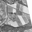
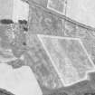
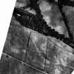
The project made use of material held in the HES archive, primarily oblique aerial photographs, cropmark mapping (transcriptions) and the 1:10,000 Record Sheets maintained by the OS Archaeology Division and subsequently RCAHMS. Other datasets were used where appropriate, all in a QGIS environment. These included vertical aerial photographs (supplied by Getmapping plc), successive iterations of OS Historic maps at 6-inch and smaller scales (supplied by the National Library of Scotland), and current OS raster and digital mapping.
The project involved the desk-based review of 153 site records. Checks were made to classification and period. Location was defined by a site area polygon and a precise National Grid Reference generated from its centre. Where required, oblique aerial photographs were rectified to assist with the definition of site area polygons. Terminology for the classification and date of archaeological sites was drawn from published HES thesauri while site area polygons were created using the Historic Environment Polygonisation Standards (Scotland) technical guidance.
In total, the project reviewed 153 archaeological sites. Some 117 required a change to their classification or period and 65 were digitally mapped for the first time.
The site records in the study area range in period from Neolithic to post medieval, though the most commonly assigned period is ‘period unknown’ (56 site records) reflecting the ambiguity of some of the evidence. This is followed by ‘prehistoric’ (31 site records) and ‘post medieval’ (27 site records). Classifications are equally varied, with the most commonly assigned classifications being ‘enclosure’ (19 site records), ‘palisaded enclosure’ (12 site records) and ‘field boundary’ (12 site records), though site types as specific as ring ditch houses, temporary camps and round barrows are also recognised. Significant Neolithic sites include a pit defined cursus (NS89SW 24), henge (NN60SE 16) and timber hall (NN60NW 57). Reflecting the pattern of the cropmark record in Scotland as a whole, the majority of the site records of prehistoric date are different forms of settlements, most of which are enclosed. Roman remains are also well represented in the study area, with the Antonine Wall, five forts and ten camps. Recognised medieval remains are limited with only nine sites identified. These include rig and furrow, one moated site (NS69NE 20) and a single possible sunken floored building (NS59SE 18). This likely reflects broader difficulties in the recognition of sites of medieval date in the cropmark record, which have proven difficult to separate from prehistoric and post medieval remains. That excavation provided the evidence to assign medieval dates to two enclosures in the pilot area reflects this difficulty; without this evidence both enclosures would likely either have been given a prehistoric date or assigned to period unknown. The post medieval remains include field boundaries, plantation banks, rig and furrow and tracks, reflecting more recent use of the landscape.
The project archive includes the initial spatial dataset before review, quality assurance and peer review (TM002255), the final spatial dataset (TM002256) and some 134 rectified oblique aerial photographs created during the project. Quality assurance was undertaken between November 2022 and January 2023, and the project dataset was entered into the NRHE in June 2023.
Information from HES Archaeological Survey (K Millican), 4 July 2023


