
Tollpark


Temporary Camp (Roman)
Site Name Tollpark
Classification Temporary Camp (Roman)
Canmore ID 45816
Site Number NS77NE 13
NGR NS 77839 77431
NGR Description Centre
Datum OSGB36 - NGR
Permalink http://canmore.org.uk/site/45816


- Council North Lanarkshire
- Parish Cumbernauld
- Former Region Strathclyde
- Former District Cumbernauld And Kilsyth
- Former County Dunbartonshire
NS77NE 13 77830 77420
(NS 77830 77420) Roman Camp (R) (site of)
OS 25" map (1972)
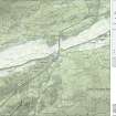
Roman Camp, Tollpark: This camp is situated on a low ridge, 1/4 mile S of the Antonine Wall, about midway between the forts at Westerwood (NS77NE 8) and Castlecary (NS77NE 24). The site is crossed by a dry-stone dyke accompanied by a farm track. The whole course of the ditch has been recorded by Dr St Joseph as crop markings, but the nature of the soil is such that the ditch could not be located readily by probing. The camp measures about 540ft by 420ft within the ditch.
R W Feachem 1956
The W half of the site is occupied by a factory site, the eastern half is under cultivation; no traces are visible on the ground.
Visited by OS (WDJ) 30 April 1959
No traces on the ground, but visible on CUCAP aerial photographs.
Visited by OS (MJF) 27 May 1980
NS 7783 7742 As part of development works an archaeological evaluation and watching brief was carried out during February 1998. The evaluation consisted of a desktop assessment focusing on the area of Tollpark Roman temporary camp (NMRS NS77NE 13), followed by the excavation of four trial trenches to assess the level of remaining archaeological deposits. The trial trenches were placed to transect the line of the temporary camp ditch on its N, S and E sides. The watching brief was undertaken during the construction of a car park to the N of the factory.
The excavations conclusively demonstrated that previous construction work in the area has removed all trace of the archaeological deposits which formerly existed. No other archaeological remains were encountered during either of the fieldwork phases.
Sponsor: Isola Ltd (through Grant Design Ltd).
P Duffy 1998.
Aerial Photography (6 July 1949)
Aerial Photography (13 July 1951)
Field Visit (30 April 1959)
The W half of the site is occupied by a factory site, the eastern half is under cultivation; no traces are visible on the ground.
Visited by OS (WDJ) 30 April 1959
Excavation (1964)
Field Visit (27 May 1980)
No traces on the ground, but visible on CUCAP aerial photographs.
Visited by OS (MJF) 27 May 1980
Note (1982)
Tollpark, Temporary Camp NS 778 774 NS77NE 13
This camp is situated about 500m S of the Antonine Wall and the same distance SE of the site of Tollpark farmhouse. First identified from cropmarks, it measures 165m by 128m (2.1 ha) and was presumably intended to accommodate legionary troops building the Wall.
RCAHMS 1982
(Feachem 1956, 329-30, 335-6)
Watching Brief (February 1998)
NS 7783 7742 As part of development works an archaeological evaluation and watching brief was carried out during February 1998. The evaluation consisted of a desktop assessment focusing on the area of Tollpark Roman temporary camp (NMRS NS 77 NE 13), followed by the excavation of four trial trenches to assess the level of remaining archaeological deposits. The trial trenches were placed to transect the line of the temporary camp ditch on its N, S and E sides. The watching brief was undertaken during the construction of a car park to the N of the factory.
The excavations conclusively demonstrated that previous construction work in the area has removed all trace of the archaeological deposits which formerly existed. No other archaeological remains were encountered during either of the fieldwork phases.
Sponsor: Isola Ltd (through Grant Design Ltd).
P Duffy 1998.
Archaeological Evaluation (March 2005 - June 2006)
NS 776 773 A desk-based assessment and evaluation were carried out between March 2005 and June 2006 in advance of redevelopment at the OKI factory site. Tollpark Roman temporary camp (NS77NE 13) was identified within the site and evaluation trenches subsequently targeted its alignment. The trenches revealed that the ditch survives beneath 1.5 to 3m of modern overburden, and it is sealed by an original ground surface. The N and S arms of the ditch were identified, as was the NW corner and part of the W arm. No other features associated with the camp were identified.
Based on the results of the evaluation and dek-based assessment, a two-phase excavation took place. Phase 1 was conducted between October and December 2005, Phase 2 between March and May 2006. The entire available length of the camp ditch was excavated, approximately 300m. The ditch was typically V-shaped with an intermittent ankle-breaker slot. Soil-stripping in the interior of the camp revealed no features. One piece of worked wood was recovered from the ankle-breaker slot in Phase 2.
Archive to be deposited with NMRS. Report lodged with WoSAS and SMR.
Sponsor: Cumbernauld Retail Park Ltd Partnership.
R White 2006
Archaeological Evaluation (October 2005 - May 2006)
NS 776 773 A desk-based assessment and evaluation were carried out between March 2005 and June 2006 in advance of redevelopment at the OKI factory site. Tollpark Roman temporary camp (NS77NE 13) was identified within the site and evaluation trenches subsequently targeted its alignment. The trenches revealed that the ditch survives beneath 1.5 to 3m of modern overburden, and it is sealed by an original ground surface. The N and S arms of the ditch were identified, as was the NW corner and part of the W arm. No other features associated with the camp were identified.
Based on the results of the evaluation and dek-based assessment, a two-phase excavation took place. Phase 1 was conducted between October and December 2005, Phase 2 between March and May 2006. The entire available length of the camp ditch was excavated, approximately 300m. The ditch was typically V-shaped with an intermittent ankle-breaker slot. Soil-stripping in the interior of the camp revealed no features. One piece of worked wood was recovered from the ankle-breaker slot in Phase 2.
Archive to be deposited with NMRS. Report lodged with WoSAS and SMR.
Sponsor: Cumbernauld Retail Park Ltd Partnership.
R White 2006
Publication Account (2008)
A 1:25000 scale map of the Antonine Wall was published by RCAHMS in 2008. The map shows the course of the Antonine Wall on a modern map base, including areas where the Wall is in public ownership or care and can be visited. The data had been collated as part of the project to prepare maps for the World Heritage Site nomination bid.
Publication Account (17 December 2011)
The remains of the camp at Tollpark were first discovered through cropmarks by St Joseph in July 1949 (St Joseph 1951a: 62). It is situated some 410m south of the Antonine Wall, approximately midway between the forts of Castlecary and Westerwood. The two camps at Garnhall lie a short distance away to the north-east.
The site lies on ground which slopes gently from west to east, about 400m south-east of the former farm of Tollpark, but the entire area is now covered by the Wardpark North Industrial Estate. Early editions of the Ordnance Survey map (Dunbartonshire 1864: sheet xxv) show that the area lay under agricultural fields, bisected by a trackway that ran NNW to SSE through the camp to Faulds Cottage to the south.
The camp measures about 186m from WSW to ENE by about 130m transversely, although it is slightly wider at the west than the east by some 10m. It encloses an area of about 2.5ha (just over 6 acres). The majority of the perimeter has been recorded from the air (in 1949 and 1951) but could not be detected through probing by Feachem in 1956 (Feachem 1958: 329). A probable entrance gap was recorded in the ENE sides, and two apparent entrances recorded in the WSW side during excavations (see below), but no additional gate protection, such as tituli, were noted (White forthcoming); there are also slight gaps in the cropmarks on the two longer sides (although these are not necessarily due to the presence of entrances). It is possible that the track that crosses the camp represents the location of the entrance on one side as the track kinks in the centre. Evaluation and trial trenching in 1998 could not locate any remains of the camp and suggested that previous development work had removed all trace of archaeological deposits through scarping into the side of the slope on which the camp lay (Duffy 1998b: 11).
However, excavations in 2005 and 2006, following the removal of the OKI factory, recorded significant survival of the ditch (228m of which was excavated), although no other features associated with the camp were identified. The ditch was generally V-shaped, and varied in width from 1.4m to 4m and was up to 1.4m in depth. It did not appear to be deliberately in-filled but seemed to have gradually filled up owing to the slumping of the rampart material. A large boulder in part of the ditch appeared to have been modified to continue the ditch’s profile. Later recuts of the ditch were thought to be related to agricultural drainage (White forthcoming).
R H Jones.
Note (10 February 2022)
The location, classification and period of this site have been reviewed.

