Bute, St Colmac Cottages
Stone Circle(S) (Neolithic) - (Bronze Age)
Site Name Bute, St Colmac Cottages
Classification Stone Circle(S) (Neolithic) - (Bronze Age)
Alternative Name(s) Ettrick Bay
Canmore ID 40338
Site Number NS06NW 3
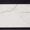
NGR NS 04434 66794
Datum OSGB36 - NGR
Permalink http://canmore.org.uk/site/40338
- Council Argyll And Bute
- Parish North Bute
- Former Region Strathclyde
- Former District Argyll And Bute
- Former County Buteshire
NS06NW 3 04434 66794.
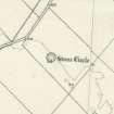
(NS 0443 6679) Stone Circle (NR)
OS 6" map (1957)
At St Calmag's, near Ettrick, there is a Druid's temple in considerable preservation.
New Statistical Account 1840
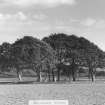
In a field on the left hand side , about half a mile farther on, are seen the very distinct and well preserved remains of a druidical temple, encircled by a grove of trees. very little seems to be known of the origin of this, or of the many other similar places of heathen worship in the island.
Wilson 1855
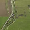
There is a stone circle, about 45ft in diameter, within the circular beech plantation, 460 yards south of South St Colmac. When complete, it consisted of nine stones, but now its plan and the dimensions of the stones are as given on Hewison's plan.
J K Hewison 1893
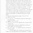
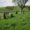
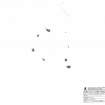
A stone circle situated within a small beech plantation in level pasture land. It comprises four complete stones (C, D, G and H on plan) and the in situ remains of four broken stones (A, B, E and F on plan). There is no trace of the ninth stone mentioned by Hewison.
Surveyed at 1/2500.
Visited by OS (TRG) 24 November 1976
Antiquarian Mapping (1823)
Reference (June 1840)
At St Calmag's, near Ettrick, there is a Druid's temple in considerable preservation.
New Statistical Account, Parish of Rothesay p.103, June 1840
Reference (1855)
In a field on the left hand side , about half a mile farther on, are seen the very distinct and well preserved remains of a druidical temple, encircled by a grove of trees. very little seems to be known of the origin of this, or of the many other similar places of heathen worship in the island.
Wilson 1855
Field Visit (1863)
Reference (1880)
On the fine fields of Kilmahalmag, near the west coast, are the remains of a Druid temple - the stones not so large as at Kingarth (NS05NE 8). A clump of trees, wherewith it was some years ago surrounded, prevent it from being seen at a distance.
Blain in Ross 1880
Field Visit (1893)
There is a stone circle, about 45ft in diameter, within the circular beech plantation, 460 yards south of South St Colmac. When complete, it consisted of nine stones, but now its plan and the dimensions of the stones are as given on Hewison's plan.
J K Hewison 1893
Field Visit (22 May 1943)
This site was recorded as part of the RCAHMS Emergency Survey, undertaken by Angus Graham and Vere Gordon Childe during World War 2. The project archive has been catalogued during 2013-2014 and the material, which includes notebooks, manuscripts, typescripts, plans and photographs, is now available online.
Information from RCAHMS (GF Geddes) 2 December 2014.
Photographic Record (1973)
Field Visit (24 November 1976)
A stone circle situated within a small beech plantation in level pasture land. It comprises four complete stones (C, D, G and H on plan) and the in situ remains of four broken stones (A, B, E and F on plan). There is no trace of the ninth stone mentioned by Hewison.
Surveyed at 1/2500.
Visited by OS (TRG) 24 November 1976
Reference (1980)
Field Visit (19 May 2009)
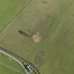
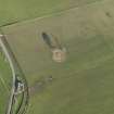
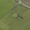
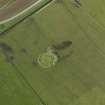
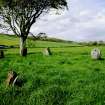
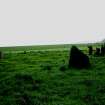
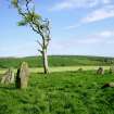
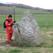
This stone circle, which stands within the remains of a small beech plantation 130m SE of St Colmac Cottages, comprises eight stones on an internal diameter of about 13m, with an outlying stone (1.7m high) immediately to the S. Of the stones in the ring, four of them are erect, ranging in height from 0.55m to 2.4m, and three survive only as stumps. The circle is enclosed within a plantation bank measuring about 33m in internal diameter; only two trees now grow within it.
There is compelling evidence that a second stone circle stood 25 yards to the W and was 'blown with powder' in the first decade of the 19th century (Aiton 1816, 118-9; RHP14262).
Visited by RCAHMS (GFG, PM) 19 May 2009.
Measured Survey (15 March 2010)
RCAHMS surveyed the stone circle at St Colmac Cottages, Bute on 15 March 2010 with plane table and alidade producing a plan at a scale of 1:100. The plan was redrawn in vector graphics software for publication at a scale of 1:200 (Geddes and Hale 2010, 13).
Geophysical Survey (30 July 2011 - 31 July 2011)
The St Colmac stone circle consists of an extant stone circle that measures c13m diameter internally. Work on 18th-century cartographic records and archive research by George Geddes of RCAHMS had suggested a second stone circle was located c25m to the W, prior to its removal by blasting powder in the early 19th century. There is little visible evidence of the second stone circle. A geophysical survey was undertaken 30–31 July 2011 at the request of the DBLPS to further investigate the site.
Whilst there is some confusion in the results arising from the natural geology and shallow bedrock the ‘lost’ stone circle is apparent in the data. It is roughly circular in plan, c22m in diameter and located c40m NW of the extant stone circle. It is possible to identify six potential stone sockets, with the data suggesting that at least two may contain remnants of standing stones, though the survey resolution does not make this identification absolute.
Perhaps as important, but more surprising, is the detection of two sub-circular concentric, but offset, ditches with a central rectangular structure. The structure (c11 x 8m) is orientated roughly N–S but presents no anthropogenic signature in the gradiometer data, as might be expected from a dwelling. It is possible that this is the site of a Christian chapel. Whilst this site is close to the known chapel site of East St Colmac c300m to the N, its location close to a stone circle does support its interpretation as a potential chapel site.
Archive: Rose Geophysical Consultants
Funder: Discover Bute Landscape Partnership
Rose Geophysical Consultants 2011


