Bute, St. Blane's Well
Well (Period Unassigned)
Site Name Bute, St. Blane's Well
Classification Well (Period Unassigned)
Alternative Name(s) St. Blaan's Well
Canmore ID 40296
Site Number NS05SE 9
NGR NS 09442 53442
Datum OSGB36 - NGR
Permalink http://canmore.org.uk/site/40296
- Council Argyll And Bute
- Parish Kingarth
- Former Region Strathclyde
- Former District Argyll And Bute
- Former County Buteshire
NS05SE 9 09444 53445.
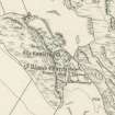
(NS 0944 5342) Well (NR)
OS 6" map, (1957)
St Blaan's Well, also known as the Holy Well and the Wishing Well is dry-stone built, 3ft broad and deep and has been partly covered. Within the last decade, visitors to the well have been known th throw coins into it. (An alternative, and apparently equally correct spelling of Blaan, is Blane - see NS05SE 5).
J K Hewison 1893-5
St Blane's Well measures 1.7m in diameter and has been covered by a concrete slab now broken in the middle. It is otherwise in good condition.
Surveyed at 1:10 000.
Visited by OS (B S) 11 November 1976
St Blane's Well is situated at the foot of a steep SE-facing slope 35m W of the ruined church (NS05SE 5). There is a low retaining boulder wall on all sides except the SE. The well, which measures 1.7m in diameter within a drystone wall, has been filled in to within 0.4m of its top and covered by an iron grill. A large slab that overlies the NW lip is probably a displaced cover stone.
Visited by RCAHMS (GFG) 31 March 2010.
Reference (19 July 1972)
St Blaan's Well, also known as the Holy Well and the Wishing Well is dry-stone built, 3ft broad and deep and has been partly covered. Within the last decade, visitors to the well have been known th throw coins into it. (An alternative, and apparently equally correct spelling of Blaan, is Blane - see NS05SE 5).
Information from OS (IF) 19 July 1972
Field Visit (11 November 1976)
St Blane's Well measures 1.7m in diameter and has been covered by a concrete slab now broken in the middle. It is otherwise in good condition.
Surveyed at 1:10 000.
Visited by OS (B S) 11 November 1976.
Field Visit (31 March 2010)
St Blane's Well is situated at the foot of a steep SE-facing slope 35m W of the ruined church (NS05SE 5). There is a low retaining boulder wall on all sides except the SE. The well, which measures 1.7m in diameter within a drystone wall, has been filled in to within 0.4m of its top and covered by an iron grill. A large slab that overlies the NW lip is probably a displaced cover stone.
Visited by RCAHMS (GFG) 31 March 2010.


