
Following the launch of trove.scot in February 2025 we are now planning the retiral of some of our webservices. Canmore will be switched off on 24th June 2025. Information about the closure can be found on the HES website: Retiral of HES web services | Historic Environment Scotland
Bute, Michael's Grave


Chambered Cairn (Neolithic)
Site Name Bute, Michael's Grave
Classification Chambered Cairn (Neolithic)
Canmore ID 39905
Site Number NR97SE 6
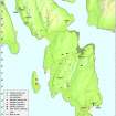
NGR NR 99470 70314
Datum OSGB36 - NGR
Permalink http://canmore.org.uk/site/39905


- Council Argyll And Bute
- Parish North Bute
- Former Region Strathclyde
- Former District Argyll And Bute
- Former County Buteshire
NR97SE 6 99470 70314
(NR 9944 7030) St Michael's Grave (NR)
(Flint and Pottery found AD 1903) (NAT)
OS 6" map, (1924)
Michael's Grave (Henshall 1972; Scott 1969; Bryce 1904) Little remains of this Clyde- type chambered cairn, and its edge is now defined by the limit of ploughing; in 1962 it was 26' across and 3'-5' high against the chamber. The outside of the S side of the chamber is exposed; the chamber itself is full of debris, and due to the slope of the site, silting has covered all but the tops of the two eastmost slabs of the N side. Excavation in 1903 revealed the chamber, oriented along the contour to face ESE. It measured 10'6" by 2'6", divided into two equal compartments by a septal stone. The floor of each compartment was covered by a layer of black earth with charcoal. Items from the chamber, now in the National Museum of Antiquities of Scotland [NMAS], are an undecorated pottery sherd and a lump of pitchstone (Accession no EO 301). Other sherds, a flint flake, fragments of burnt human bones, a tooth of a pig and ox bones, also found at the same time and place, are now lost.
T H Bryce 1904; J G Scott 1969; A S Henshall 1972.
A chambered cairn as described in the previous information and measuring 13.0m ESE by 4.0m transversely. Lying to the S of the chamber is a probable capstone measuring 2.1m by 1.4m by 0.2m thick. The name St Michael's Grave was confirmed locally.
Surveyed at 1:10 000.
Visited by OS (B S) 29 October 1976.
Antiquarian Mapping (1823)
Field Visit (1864)
Excavation (1903)
Reference (1969)
Reference (1972)
Michael's Grave (Henshall 1972; Scott 1969; Bryce 1904) Little remains of this Clyde- type chambered cairn, and its edge is now defined by the limit of ploughing; in 1962 it was 26' across and 3'-5' high against the chamber. The outside of the S side of the chamber is exposed; the chamber itself is full of debris, and due to the slope of the site, silting has covered all but the tops of the two eastmost slabs of the N side. Excavation in 1903 revealed the chamber, oriented along the contour to face ESE. It measured 10'6" by 2'6", divided into two equal compartments by a septal stone. The floor of each compartment was covered by a layer of black earth with charcoal. Items from the chamber, now in the National Museum of Antiquities of Scotland [NMAS], are an undecorated pottery sherd and a lump of pitchstone (Accession no EO 301). Other sherds, a flint flake, fragments of burnt human bones, a tooth of a pig and ox bones, also found at the same time and place, are now lost.
T H Bryce 1904; J G Scott 1969; A S Henshall 1972.
Field Visit (29 October 1976)
A chambered cairn as described in the previous information and measuring 13.0m ESE by 4.0m transversely. Lying to the S of the chamber is a probable capstone measuring 2.1m by 1.4m by 0.2m thick. The name St Michael's Grave was confirmed locally.
Surveyed at 1:10 000.
Visited by OS (B S) 29 October 1976.
Field Visit (19 May 2009)
This chambered cairn is situated on the leading edge of a S-facing terrace in a field of pasture about 500m S of Kilmichael farmsteading. The cairn has been severely reduced by robbing and ploughing and now measures 10.5m from E to W by 7.2m transversely and no more than 1m in height. The burial chamber, which was shown by excavation to contain two compartments, measures 4.9m from E to W by 0.8m overall and up to 1.3m in height on the S. Its interior is now choked with rubble, and a displaced capping stone, measuring 1.4m by 2m and at least 0.2m in thickness, lies immediately to the S.
Visited by RCAHMS (GFG, PM) 19 May 2009.

