Pricing Change
New pricing for orders of material from this site will come into place shortly. Charges for supply of digital images, digitisation on demand, prints and licensing will be altered.
Upcoming Maintenance
Please be advised that this website will undergo scheduled maintenance on the following dates:
Thursday, 9 January: 11:00 AM - 3:00 PM
Thursday, 23 January: 11:00 AM - 3:00 PM
Thursday, 30 January: 11:00 AM - 3:00 PM
During these times, some functionality such as image purchasing may be temporarily unavailable. We apologise for any inconvenience this may cause.
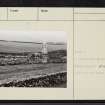
Islay, Cill Chiarain
Burial Ground (Medieval), Chapel (Medieval), Font (Medieval), Grave Slab(S) (Medieval), Township (Post Medieval)
Site Name Islay, Cill Chiarain
Classification Burial Ground (Medieval), Chapel (Medieval), Font (Medieval), Grave Slab(S) (Medieval), Township (Post Medieval)
Alternative Name(s) St Ciaron's Chapel; Kilchiaran
Canmore ID 37468
Site Number NR26SW 6
NGR NR 20447 60109
Datum OSGB36 - NGR
Permalink http://canmore.org.uk/site/37468
- Council Argyll And Bute
- Parish Kilchoman
- Former Region Strathclyde
- Former District Argyll And Bute
- Former County Argyll
NR26SW 6 20453 60115
See also NR26SW 8.
(NR 2045 6011) Cill Chiarain (NR)
Chapel (NR) (In Ruins) (NAT)
OS 6" map, Argyllshire, 2nd ed., (1900)
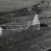
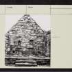
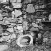
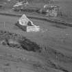
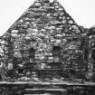
Little remains of the chapel of Kilchoman exxcept the E gable, which is entire, although Muir saw part of the S wall containing a ruined window. A modern burial chapel has been added to the E end and there is a similar enclosure within the walls. On the inside of the E gable there are two small recesses one square-headed and the other pointed, and to the right of where the altar stood, there is a projecting stone hollowed into a little basin as if for holy water.
R C Graham 1895; T S Muir 1855.
The E end of Kilchoman probably dates from the dearly 13th century. The burial ground contains the font and Medieval slabs.
W D Lamont 1972.
Islay Historic Works Group has restored the chapel of Kilchiarain.
E W MacKie 1976.
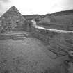
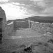
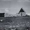
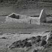
Kilchiaran Chapel, partly restored, measures 16.0m E-W by 6.5m and is generally as described. The E gable-end stands to its full height and the other walls have a maximum height of 3.0m. Within the chapel are a number of cross-slabs, and a font mounted upon a modern pedestal A ruinous stone enclosure attached to the E end of the chapel contains three grave slabs.
Visited by OS (B S) 4 March 1978.
Field Visit (August 1975)
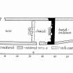
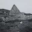
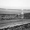
NR204 601. This church, dedicated to St Ciaran, stands within its burial-ground, overlooking the valley of the Abhainn na Braghad close to the head of Kilchiaran Bay. Before its restoration and partial reconstruction by the Islay Historic Buildings Works Group in 1972-3 the building was ruinous, the E gable alone standing to its full height and the other walls for the most part to a height of less than 1m.
The church measures 14.5m from E to W by 5.1m transversely within walls some 0.73m in thickness; a later unroofed burial-enclosure abuts the E gable. The original masonry is of random rubble, comprising slate, flagstones and boulders of local origin, and the quoins and dressings are formed of worked blocks of the same material. The W gable is founded upon a splayed plinth, a portion of which can be seen at the foot of the newly reconstructed wall. Partial excavation of the interior undertaken during the work of reconstruction showed that the chancel was floored at a height of about 0.6m above the nave, from which it was reached by means of two centrally-placed steps set within a low transverse wall. The nave was entered from a doorway at the W end of the N wall, while the chancel had its own doorway in the S wall; only the lowest courses of the existing openings are original.
Apart from the E gable, which is unlit, the walls of the church prior to 1972 did not survive to a height sufficient to indicate the positions of the window-openings. It is likely, however, that the partially reconstructed splayed recess now visible in the s wall of the chancel was originally a window, and a photograph taken in 1925 shows part of the E splay of a window in the corresponding position in the N wall (Photograph in NMRS, Symington Grieve Collection). The interior of the E wall incorporates three aumbries, two of which have projecting sills; one of the aumbries is triangular-headed. There is also a stone bracket whose upper surface incorporates a small crudely-worked basin, perhaps intended to serve as a lamp. The altar was constructed in 1972 upon earlier footings revealed by excavation.
The church itself may be ascribed to the later Middle Ages while the adjacent burial-aisle is unlikely to be older than the 18th century.
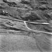
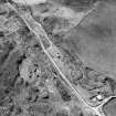
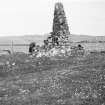
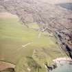
The burial-ground measures about 60m from SW to NE by 37m transversely. Originally, however, it must have been somewhat larger, for its NW side is being progressively removed by river erosion, while the SW side is overlain by the present roadway. Moreover, another track or roadway, now disused, passes through the centre of the burial-ground, entering at the SW end and passing close to the S side of the church before forking towards two outlets of which one, near the centre of the NE side, seems formerly to have led into a field, while the other, near the N corner, formed the main exit. Beside this last there may be seen traces of a subrectangular building (A) measuring 9.0m by 5.5m over all, while the remains of four similar buildings (B-D) lie close to the sw entrance to the burial-ground. These buildings appear to be contemporary with the track already described and may represent the remains of a small township of post-medieval date.
Although larger than most of the parochial chapels of the area, the church of Kilchiaran was evidently a dependency o the medieval parish church of Kilchoman (RCAHMS 1984, No. 366). During the period following the Reformation the church is occasionally described, jointly with that of Kilchoman, as one of two parish churches in the Rinns, but there is no record of the existence of an independent parish of Kilchiaran. The church is included in Martin's late 17th-century list of Islay churches, but the building was evidently roofless by 1794 (OPS 1854; Graham 1895; Statistical Account 1790; Martin 1703; Geog Coll, 2, 191; Islay Bk, 481).
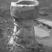
Font.
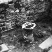
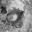
A damaged font stands upon a modern base at the W end of the nave. It comprises a circular basin of schist having an internal diameter of 0.46m and a depth of 0.24m. The exterior of the basin is divided into four more or less equal panels by plain vertical ribs which return at base to form a continuous horizontal moulding. The font is probably of late medieval date. (Graham 1895, pl. xviii, 58).
Funerary Monuments and other Carved Stones.
The following monuments are inside the chapel, but number 8 could not be found at the date of visit.
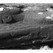
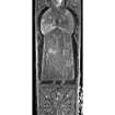
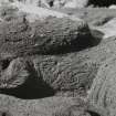
(1) Tapered slab, 1.59m by 0.44m. The upper two-thirds is occupied by a double-cusped niche whose ogival head is embellished with nail-head and flanked by foliaceous ornament. It contains the effigy of a tonsured priest in Eucharistic vestments; a chalice is set below the hands, which are joined in prayer. The front of the figure is heavily worn, but at the sides it can be seen that the apparel of the amice has been decorated with double-beaded interlace, and the chasuble with roundels of foliaceous ornament. In the lower part of the slab is a foliated cross, followed by a plain panel which may originally have borne an inscription. (Graham 1895, pl. xviii, 57). lona school, 14th-15th century.
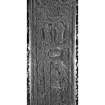
(2) Tapered slab bordered by triple plain mouldings, 1.90m by 0.62m; the top left corner is slightly bevelled and the bottom right comer has broken off. At the top there is a foliated cross with plaited centre, followed by an inscription in Lombardic capitals which reads:
+ HIC l[A]CET IOHANN/ES ET DON/ALD/VS
'Here lies John and Donald.'
Below the inscription there are two conjoined niches containing the figures of two laymen, kneeling in prayer and facing inwards. The lower half of the slab bears a sword with lobated pommel and inclined quillons, whose blade is flanked at the right by a griffin and two intertwined plant-stems, and at the left by a single plant-stem. To the right of the sword-hilt there is a small figure of a man, possibly bearing a sword at his waist and with his arms out-stretched towards a large barrel-shaped object. (Steer and Bannerman 1977, insc. 45). 14th-15th century.
(3) Tapered slab with roll-moulded margin, 1.91m by 0.38m; it is broken across near the centre, and much worn. At the top is a foliated cross, and then a central sword similar to that on number 2. To the right of the blade there is an undulating plant-stem issuing from the tail of an animal, while to the left, pairs of leaves issue from a straight central stem. (Graham 1895, pl.xxxi, 59). 14th-15th century.
(4) Tapered slab, 1.53m by 0.40m, bordered by a single plain moulding. At the top is a foliated cross, and then a central sword similar to that on number 2. Above each quillon is an animal from whose tail there issues an undulating plant-stem; the stem to the left of the blade terminates some distance from the foot of the slab, the remaining space apparently being uncarved. (Graham 1895, pl. xxxi, 60). 14th-15th century.
(5) Tapered slab, 1.69m by 0.41m; it is much worn. The general design of the decoration resembles that on number 4. 14th-15th century.
(6) Tapered slab with pointed base, 1.87m by 0.44m; it is broken across near the foot, and the surface has flaked off in places. Within a border consisting of a row of nail-head ornament between plain mouldings, there is a cross at the top formed by eight double-beaded bands radiating from the centre, with rosettes in the interspaces (The motif strongly resembles the cross on a slab of the Loch Sween school at Kilmory, Knapdale (Steer and Bannerman, pl.23B).Below there is a sword with diamond-shaped pommel and horizontal quillons, while on each side of the sword short stems ending in rosettes or tri-lobed leaves spring from the inner moulding. Probably Loch Sween school, 15th-early 16th century.
(7) Tapered slab of schist, probably of local origin, 1.82m by about 0.42m; the upper part of the right edge is damaged. Near the top is an outline Greek cross, measuring 0.27m across the arms, whose lower arm is open at the foot. It is uncertain whether the cross is of medieval or later date.
(8) A photograph taken in 1925 shows a small cruciform stone, about 0.3m in height, in one of the niches in the E wall of the chapel. The shaft appears to be incomplete, and the cross may have served as a grave-marker, or as a gable-finial. It may tentatively be ascribed to the medieval period. (Photograph in NMRS, Symington Grieve Collection).
Visited August 1975
RCAHMS 1984
Measured Survey (1975)
RCAHMS prepared measured survey drawings to include a general plan of the site, a phased plan of the chapel and a plan and section of the font. The drawings were redrawn in ink and reproduced at a smaller size (RCAHMS 1984, figs 33Q, 194C, 195B, 195C.


