Pricing Change
New pricing for orders of material from this site will come into place shortly. Charges for supply of digital images, digitisation on demand, prints and licensing will be altered.
Upcoming Maintenance
Please be advised that this website will undergo scheduled maintenance on the following dates:
Thursday, 9 January: 11:00 AM - 3:00 PM
Thursday, 23 January: 11:00 AM - 3:00 PM
Thursday, 30 January: 11:00 AM - 3:00 PM
During these times, some functionality such as image purchasing may be temporarily unavailable. We apologise for any inconvenience this may cause.
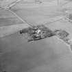
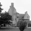
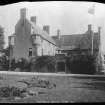
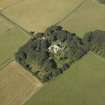
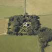
Muchalls Castle
Tower House (17th Century)
Site Name Muchalls Castle
Classification Tower House (17th Century)
Canmore ID 37138
Site Number NO89SE 6
NGR NO 89181 91838
Datum OSGB36 - NGR
Permalink http://canmore.org.uk/site/37138
- Council Aberdeenshire
- Parish Fetteresso
- Former Region Grampian
- Former District Kincardine And Deeside
- Former County Kincardineshire
NO89SE 6.00 89181 91838
NO89SE 6.01 89115 91843 The Stables
NO89SE 6.02 89133 91812 Dovecot
NO89SE 6.03 89179 91820 The Crypt
NO89SE 6.04 89107 91815 The Cottage (Gardener's Cottage)
(NO 8917 9183) Muchalls Castle (NR)
OS 6" map, Kincardineshire, 2nd ed., (1904)
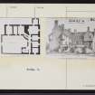
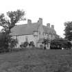
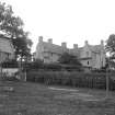
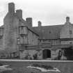
Muchalls House is a well-preserved specimen of the Scottish mansion of the beginning of the 17th century. A tablet on the wall bears the dates 1619 and 1927. It is designed on the plan of buildings surrounding a courtyard, the north, east and part of the west sides of the square being occupied with the house, and the remaining side enclosed with a wall.
D MacGibbon and T Ross 1887-92.
A vault, ruinous in 1864, probably the Donjon Keep or Prison, on the south side of the castle, is traditionally much older than the rest, which was then begin extensively repaired.
Name Book 1865.
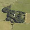
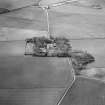
Muchalls Castle is as described by MacGibbon and Ross (1887-92) except that the buildings surround the courtyard on the N, S and E sides only. It is in good condition and, according to the owner (Mr Simpson), it was rebuilt in the 17th century on the site of a 13th century castle, the only extant part of which is a vault attached to the S wing of the present building at NO 8918 9182. The vault measures 4.9m E-W by 3.8m transversely and has a barrel roof. It was originally used as a crypt of a chapel which was burned to the ground by the Duke of Cumberland in 1746.
Visited by OS (RB) 2 August 1965.
Muchalls Castle. Open May to September.
N Patullo 1974.
Listed.
Scottish Castle Survey 1988; N Bogdan and I B D Bryce 1991.
NO89SE 6.00 89181 91838
For full collection see Green Catalogue Book
ARCHITECT:
Walker and Duncan
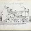
Proposed additions to Castle (1898)
Proposed Stable (1894)
NMRS REFERENCE:
PLANS F.A.M. MacDonald Collection
Walker and Duncan 1894 1 sheet plan and elevation of proposed new stable
Walker and Duncan 1898 1 sheet plan and elevation of proposed additions
EXTERNAL REFERENCE:
National Library. Country Life, Dec 18th 1937
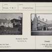
Photographic Survey (1955)
Photographic survey by the Scottish National Buildings Record in 1955.


