
Smiddyhill


Ring Ditch (Prehistoric)
Site Name Smiddyhill
Classification Ring Ditch (Prehistoric)
Alternative Name(s) West Water
Canmore ID 35968
Site Number NO66NW 38
NGR NO 61111 65750
Datum OSGB36 - NGR
Permalink http://canmore.org.uk/site/35968


- Council Angus
- Parish Stracathro
- Former Region Tayside
- Former District Angus
- Former County Angus
NO66NW 38 NO 61111 65750
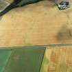
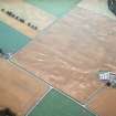
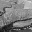
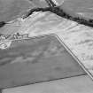
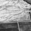
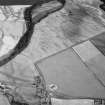
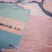
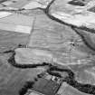
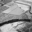
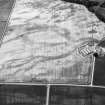
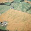
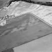
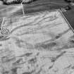
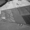
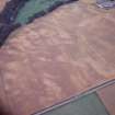
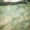
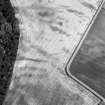
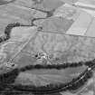
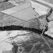
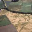
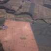
Cropmarks reveal a small sub-circular enclosure situated on a terrace 200m S of West Water, c. 46m OD. It measures some 16.25m in diameter within a medium/narrow ditch with two entrances and internal pits. No trace of a bank.
A F Harding and G E Lee 1987.
Note (1983)
Smiddyhill NO 611 657 NO66NW 38
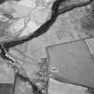
A ring-ditch is revealed by cropmarks 410m W of Smiddyhill farmhouse; it has an internal diameter of 12m and there are opposed entrances on the E and W respectively.
RCAHMS 1983

