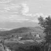
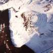
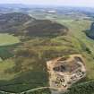
Dunsinane Hill
Fort (Iron Age), Finger Ring (Bronze)(Iron Age)
Site Name Dunsinane Hill
Classification Fort (Iron Age), Finger Ring (Bronze)(Iron Age)
Alternative Name(s) Macbeth's Castle; Dunsinnan; Dunsinan Hill
Canmore ID 30660
Site Number NO23SW 1
NGR NO 2139 3167
Datum OSGB36 - NGR
Permalink http://canmore.org.uk/site/30660
- Council Perth And Kinross
- Parish Collace
- Former Region Tayside
- Former District Perth And Kinross
- Former County Perthshire
NO23SW 1.00 2139 3167
NO23SW 1.01 NO 2133 3166 Cup-markings
NO23SW 1.02 NO 2120 3184 Macbeth's Well
(NO 2137 3167) Macbeth's Castle (Fort) (NR)
(NO 2120 3184) Macbeth's Well (NR)
OS 6" map (1959)
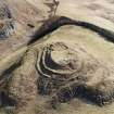
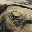
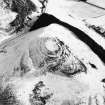
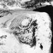
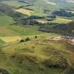
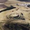
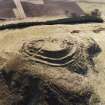
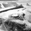
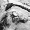
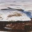
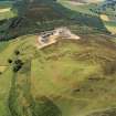
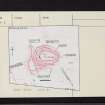
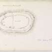
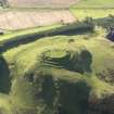
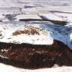
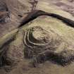
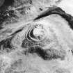
The fort of Dunsinnan is situated on a little green knoll on the narrow summit of a hill. The slightly dished top of the knoll, measuring c. 185' x 105', is surrounded by a slight ridging at the edge, 6' - 12' wide, not always visible. Around this, on the steep short slopes of the knoll, is a series of narrow terraces varying from three on the NE to one on the S. Overall the fort measures 325' x 240'.
Shortly before 1799, excavations by Playfair (D Christison 1900) revealed a stone wall around the top of the knoll, comprising two faces of large stones, with a filling of loose stones. No entrance through the wall was discovered in 1854, but there is a very distinct entrance through the outer defences at the NE corner.
Within the wall, Wise, in 1854, recorded the discovery of two connected stone-walled subterranean rooms, 20' long, 6' - 8' wide, and up to 6' high, with corbelled roofs, in which were found a quern, ashes and occupation debris, also three human skeletons. However, the MS account by A Stewart (of Kinrossie), who took part in the excavation, shows that the buildings were located on ground level, together with other building remains and a court, and that Wise had been misled by the considerable accretion of earth, containing evidence of burnt timber, over the site. Much vitrified material has been found among the stonework but there can hardly be any doubt that it came from either an earlier structure or some other site.
In 1857 a small bronze spiral ring of serpent design was found during an excavation near the gateway of the fort but it was lost within the year. Two hut circles were noted in the interior by Mrs Stewart (information to OS, 9 March 1957).
T A Wise 1859; T Brown 1873; M A Cotton 1954
Field Visit (7 July 1956)
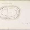
There are three concentric lines of defence around the summit of the knoll. The innermost is a heavily robbed massive stone wall of Abernethy type; the middle wall has been of stone, but the outer, now represented for the most part by a terrace, may have been simply faced with stones or purely an earthwork although the RCAHMS state, on the evidence of internal quarry-ditches, that both outer walls were rubble-cored. Only excavation can determine the relative dating of the walls - the innermost may have replaced an original defence contemporary with the other two. A single piece of vitrifaction, not certainly in situ, was seen. The entrance leads directly through all three defences. On the S side of the fort, a stone wall enclosing the plateau can be traced; it is presumably contemporary with one or other of the occupations of the fort. Just inside the wall, near the SE corner, there are the remains of one certain and two possible stone-walled circular huts, and there are entrances both in the E and W sides.
A second enclosure covers the W side and part of the N side of the fort. It has been bounded by a stone wall similar to that of the other enclosure, and the entrance on the NW is bordered by a line of stones as in certain Dark Age forts (e.g. Buchtrig - NT71SE 24) but no internal dwellings are visible. Similar enclosures exist at Moncrieffe fort (D A - NO11NW 23).
RCAHMS TS, visited 1956.
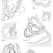
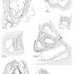
This site was included within the RCAHMS Marginal Land Survey (1950-1962), an unpublished rescue project. Site descriptions, organised by county, are available to view online - see the searchable PDF in 'Digital Items'. These vary from short notes, to lengthy and full descriptions. Contemporary plane-table surveys and inked drawings, where available, can be viewed online in most cases - see 'Digital Images'. The original typecripts, notebooks and drawings can also be viewed in the RCAHMS search room.
Information from RCAHMS (GFG) 19 July 2013.
Publication Account (1963)
This fort occupies the conspicuous summit of Dunsinane Hill, 12 miles ESE of Birnam Wood, with which it is intervisible. It was somewhat spoiled by excavations in 1854. The central enclosure measures about 180 ft (54.8m) by 100 ft (30.5m) within a bold ruined rampart which might have been a timber-laced wall; it is strengthened by the remains of three lesser ramparts. The excavators found a small bi-lobed souterrain inside the fort, and some vitrified stone. They gave the impression that the main wall was the source of this, the wall 'prepared by an ancient people, who had advanced so far in refinement as to have felt the importance of uniting in considerable bodies, to defend themselves against their powerful enemies'. The fort may probably be numbered among the timber-laced structures.
R W Feachem 1963.
Field Visit (4 February 1969)
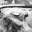
This fort is generally as described although the interior and the main rampart are mutilated to a great extent by various excavations. At the E end of the interior are the remains of the two chambers, but these are so amorphous that little could be made of them. The entrance to the fort would appear to be in the NE and to the W of it, within the fort, is the outline of a probable hut circle. No evidence of vitrifaction was found, nor was any evidence found (except the slight scarp at NO 2135 3157, the significance of which cannot be assessed) to support "Track of Wall" published on OS 25" to the S of the fort. The two hut circles noted by Stewart at approximately NO 2129 3162 appear to be no more than natural stone settings.
Water still flows from Macbeth's Well, a natural spring.
Fort resurveyed at 1:2500.
Visited by OS (WDJ) 4 February 1969
Field Visit (5 May 1989)
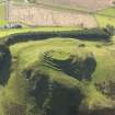
This fort occupies the summit and lower slopes of a craggy, steep-sided hill commanding extensive views in all directions except to the NE, where it is overlooked by Black Hill. It consists of a strongly defended inner enclosure, displaying evidence of successive reconstructions, and an outer enclosure. The earliest phase of the defences probably comprised a timber-laced wall on the summit; this was subsequently burnt and the resulting vitrified debris was incorporated into the wall of the outer enclosure. It is unclear whether the outer enclosure was accompanied by the refortification of the summit, but at some stage the timber-laced work was replaced by a wall and two outer ramparts.
The inner work has been much disturbed as a result of excavation by Playfair about 1799 (Robertson 1799; Playfair 1819) and by Nairne in 1854 (Wise 1859). The fort has been identified with Dunsion, mentioned in the Pictish Regnal Lists, but the attribution is uncertain (Alcock 1981).
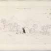
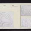
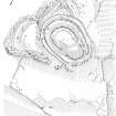
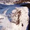
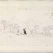
Roughly oval on plan, the inner work measures 52m by 25m within a wall about 9m in thickness and 0.5m in height. Several outer facing-stones have been revealed as a result of Nairne's trenching along the line of the wall, and his excavation also demonstrated that vitrified material from the earlier timber-laced work had been incorporated in the later wall. The entrance through the inner work, which lies on the NE, is approached up a winding path that commences at the top of the steep lower slope on the SE flank of the hill and passes obliquely through the outer lines of defence. The interior of the fort has been confused by the unbackfilled excavation trenches and spoil-heaps. Sketches by Skene (1832) and Stewart (1854) show (in Christison 1900, 88, fig. 42) that Playfair drove a trench from the entrance through the centre of the fort and dug a number of pits on the line of the inner rampart. Nairne (Wise 1859) concentrated his efforts on trenching the E part of the interior, where he claimed to have found the base of a 'tower' and a two-chambered structure (possibly parts of a souterrain). Further protection was provided by two outer ramparts which, apart from a short gap on the NE, above a cliff, enclose the summit of the hill; they are now much reduced, particularly on the N and W.
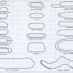
The outer enclosure takes in a number of terraces on the lower slopes of the hill below the outer ramparts on the S. It was defended by a wall, now reduced to a stony bank measuring 2.5m in thickness by up to 0.3m in height which contains small fragments of vitrified stone, probably derived from the summit wall. There are three entrances; those on the NW and E are approached along trackways that climb obliquely up the slopes, while the third entrance (on the SW) is boulder-lined, and its extension towards the inner work is blocked by the lower of the inner ramparts. Situated on the broad S terrace, there are a number of crescentic quarry-scoops; on the SE there is a house platform (A on plan) and, 35m to the SW, a hut-circle appears to overlie the line of the enclosure wall.
Finds (now lost) from the excavations included a bronze spiral finger-ring (Brown 1873), a quern, animal bones and midden material, and, from the two-compartment chamber, the skeletal remains of two adults and a child.
Visited by RCAHMS (JRS) 5 May 1989.
T Brown 1873; D Christison 1900; L Alcock 1981; T A Wise 1859; J Playfair 1819; J Robertson 1799.
Publication Account (1991)
These monuments are threatened by a proposed extension to Collace Quarry. Evidence of vitrification has been confirmed by the independent photographic examination of samples.
D B McIntyre 1991.
Note (1994)
N.B. The following text is based on that written about the fort by S P Halliday (RCAHMS 1994, 55-6)
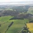
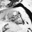
The fort on Dunsinane Hill is the most spectacular of the fortifications in the area, commanding a wide sweep of country across the lower end of Strathmore. The association of its name with Macbeth has led to the series of antiquarian excavations that now disfigure the interior. At the core, crowning the summit of the hill, there is a massively-defended citadel, which almost certainly occupies the site of an earlier fort, but there are also traces of a large outer enclosure. The defences of the citadel comprise a substantial inner wall, possibly as much as 9m thick, accompanied by two outer ramparts, which together enclose an area measuring about 52m by 25m. The interior of the fort, particularly at the E end, has been extensively trenched by the early excavators, who also attempted to trace the outer wall-face, creating the narrow ledge visible at the foot of the wall today. The entrance is probably on the NE, approached by a winding trackway which passes obliquely through the outer lines of defence. On the N side of the fort, the outer rampart blocks an earlier trackway, which, lower down the slope, passes through what is an original entrance in the heavily-robbed rampart of the outer enclosure. The latter feature, which takes in a series of terraces on the hill, must, therefore, predate the visible defences on the summit. Indeed, the present state of its rampart on the upper terraces of the hill leaves little doubt that it has been robbed to provide stone for the defences of the citadel. On the lower terrace, to the S, it is in a considerably better state of repair, forming a stony bank 2.5m in thickness with several visible rims of outer facing-stones. In all, this rampart encloses an area of 2.16 ha, and there are traces of several crescentic scarps indicating the positions of timber houses on the terrace that forms the southern part of the interior. There is also a stone-walled hut-circle overlying the rampart on the S side of the fort.
The sequence of construction between the visible defences on the summit of the hill and the rampart taking in the surrounding terraces may be reasonably clear, but there is less certainty concerning the question of the presumed earlier fort on the summit. Indeed, there is little tangible evidence for such a fortification at all. The most persuasive evidence for the existence of an earlier fort on the summit of the hill is the quantity of vitrified stone that is strewn about the inner defences, and the three pieces that were identified in the course of survey along the rampart enclosing the southern terrace. None of this material appears to be in situ, and it may be argued that it has been robbed from an earlier timber-laced wall. To a certain extent, the case is sustained by the confused accounts of the antiquarian excavations on the hill, which do not appear to have located a vitrified core to the inner wall, but it would be unwise to imply a relationship between an earlier fortification on the summit and the rampart taking in the terraces on the strength of the three pieces of vitrified stone found in the S side of the fort.
In view of the historical associations of the place-name, it is not surprising that the fort has been the scene of two sets of antiquarian investigations. The first was carried out in about 1799 by James Playfair, and the second in 1854 by a Mr Nairne, who then owned the hill. The results of these investigations are far from clear, and the published accounts are both confused and conflicting. Sketches by Skene (SAS 465; PTD/323/3) and Stewart (as published by Christison in 1900) show that Playfair drove a trench from the entrance through the centre of the fort and dug a number of pits on the line of the wall. Nairne concentrated his efforts on trenching the E part of the interior, where he claimed to have found the base of a 'tower' and a two-chambered structure. The trenches and mounds of spoil that have resulted from these excavations give little clue to the nature of the structures that were uncovered; the finds, which included a bronze spiral finger-ring and a quern, have been lost. The excavations do show, however, that the deposits in the eastern part of the interior are quite deep, sufficient to bury the walls of the two chambers. The discovery of the skeletal remains of two adults and a child in a blocked-off 'passage' between the two chambers may indicate that Nairne also broke into an earlier burial chamber set in the summit of the hill.
Information from RCAHMS (SPH) 1994.
Artefact Recovery (26 December 2011)
NO 2139 3167 A Roman coin was found by the side of a molehill a couple of metres to the N of the hillfort’s entrance on 26 December 2011. The coin is small, crudely struck and apparently bronze. The obverse has a faint, bearded portrait wearing a diadem. The letters ‘C’ ‘A’ and ‘V’ are visible. The reverse is largely smoothed away except for the letters ‘F’ ‘A’ and ‘B’ and possibly a very faint figure with an outstretched arm. Overall, the coin looks most like one of Carausius. A fragment of grey slip pottery, c10 x 10mm, was found in an adjacent molehill.
Note (12 May 2015 - 17 October 2016)
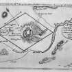
The fort on Dunsinane Hill, with the popularisation of its historical associations courtesy of Shakespeare's Macbeth, has long caught the antiquarian imagination, possibly appearing on Timothy Pont's map of Lower Angus and Perthshire east of the Tay (1583-96) and named Macbeth's Castle on Stobie's map of The counties of Perth and Clackmannan (1783). The defences comprise two major elements: a small heavily defended enclosure on the very summit of the hill; and a large outer enclosure not only taking in the upper shoulders of the hill but also a lower terrace on the SE flank. The summit enclosure, which is disfigured by the excavations of James Playfair in 1799 and Mr Nairne in 1854, measures about 52m from ESE to WNW by 25m transversely (0.01ha) within a wall that may be as much as 9m in thickness, and Playfair located its face standing up to 1.8m high (Robertson 1799, 570). Two concentric outer ramparts can also be seen, and the entrance is apparently on the NE where a trackway mounts the slope obliquely to expose the lefthand side of the visitor. On the N, however, the outer of these defences also blocks an earlier trackway, which climbs the slope through an original entrance in the larger outer enclosure, not only indicating that the latter is the earlier, but possibly also indicating that the present configuration of the inner defences was imposed on an earlier scheme. Numerous bits of vitrified stone are strewn around the inner defences, but none of it is in situ, and it is unclear whether this material comes from the burning of the visible defences or from the hypothetical earlier fort; three loose pieces were also identified by RCAHMS on the SE rampart of the outer enclosure, which if derived from an earlier timber-laced wall on the summit indicates a yet more complex sequence. The outer enclosure is roughly triangular on plan, measuring internally about 205m from N to S by 160m transversely (2.16ha) and in addition to the entrance mentioned already on the NW, there are others on the SW and SE respectively, both giving access onto the lower terrace on the SE flank. That on the SW, is in the W side just short of the SW corner and has a worn hollow immediately within the interior; the SE entrance has staggered rampart terminals and is approached obliquely up the slope from the N to expose the right side of the visitor. Within the interior on this lower terrace there are traces of at least seven house platforms, while on the S a small hut-circle appears to overlie the rear of the dilapidated rampart. The results of the excavations within the summit fort are incoherent, but seem to have included several sunken chambers with collapsed corbelled roofs that were thought to have stood 1.8m high, while in a connecting passage three skulls and other human bones were found (Wise 1856, 96-7). The only other finds were a rotary quernstone and a bronze spiral finger ring (Brown 1872), both now lost.
Information from An Atlas of Hillforts of Great Britain and Ireland – 17 October 2016. Atlas of Hillforts SC3062
Excavation (23 May 2022 - 27 May 2022)
NO 21390 31670 As part of the Comparative Kingship project and PhD research at the University of Aberdeen an excavation was carried out at Dunsinane Hill, in May 2022. Two trenches targeted areas of probable antiquarian intervention on the NE side of the hill. Trench 1 was opened over the innermost ramparts at the entrance to the fort. Some evidence of antiquarian disturbance was identified, but was m inimal. The w all and c ore of the i nnermost rampart was identified in the southern part of Trench 1 and overall the rampart measured around 4m wide and at least 1.7m high. The wallface was around 1m wide enclosing a loose rubble core. A small sondage at the side of the wall identified animal bone and charcoal for dating, but the trench was not bottomed in this area due to the depth of deposits. The rampart immediately downslope was at least 2.5m wide and around 2m high, comprising an earth capping and a stone core sitting on two layers of compact clay. Charcoal was retrieved for dating from the wall core and clay layers. Trench 2 targeted the terminal of the outermost rampart of the citadel fort. This survived to only around 0.2m high. Charcoal was
found on the bedrock below the terminal of the rampart.
Trench 3 was placed over the wall of an annexe enclosure on a lower terrace of the hill to the S of the citadel fort. This trench identified an annexe wall around 2.2m wide and 1m high, composed of large basalt boulders up to 0.5m across. A wallface was identified downslope, while in the interior of the annexe a narrow wall, probably of a roundhouse, was found abutting the annexe wall. This contained a possible floor layer. Samples from the floor layer and within the annexe wall were retrieved for dating. Archive: University of Aberdeen
Funder: The Leverhulm Trust
Gordon Noble – University of Aberdeen
(Source: DES Volume 23)


