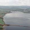
Accessibility

Font Size

100% 150% 200%

Background Colour

Default Contrast
Close Reset

Cromarty Firth

Fish Trap(S) (Period Unassigned)

Site Name Cromarty Firth

Classification Fish Trap(S) (Period Unassigned)

Canmore ID 294177

Site Number NH56SE 52

NGR NH 597 607

Datum OSGB36 - NGR

Permalink http://canmore.org.uk/site/294177

Ordnance Survey licence number AC0000807262. All rights reserved.
Canmore Disclaimer. © Bluesky International Limited 2025. Public Sector Viewing Terms

Toggle Aerial | View on large map

Digital Images

Oblique aerial view of the fish traps, looking SE.
Oblique aerial view of the fish traps, looking SE.Aerial view of Cromarty Firth, looking SW.Oblique aerial view of the fish traps, looking SE.Oblique aerial view of fish traps in the Cromarty Firth, looking NW.Oblique aerial view of the remains of the  fish traps, looking NNE.Oblique aerial view of fish traps in the Cromarty Firth, looking NW.Aerial view of Findon Quarry, Black Isle, looking W.Oblique aerial view of the remains of the  fish traps, looking NNE.Aerial view of Cromarty Bridge, Cromarty Firth, looking NW.Oblique aerial view of the fish traps, pier and enclosures in the Cromarty Firth, looking WSW.Oblique aerial view of the fish traps, looking SE.Oblique aerial view of the fish traps, looking SE.Aerial view of Cromarty Bridge, Cromarty Firth, looking N.General oblique aerial view of the fish traps, pier and enclosures in the Cromarty Firth, looking SW.

Administrative Areas

  • Council Highland
  • Parish Urquhart And Logie Wester
  • Former Region Highland
  • Former District Ross And Cromarty
  • Former County Ross And Cromarty

Archaeology Notes

NH56SE 52 597 607

Fish Traps - 3 - seen not visited.

CFA/MORA Coastal Assessment Survey 1998.

References

MyCanmore Image Contributions


Contribute an Image

MyCanmore Text Contributions