
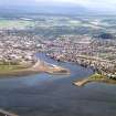
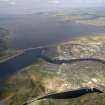
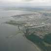
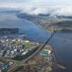
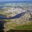
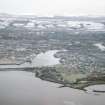
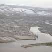
Inverness Harbour, Western Breakwater


Breakwater (Period Unassigned)
Site Name Inverness Harbour, Western Breakwater
Classification Breakwater (Period Unassigned)
Alternative Name(s) River Ness
Canmore ID 280002
Site Number NH64NE 129.10
NGR NH 65998 47244
Datum OSGB36 - NGR
Permalink http://canmore.org.uk/site/280002


- Council Highland
- Parish Inverness And Bona
- Former Region Highland
- Former District Inverness
- Former County Inverness-shire
NH64NE 129.10 65998 47244
The location assigned to this record defines the N extremity of the breakwater. The S limit is ill-defined, but it appears to extend from NH 65998 47244 to NH c. 65876 46886.
Information from RCAHMS (RJCM), 29 March 2006.

