Scheduled Maintenance
Please be advised that this website will undergo scheduled maintenance on the following dates: •
Tuesday 3rd December 11:00-15:00
During these times, some services may be temporarily unavailable. We apologise for any inconvenience this may cause.
South Yarrows
Bridge(S) (Period Unassigned), Clearance Cairn(S) (Period Unassigned), Farmstead (Period Unassigned), Quarry(S) (Period Unassigned), Rig And Furrow (Medieval) - (Post Medieval)
Site Name South Yarrows
Classification Bridge(S) (Period Unassigned), Clearance Cairn(S) (Period Unassigned), Farmstead (Period Unassigned), Quarry(S) (Period Unassigned), Rig And Furrow (Medieval) - (Post Medieval)
Canmore ID 271681
Site Number ND34SW 474
NGR ND 30694 43298
Datum OSGB36 - NGR
Permalink http://canmore.org.uk/site/271681
- Council Highland
- Parish Wick
- Former Region Highland
- Former District Caithness
- Former County Caithness
ND34SW 474 ND 30694 43298
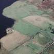
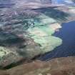
This farmstead is still inhabited and was not recorded in detail. It is situated on an E-facing slope overlooking Loch of Yarrows, lying between rough moorland to the S and W and its improved fields to the N and E, and comprises at least four roofed buildings. The dwelling is contained in the main range, which drops down a pronounced slope. Three quarries close to the farmstead have provided building stone. A field drain that flows from a boggy area to the S of the croft, N through the improved fields and to debouch into the S end of Loch of Yarrows, is bridged six times along its length. The bridges comprise single span slabs laid upon drystone abutments (YARROWS04 250-254, 305) and vary in width from 0.9m to 3.3m, the narrower ones probably being used as footbridges and the broader ones for carts. There are a number of piles of field clearance in the improved fields, some of which are heaped on top of rock outcrops.
(YARROWS04 250-254)
Visited by RCAHMS (AGCH, JRS) 30 June 2004.


