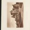
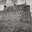
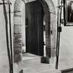
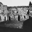
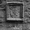
Mull, Duart Castle
Castle (14th Century)
Site Name Mull, Duart Castle
Classification Castle (14th Century)
Canmore ID 22662
Site Number NM73NW 1
NGR NM 74893 35325
Datum OSGB36 - NGR
Permalink http://canmore.org.uk/site/22662
First 100 images shown. See the Collections panel (below) for a link to all digital images.
- Council Argyll And Bute
- Parish Torosay
- Former Region Strathclyde
- Former District Argyll And Bute
- Former County Argyll
NM73NW 1.00 74893 35325
NM73NW 1.01 centred NM 74952 35261 Burial-ground
For nearby (associated) shipwreck (Swan: warship), see NM73NW 8005.
(NM 7487 3531) Duart Castle (NR) (restored)
OS 1:10,000, (1977)
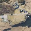
Duart Castle, the residence of the present chief of the MacLeans, is as described.
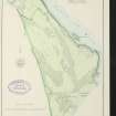
Earthworks surveyed at 1:2500.
Visited by OS (RD) 17 May 1972.
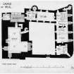
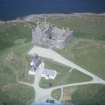
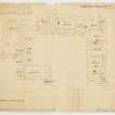
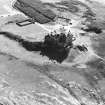
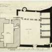
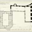
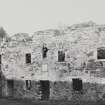
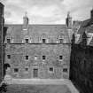
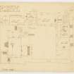
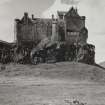
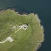
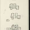
Duart Castle seems originally to have comprised a rectangular wall of enceinte enclosing a courtyard measuring 19.7m from NW to SE by 21.5m transversely. The entrance was situated in the SW curtain-wall, while one or more sides of the courtyard were probably occupied by lean-to buildings of stone or timber. Clear indications of date are lacking, but the structure appears to belong to a class of stronghold well represented on the western seaboard and attributable to the 13th century.
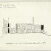
The NW extremity of the rock, which is somewhat lower than the remainder of the summit area, lay outside the main wall of enceinte. It is possible, however, that this portion of the site was enclosed to form a small ancilliary court containing a kitchen and other offices, together with the castle well, which alone survives. When it was decided to enlarge the castle towards the end of the 14th century, following its acquisition by the MacLeans, the NW portion of the rock was cleared of any buildings that might then have existed, and the site utilised for the erection of a substantial tower-house. This has walls of great solidity, those on the outer sides being heavily buttressed, while the inner (SE) wall was built directly against the outer face of the 13th century curtain-wall. The tower comprised a ground-floor cellar and three upper storeys, the first floor being occupied by a hall.
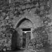
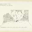
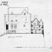
No doubt the erection of the tower-house enabled much of the accommodation provided by the original courtyard-buildings to be abandoned or re-allocated, but the first major alteration in this part of the castle that can be traced today appears to have taken place about the middle of the 16th century, when the present SE range was constructed. This was of two main storeys, comprising a vaulted cellarage, a first-floor hall and perhaps a part-garret. At the same time the defences of the original entrance-gateway in the SW curtain-wall were strengthened by the erection of a gatehouse, and the SE section of the adjacent curtain and the S angle were rebuilt. It was probably at this period that the upper-works of the tower-house were remodelled. At this time too, the postern-doorway at the N corner of the castle seems to have gone out of use. Accordingly part of the rock platform directly outside the postern was enclosed to form a small apartment at ground-floor level, possibly a prison, with a gun-platform above. Further alterations were carried out towards the end of the 16th century, the NE range of courtyard buildings apparently being remodelled and equipped with a projecting stair-turret at the rear.
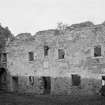
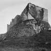
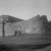
By the middle of the 17th century the NE courtyard-range appears to have been abandoned and perhaps dismantled, but in 1673 it was reconstructed to form a three storeyed building. Following the acquisition of the castle by the Campbell Earls of Argyll in 1674 a number of repairs were carried out, but although the building continued to be garrisoned from time to time it does not appear to have been put to regular use for residential purposes. The fabric soon deteriorated, and by 1748 the tower-house was roofless and derelict, while the roofs of the remaining buildings were no longer weatherproof. By the time it was re-acquired by the MacLeans in 1911 the castle had become completely ruinous, but during the following year it was restored and partially reconstructed. (A full architectural description of the castle is given.)
RCAHMS 1980, visited June 1972.
Mull, Duart Castle.
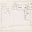
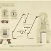
ARCHITECT: Sir J J Burnet - restoration c.1906.
Mull, Duart Castle.
National Library of Scotland: Board of Ordnance drawings: no. Z.3/28, Lewis Petit 1741 & 1748.
Mull, Duart and Aros Castle.
In the National Library of Scotland, vol 8, nos 24 and 25 of watercolour sketches by Thomas Brown, advocate, are a view of Duart Castle or house and view of Aros Castle or House. Ref: 'Adv. MSS 34-8.1-3'.
Publication Account (1985)
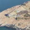
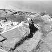
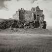
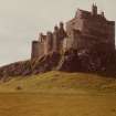
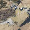
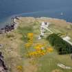
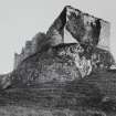
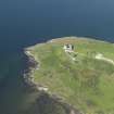
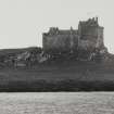
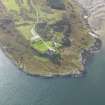
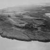
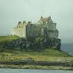
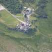
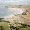
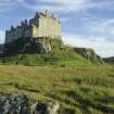
The outstanding location of Duart Castle, dominating the southern approach to the Sound of Mull and visible by every traveller to Mull and the southern Hebrides, has helped to make Duart one of the classic residences of the Highland chieftain. There is an excellent guidebook to the castle describing its history and the contents of the main rooms; here we shall describe briefly the main architectural features, some of which were masked by the extensive renovations of 1911-12 by Colonel Sir Fitzroy MacLean, 26th Chief of the Clan MacLean.
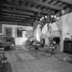
The original fortification was a simple castle of enclosure probably rectangular on plan measuring about 21.5m by 19.7m internally; today the only portions of this work are on the south-east section of the curtain wall and the western corner of the present courtyard. This was probably a MacDougall castle dating to about the 13th century. The main portion of the castle, the tower-house, is oflate 14th century date by which time it was already in MacLean hands; the tower-house abuts the earlier work using the western corner of the earlier castle, and employing its walls as a stoutly defended courtyard. The unusually massive tower-house has four principal floors: cellars at the bottom, a first-floor hall (now the Banqueting Hall), the second floor (with the present Ante-Room and State Bedroom); the upper floors now house the Scout Exhibition.
The MacLean estates were lost to the family in the 1670s, though the castle continued to play an important part in the military affairs of the west. The final chapter of the castle's history begins in 1911 with the purchase of the castle by Sir Fitzroy MacLean and the initiation of the programme of restoration that has preserved the fabric, as well as adding features such as the Sea Room, more appropriate to the 20th century.
Information from ‘Exploring Scotland’s Heritage: Argyll and the Western Isles’, (1985).


