
Tiree, Hynish Harbour


Harbour (19th Century) (1837)-(1843)
Site Name Tiree, Hynish Harbour
Classification Harbour (19th Century) (1837)-(1843)
Canmore ID 21416
Site Number NL93NE 9
NGR NL 98659 39304
NGR Description Centred NL 98659 39304
Datum OSGB36 - NGR
Permalink http://canmore.org.uk/site/21416


- Council Argyll And Bute
- Parish Tiree
- Former Region Strathclyde
- Former District Argyll And Bute
- Former County Argyll
NL93NE 9.00 centred 98659 39304
NL93NE 9.01 NL 98636 39277 Dock
NL93NE 9.02 NL 98695 39299 Pier
See also Hynish, Lighthouse Establishment (Signal Station), NL93NE 8.00.
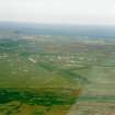
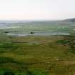
(Location cited as NL 98 39). 1837-43, engineer Alan Stevenson. A masonry dock and pier with crane for boom and the remains of a scouring system. There is a terraced pair of plain 2-storey buildings, designed for workers, a range of 1-storey ancillary buildings, a signal tower (NL93NE 8) about 30 ft (9.3m) high and a 1-storey block of flat-roofed keepers' cottages. Nearby are quarry-workings associated with the construction of Skerryvore lighthouse (NL82NW 1).
J R Hume 1977.
NL93NE 9.00 NL 98659 39304 Harbour
NL93NE 9.01 NL 98636 39277 Dock
NL93NE 9.02 NL 98695 39299 Pier
See also Hynish lighthouse station
NL93NE 8.00 NL 98528 39183 Signal Tower
NL93NE 8.01 NL 98496 39180 1 Upper Sq
NL93NE 8.02 NL 98541 39266 Lower Sq Courtyard buildings
NL93NE 8.03 NL 98497 39171 2 Upper Sq
NL93NE 8.04 NL 98502 39161 3 Upper Sq
NL93NE 8.05 NL 98509 39151 4 Upper Sq
NL93NE 8.06 NL 98567 39254 1 & 2 Lower Sq
NL93NE 8.07 NL 98562 39249 3 & 6 Lower Sq
NL93NE 8.08 NL 98557 39244 4 & 5 Lower Sq
NL93NE 8.09 NL 98570 39305 Stores
NL93NE 8.10 NL 98460 39349 Reservoir
NL93NE 8.11 NL 98638 39247 Stores
NL93NE 8.12 NL 98588 39212 Coal Store
Publication Account (1985)
Few visitors will see the magnificent lighthouse of Skerryvore except remotely through binoculars, but the achievement of its construction on a remote windand sea-swept reef has an important place in lighthouse history. When Sir Waiter Scott visited the reefin 1814 in the company of Robert Stevenson, he described a 'long ridge of rocks (chiefly under water), on which the tide breaks in a most tremendous style'. 'Our rowers, however, get the boat into a quiet creek between two rocks where we contrive to land well wetted.' Such were the problems of the situation that it was not until 1834 and 1835 that the survey of the reef was undertaken. The hardships of the various seasons of work on the rock with the wind whistling and the waves foaming round are a constant feature of Stevenson's account of the building. The foundation pit for such a massive tower took twenty men over two hundred days! The tower is 42m in height rising in a gentle curve from a basal diameter of 12.8m, and first showed its light on 1 February 1844.
If the lighthouse itself remains a distant pencil on the horizon, the shore establishment and harbour, from which workmen and stone were shipped out to the reef can still be seen. Here each stone was carefully prepared and shaped for its special position within the structure. It had been entended to use local stone, a hard gneiss, but this proved difficult to work and, although the bottom three courses of the tower are of Hynish stone, the remainder are of Ross of Mull granite.
The well-built pier, dock, storehouses and shorebarracks for the masons and seamen still survive, as well as a signal-tower and a row of lightkeepers' houses. The signal-tower has been refurbished as a museum, with details of the building of Skerryvore and of the method of communication by semaphore signals, seen through telescopes, between the tower at Hynish and the lighthouse.
An unexpected problem at Hynish harbour was that it was liable to silting, and Stevenson devised an ingenious method of scouring out the dock. Up to a million gallons of water could be collected in a reservoir above the site, which could be let out through a conduit in a controlled flood to clear the harbour basin and channel of accumulated sand.
Information from ‘Exploring Scotland’s Heritage: Argyll and the Western Isles’, (1985).

