Pricing Change
New pricing for orders of material from this site will come into place shortly. Charges for supply of digital images, digitisation on demand, prints and licensing will be altered.
Broomend Of Crichie
Pictish Symbol Stone (Pictish)
Site Name Broomend Of Crichie
Classification Pictish Symbol Stone (Pictish)
Alternative Name(s) Broom Lodge
Canmore ID 18644
Site Number NJ71NE 8
NGR NJ 7798 1970
NGR Description Removed to NJ 7792 1967
Datum OSGB36 - NGR
Permalink http://canmore.org.uk/site/18644
- Council Aberdeenshire
- Parish Kintore
- Former Region Grampian
- Former District Gordon
- Former County Aberdeenshire
Broomend of Crichie, Kintore, Aberdeenshire, Pictish symbol stone
Measurements: H 1.40m (above ground level), W 1.18m, D 0.40m
Stone type: grey granite
Place of discovery: NJ 7798 1970
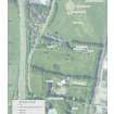
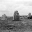
Present location: NJ 7792 1967, at the centre of the henge.
Evidence for discovery: first recorded c 1850 some 50m to the NE of the henge and by 1869 it had been moved into the henge for safety.
Present condition: good.
Description
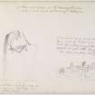
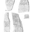
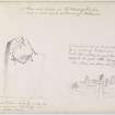
This large slab bears two incised symbols: the Pictish beast above a crescent and V-rod. The beast’s limbs are embellished with extra scrolls, and the crescent has arc decoration within it.
Date: seventh century.
References: Stuart 1856, 6; RCAHMS 2007, 116, 122; Fraser 2008, no 8.
Compiled by A Ritchie 2017
Field Visit (9 March 1964)
This symbol stone is positioned and described correctly above.
Visited by OS (RD) 9 March 1964.
Desk Based Assessment (1964)
NJ71NE 8 7798 1970 removed to NJ 7792 1967
(NJ 7798 1970) Standing Stone (NR) Sculptured (Site of) Removed to the adjacent Stone Circle
(NJ 7792 1967) Standing Stone (Sculptured) (NAT)
OS 6" map, (1938)
This symbol stone was removed to the centre of the henge (NJ71NE 6) when its original site, nearly 50 yards to the north-east, was quarried away. It is 5 feet 3 inches high, 3 feet 6 inches broad, and about a foot thick.
J R Allen and J Anderson 1903; J Ritchie 1920.
Information from OS, c. 1964.
Reference (1994)
This stone has been moved into the henge NJ71NE 6, and now stands at NJ 7792 1967.
RCAHMS 1994.
Reference (1997)
Class I symbol stone : South face shows an elephant above a crescent and V-rod .
A Mack 1997.
Field Visit (15 August 2000)
This Class I Pictish symbol stone now stands within the Broomend of Crichie henge (NJ71NE 6), but it formerly stood a short distance towards the E. A block of grey granite, it measures 1.18m in breadth by up to 0.4m in thickness and in height 1.4m high. The stone, which has conspicuous band of quartz running diagonally through it, is unshaped, but tapers upwards from its base. On its S face it bears the incised figure of a Pictish elephant above a crescent and V-rod. The elephant is depicted with a curled limb-joint above the fore-leg, and additional curlicues at the back of each leg above the spirals of the feet. The V-rod is portrayed with a leaf-shaped 'blade' to the right, and a flower-like tail to the left. Both are furnished with curlicues. The angle of the rod is bracketed, with simple internal decoration. The internal area of the crescent is decorated with a succession of arcs.
Although the earliest records of the stone (by Stuart and Dalrymple) place it a short distance eastwards from the henge, the location identified by the Ordnance Survey lies towards the NE, at NJ 7798 1970. The area around the stone was examined when the henge was excavated in 1855, but the ground appeared to have been disturbed previously and there were no finds. A few flat stones lying nearby possibly came from a cist (noted by Ritchie). Thereafter the symbol stone was moved to the centre of the henge (OS 6-inch map, Aberdeenshire, 1st edition, 1869, sheet lxiv), where it stands to this day.
Visited by RCAHMS (SPH, IFr), 15 August 2000).
J Stuart 1856; C E Dalrymple 1884; J Ritchie 1920.
Aerial Photographic Interpretation
CUCAP air photograph BVD 083 shows a very convincing square barrow-like mark at the original findspot.
NMRS, MS/712/67.


