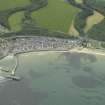
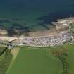
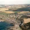
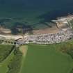
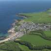
Cullen Harbour, Moray Firth
Harbour (Post Medieval)
Site Name Cullen Harbour, Moray Firth
Classification Harbour (Post Medieval)
Alternative Name(s) North Sea
Canmore ID 17961
Site Number NJ56NW 27
NGR NJ 51001 67408
NGR Description Centred NJ 51001 67408
Datum OSGB36 - NGR
Permalink http://canmore.org.uk/site/17961
- Council Moray
- Parish Cullen
- Former Region Grampian
- Former District Moray
- Former County Banffshire
NJ56NW 27.00 centred 51001 67408
Harbour [NAT] (at NJ 5103 6736)
OS 1:2500 map, 1965.
NJ56NW 27.01 NJ 5097 6745 Harbour Light (Beacon)
NMRS REFERENCE:
Architect - Thomas Telford 1803-21.
(Undated) information in NMRS.
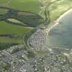
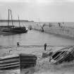
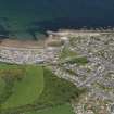
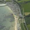
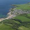
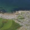
(Location cited as NJ 501 673). Cullen Harbour, built 1817, enlarged 1934 and later. A classic small harbour with a triangular basin enclosed by a curved and a straight pier, both rubble. A second straight pier, concrete-built, has been added to form a stilling basin.
J R Hume 1977.
(NJ 510 674). Royal Burgh though it was, Cullen could be described at some undetermined date in the 17th century as hardly worthy of the name of even a modest township, on account of its lack of a port. In respect of this latter point, the debased Latin expression 'defecta portu' is used, as it was in the case of Banff, with the possible implication that a harbour had once existed, but was no longer fit to use; and support for this suggestion may perhaps be seen in the marking of Cullen on Blaeu's map and in the existence in 1619 of a 'decayit harbarie', for the repair of which help was then asked from the Commissioners of Royal Burghs. This request does not seem to have been successful, but in 1699 a grant of 500 Scots pounds was authorised for the reapir of a pier, the harbour and a bridge. Nevertheless, both Defoe's continuator and the parish minister of 1794 noted the lack of a harbour, the latter remarking that one was badly needed to serve for the import of coal.
Improvement thus seems to have come inly in 1817 with the building of a small but substantial harbour, which was itself improved and enlarged with an additional quay of 1834. The writer of this note records that in his time (1842) Cullen harbour was one of the best in the Firth, giveng depths of water at the pier-head of from 8ft 6ins (2.6m) to 12 ft (3.66m). In 1847 Cullen was classed as a 'small pier harbour' and noted as liable to silting with sea-sand. The main imports were coal, salt, staves and barley, and the exports, herring, dried fish, timber, oats and potatoes.
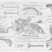
Earlier construction has no doubt been much altered and disguised by improvements effected in 1886-7; the styles of masonry now visible are quite varied, including smallish coursed blocks, dark in colour in the N and W piers, and some better-dressed work in the outer part of the former and at the end of the latter. The central pier has been covered with cement. Industrial archaeology can record an iron capstan on the N pier, 3ft 6ins (1.06m) high by 4ft (1.22m) in diameter, with sockets for ten bars; its centre is inscribed BLAIKIE BROTHERS ABERDEEN 1848 and it may be compared with one at Pettycur, Fife (NT28NE 43.01), made at Leith and dated 1813.
A Graham 1979, visited 1973.
Air photographs: AAS/97/12/G26/30 and AAS/97/12/CT.
NMRS, MS/712/29.
Construction (1817 - 1819)
Harbour typical of those constructed under the auspices of the Commissioners for Highland Roads and Bridges. The North Pier, built from 1817–19 by William Minto to a design by Telford, comprised coursed masonry walls enclosing rubble infill.
Construction (1835)
Enclosed harbour enlarged.
Construction (1886 - 1887)
North Pier extended.
Publication Account (2007)
Cullen Harbour
This small fishing harbour with two basins is typical of those constructed under the auspices of the Commissioners for Highland Roads and Bridges. The North Pier, built from 1817–19 by William Minto to a design by Telford,
comprised coursed masonry walls enclosing rubble infill.
During construction it was found necessary to build a breakwater to prevent the accumulation of sand against its inner face.
In 1835 the enclosed harbour was enlarged by demolishing the breakwater and re-siting it to form the present West Pier. At the same time, to reduce wave action in the harbour during adverse weather conditions, the inner
jetty was constructed to form a stilling basin.
In 1886–87 the North Pierwas extended to provide protection to the entrance of the harbour. This was constructed of inner and outer mass concrete walls infilled with rubble. The engineer was John Willet and the contractor, R. C. Brebner. The harbour is now used mainly for recreational
activities.
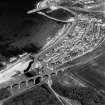
The harbour and town are dominated by the three now disused railway masonry viaducts with brick arch-rings completed on the Great North of Scotland Railway coastal line in 1886 under the direction of its engineer P. M. Barnett of Blyth & Cunningham. The nearest viaduct to the harbour is in two parts, one with 13 arches, and the other of eight arches passes over the Cullen Burn at a height of 77 ft.
R Paxton and J Shipway, 2007.
Reproduced from 'Civil Engineering heritage: Scotland - Highlands and Islands' with kind permission from Thomas Telford Publishers.


