
Pricing Change
New pricing for orders of material from this site will come into place shortly. Charges for supply of digital images, digitisation on demand, prints and licensing will be altered.
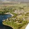
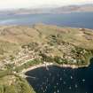
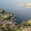
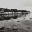
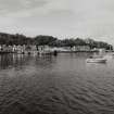
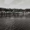
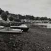
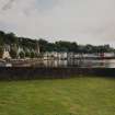
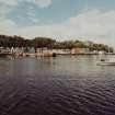
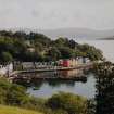
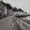
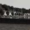
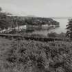
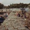
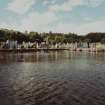
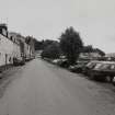
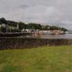
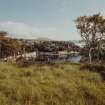
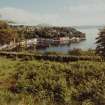
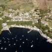
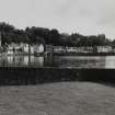
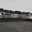
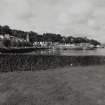
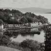
Mull, Tobermory Harbour


Harbour (Period Unassigned)
Site Name Mull, Tobermory Harbour
Classification Harbour (Period Unassigned)
Alternative Name(s) Tobermory Bay; Sound Of Mull
Canmore ID 157750
Site Number NM55NW 19
NGR NM 505 552
NGR Description Centred NM 505 552
Datum OSGB36 - NGR
Permalink http://canmore.org.uk/site/157750


- Council Argyll And Bute
- Parish Kilninian And Kilmore
- Former Region Strathclyde
- Former District Argyll And Bute
- Former County Argyll
NM55NW 19.00 centred 505 552
The Harbour [NAT]
OS 1:10,000 map, 1976.
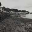
For boatbuilder's shed (NM c. 505 553), see NM55NW 34.
For Santa Maria de Gracia y San Juan Bautisa (Florencia or the 'Tobermory galleon') at NM c. 5100 5500, see NM55NW 8103.
For shipwrecks around Calve Island, see NM55SW 8002-5 and 8009.
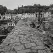
NM55NW 19.01 NM 50579 55243 Old (Telford) Pier
NM55NW 19.02 NM 5079 5529 Mishnish (New) Pier ('Steamer pier')
NM55NW 19.03 NM 5078 5531 Mishnish Pier, Harbour Office
NM55NW 19.04 NM 5046 5507 to NM 5055 5506 breakwater

