|
Photographs and Off-line Digital Images |
B 93517 S |
|
Comparative plans of hillforts with timber-laced walls or ramparts in the NE province from Feachem in Rivet (ed) The Iron Age in N Britain. |
1966 |
Item Level |
|
|
Prints and Drawings |
DC 31545 |
Records of the Royal Commission on the Ancient and Historical Monuments of Scotland (RCAHMS), Edinbu |
Plane table survey: Dunearn Fort. |
15/4/1956 |
Item Level |
|
|
Prints and Drawings |
DC 31546 |
Records of the Royal Commission on the Ancient and Historical Monuments of Scotland (RCAHMS), Edinbu |
Inked plan: Dunearn fort. |
15/4/1956 |
Item Level |
|
|
Manuscripts |
MS 36/181 |
Records of the Royal Commission on the Ancient and Historical Monuments of Scotland (RCAHMS), Edinbu |
Field notebook of R W Feachem (RCAHMS). 1955-57 (ii). Counties: Dumf, Stir, ELot, Banff, Inv, S.Uist, Aber, Pee, R+C, Moray. Includes some Marginal Land Survey. |
4/1955 |
Item Level |
|
 |
On-line Digital Images |
DP 149871 |
Records of the Royal Commission on the Ancient and Historical Monuments of Scotland (RCAHMS), Edinbu |
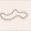
Inked plan: Dunearn fort. |
c. 1974 |
Item Level |
|
 |
On-line Digital Images |
DP 149872 |
Records of the Royal Commission on the Ancient and Historical Monuments of Scotland (RCAHMS), Edinbu |
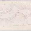
Plane table survey: Dunearn Fort. |
15/4/1956 |
Item Level |
|
 |
Digital Files (Non-image) |
WP 000781 |
Records of the Royal Commission on the Ancient and Historical Monuments of Scotland (RCAHMS), Edinbu |
Scanned copy of RCAHMS Marginal Land Survey unpublished typescripts (Nairnshire). |
1957 |
Item Level |
|
 |
Digital Files (Non-image) |
WP 002403 |
Records of the Royal Commission on the Ancient and Historical Monuments of Scotland (RCAHMS), Edinbu |
Scanned copy of RCAHMS Emergency Survey: Manuscripts (1943 Volume 2). |
1943 |
Item Level |
|
 |
Digital Files (Non-image) |
WP 002412 |
Records of the Royal Commission on the Ancient and Historical Monuments of Scotland (RCAHMS), Edinbu |
RCAHMS Emergency Survey: Typescripts (Nairn). |
1943 |
Item Level |
|
 |
On-line Digital Images |
DP 171764 |
|
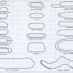
Comparative plans of hillforts with timber-laced walls or ramparts in the NE province from Feachem in Rivet (ed) The Iron Age in N Britain. |
1966 |
Item Level |
|
 |
On-line Digital Images |
DP 171887 |
RCAHMS Field Survey Digital Photography |
Distant view. |
11/10/2013 |
Item Level |
|
 |
On-line Digital Images |
DP 171888 |
RCAHMS Field Survey Digital Photography |
Distant view. |
11/10/2013 |
Item Level |
|
 |
On-line Digital Images |
DP 171890 |
RCAHMS Field Survey Digital Photography |
General shot. |
11/10/2013 |
Item Level |
|
 |
On-line Digital Images |
DP 171891 |
RCAHMS Field Survey Digital Photography |
General shot. |
11/10/2013 |
Item Level |
|
 |
On-line Digital Images |
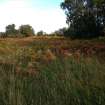
DP 171892 |
RCAHMS Field Survey Digital Photography |
General shot. |
11/10/2013 |
Item Level |
|
|
Manuscripts |
MS 36/275 |
Records of the Royal Commission on the Ancient and Historical Monuments of Scotland (RCAHMS), Edinbu |
RCAHMS Emergency Survey; manuscripts 1943 (vol.2) |
1943 |
Item Level |
|
 |
Digital Files (Non-image) |
WP 007514 |
Publications by the Royal Commission on the Ancient and Historical Monuments of Scotland |
(5) The Archaeological Sites and Monuments of Nairn District |
9/1978 |
Item Level |
|
 |
On-line Digital Images |
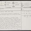
SC 2368337 |
Records of the Ordnance Survey, Southampton, Hampshire, England |
Dunearn, NH94SW 1, Ordnance Survey index card, page number 1, Recto |
c. 1958 |
Item Level |
|
 |
On-line Digital Images |
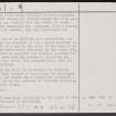
SC 2368338 |
Records of the Ordnance Survey, Southampton, Hampshire, England |
Dunearn, NH94SW 1, Ordnance Survey index card, page number 2, Verso |
c. 1958 |
Item Level |
|
 |
On-line Digital Images |
SC 2368339 |
Records of the Ordnance Survey, Southampton, Hampshire, England |
Dunearn, NH94SW 1, Ordnance Survey index card, Recto |
c. 1958 |
Item Level |
|
 |
On-line Digital Images |
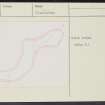
SC 2368340 |
Records of the Ordnance Survey, Southampton, Hampshire, England |
Dunearn, NH94SW 1, Ordnance Survey index card, Recto |
c. 1958 |
Item Level |
|
|
All Other |
551 166/1/1 |
Records of the Ordnance Survey, Southampton, Hampshire, England |
Archaeological site card index ('495' cards) |
1947 |
Sub-Group Level |
|