Dunearn
Fort (Prehistoric), Vitrified Stone (Prehistoric)(Possible)
Site Name Dunearn
Classification Fort (Prehistoric), Vitrified Stone (Prehistoric)(Possible)
Alternative Name(s) Doune
Canmore ID 15497
Site Number NH94SW 1
NGR NH 9324 4067
Datum OSGB36 - NGR
Permalink http://canmore.org.uk/site/15497
- Council Highland
- Parish Ardclach
- Former Region Highland
- Former District Nairn
- Former County Nairn
NH94SW 1 9324 4067
(NH 9324 4067) Dunearn (NAT)
Fort (NR)
OS 1:10,000 map, (1976)
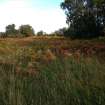
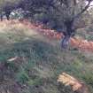
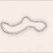
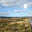
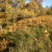
Dunearn, a fort, timber-laced according to Feachem (1963), occupies the level S-shaped summit of a wooded hill named Doune.
It measures about 245.0m NE-SW by a maximum of stome 45.0 m transversely, within two ruinous, turf-covered walls whose character and content of small stones and the fact that facing stones are nowhere evident suggest that they were timber-laced. According to Feachem, patches of vitrifaction can be seen in the inner wall, particularly in the SE sector, but none was seen during field investigation. The inner wall conforms to the lip of the summit of the hill and is spread to about 4.0m. The outer wall, visible as a stony scarp averaging some 3.5m wide, is separated from the inner by a terrace at the most 3.0m wide and generally only 1.5m wide. As it is unlikely that two walls would be built so close together and as at no point around the circumference can it be seen that either wall has tumbled over the other, it seems probably that they represent one structure, with a central stabilising wall of timbers, but only excavation can qualify this.
A gap in the NE may be an entrance or a mutilation, but the main entrance was probably at the easiest approach in the S where there is a gap in the walls at the head of an ill-defined track which leads obliquely up the slope from the SW. This track is possibly the original approach but has undoubtedly been used for access to cultivate the interior of the fort which was ploughed until 1906 (Feachem 1963) and is now featureless.
Down the slope to the S of the entrance, the hillside appears to have been scarped in two places for distances of about 70.0m, and around the W slopes are traces of a terrace. These may be the remnants of outworks defending the more vulnerable slopes.
Surveyed at 1:2500.
Visited by OS (A A) 23 February 1971.
A small piece of iron slag, picked up on the slope of this fort, has been retained by the finder.
I Keillar 1974.
Field Visit (21 September 1943)
This site was included within the RCAHMS Emergency Survey (1942-3), an unpublished rescue project. Site descriptions, organised by county, vary from short notes to lengthy and full descriptions and are available to view online with contemporary sketches and photographs. The original typescripts, manuscripts, notebooks and photographs can also be consulted in the RCAHMS Search Room.
Information from RCAHMS (GFG) 10 December 2014.
Field Visit (15 April 1957)
Fort, Doune.
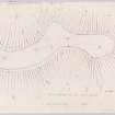
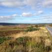
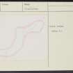
This fort occupies a serpentine hill named Doune on the O. S. map which rises to a height of a little over 800 feet O. D. close to the right bank of the River Findhorn, half a mile S. of Bridge of Dulsie. It commands a fairly extensive view in all directions, including the lower part of that section of the valley of the River Findhorn which is known as Streens and which forms a pass to Strathdearn. To N., E. and S. the flanks of the hill are steep but not precipitous, but the approach from the W. is much easier. The summit of the hill must always have been comparatively level, but was doubtless made more so when it was under the plough. The farmer at Dunearn stated that cultivation had ceased in 1906 but until that date had been carried on for some considerable time. As a result of this, in addition to the normal processes of stone robbing and decay, the remains of the fort are slight. The level summit area is, as can be seen on the plan, S-shaped in form, and measures medially almost 900 feet in length from E. to by a maximum of 160 feet in breadth. This sinuous area was defended by two parallel walls, both of which are now very ruinous. The inner, built -on the natural crest of the hill, reveals solid lumps and masses of vitrifaction at points towards the E. end of the SE section (see plan), while over the rest of its length scattered stones and boulders occur in varying degrees of concentration. At certain places a very slight mound occurs along the course of the wall, but the slight nature of this suggests that it probably belonged to the phase of cultivation rather than to that of fortification. The outer wall is represented by a shallow scarp or by a mere crest-line, dotted rather sparsely with stones and boulders and lying about 20 feet outside the crest of the inner wall. The entrance to the fort lies in the SW. arc of the walls, and was doubtless reused when the interior of the fort was cultivated and during the War of 1939/45 when an artillery base was established in the fort.
Among forts with vitrifaction this one falls into the group of the larger, more open, structures such as Craig Phadraig [NH64NW 6] and the Ord Hill of Kessock [NH64NE 37] rather than with the small, sometimes secondary, structures, such as the Doune of Relugas [NJ04NW 5], Castle Finlay [NH85SE 7] or Dun Evan [NH84NW 5], distant seven miles to the NE, seven and a half miles to the NNW, and eight miles to the WNW respectively. While the small structures mentioned seem to represent elements in the easternmost spread of a structural type, the larger forts may rather be aligned with the type stretching SE from Knockrarril in Strathpeffer [NH55NW 10] into eastern Scotland. Tentatively at least this structure at Dunearn can be fitted into this group.
Visited by RCAHMS 15 April 1957.
Field Visit (April 1978)
Dunearn NH 932 406 NH94SW 1
This fort, which is S-shaped on plan, measures 274m from SW-NE by 49m tranversely, and is defended by two walls, the inner of which contains vitrified stone. The entrance lies on the S.
RCAHMS 1978, visited April 1978
Feachem 1966, 67; 1977, 140
Note (25 March 2015 - 28 November 2016)
Situated on the summit of a low hill rising from the SE bank of the River Findhorn, this fort follows the contour around the flat-topped summit, which describes a sinuous S-shape on plan. The perimeter is largely reduced to two stony scarps separated by a terrace typically about 1.5m wide, but opinions on its true character vary, Angus Graham and Gordon Childe describing it in 1943 as a single rampart, the RCAHMS investigators drawing up the plan in 1956 for the Survey of Marginal Lands as two walls, and Alan Ayre for the OS in 1971 suggesting that the two scarps were so close together that they were perhaps the remains of a single structure. Nevertheless, in 1943 a slit trench dug into the inner, which in places forms a bank of rubble rising 0.6m above the level of the interior, revealed pieces of vitrified stone, and other pieces were observed in the SE sector in 1956, indicating that there is at the very least a timber-laced wall here. Ayre also noted traces of scarps on the slopes below the S and W flanks of the SW end of the fort, possibly representing the remains of outer ramparts blocking the easiest line of approach. The interior, which was under plough until about 1906, measures about 275m in length along a medial line by about 45m transversely (0.7ha). A gap in the S arc of the SW end, which is approached obliquely up the slope from the SW by a trackway may be an entrance, but a second gap noted by Ayre at the NE end does not appear on the plan drawn up in 1956 and may not be original.
Information from An Atlas of Hillforts of Great Britain and Ireland – 28 November 2016. Atlas of Hillforts SC2916


