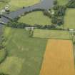
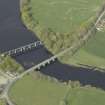
Glenlochar Bridge
Road Bridge (Period Unassigned)
Site Name Glenlochar Bridge
Classification Road Bridge (Period Unassigned)
Alternative Name(s) River Dee; Water Of Ken; Culvennan
Canmore ID 151731
Site Number NX76SW 41
NGR NX 73206 64512
Datum OSGB36 - NGR
Permalink http://canmore.org.uk/site/151731
- Council Dumfries And Galloway
- Parish Balmaghie
- Former Region Dumfries And Galloway
- Former District Stewartry
- Former County Kirkcudbrightshire
NX76SW 41 73206 64512
Glenlochar Bridge [NAT]
OS 1:10,000 map, 1982.
For barrage to the N (at NX 7322 6460), see NX76SW 40.
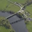
(Location cited as NX 732 645). Glenlochar Bridge: a very similar bridge [to Ken Bridge, NX67NW 7] over the River Dee; dates from the raly 19th century.
I Donnachie 1971.
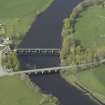
(Location cited as NX 733 645). Glenlochar Bridge, early 19th century. A 6-span bridge with segmental arches and circular flood-relief holes through the spandrels.
J R Hume 1976.
Glenlochar Bridge, c. 1790. Five-arched granite and rubble, spanning the River Ken.
J R Hume 2000.
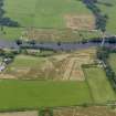
This bridge carries the B795 public road across the River Dee to the S of Glanlochar Barrage (NX76SW 40). The river here forms the boundary between the parishes of Balmaghie (to the W) and Crossmichael (to the E).
The location assigned to this record defines the midpoint of the structure. The available map evidence indicates that it exists from NX c. 73154 64503 to NX c. 73250 64517.
Information from RCAHMS (RJCM), 16 March 2006.
Publication Account (2007)
This substantial bridge carries the B795 Laurieston road over the Dee north-west of Castle Douglas. It was built
from 1797–99 and has six masonry arches each of 3912 ft span, and a width between parapets of 1712 ft. The
masonry is grey granite with dressed arch stones and random rubble parapets with dressed copes. The cutwaters are rounded with buttresses above which are blind circular medallions in the spandrels. The bridge
was built by Samuel McKean and John McCraken was consulted.
R Paxton and J Shipway 2007
Reproduced from 'Civil Engineering heritage: Scotland - Lowlands and Borders' with kind permission from Thomas Telford Publishers.


