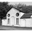
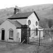
Inveraray Castle Estate, Garron Bridge, Garron Lodge
Lodge (18th Century)
Site Name Inveraray Castle Estate, Garron Bridge, Garron Lodge
Classification Lodge (18th Century)
Alternative Name(s) Shira Bridge; Inveraray Castle Policies
Canmore ID 149828
Site Number NN11SW 10.01
NGR NN 11342 10134
Datum OSGB36 - NGR
Permalink http://canmore.org.uk/site/149828
- Council Argyll And Bute
- Parish Inveraray
- Former Region Strathclyde
- Former District Argyll And Bute
- Former County Argyll
NN11SW 10.01 11342 10134 Lodge
NN11SW 10.00 NN 11395 10097 Inveraray Estate, Garron Bridge
NN11SW 10.01 NN 11357 10123 Screen Wall
Measured Survey (4 July 1988)
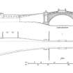
RCAHMS surveyed Garron Lodge on 4 July 1988 producing an elevation of the lodge from the south at a scale of 1:200. The elevation was redrawn in ink and published at a scale of 1:500 (RCAHMS 1992, 518).
Field Visit (June 1988)
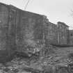
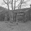
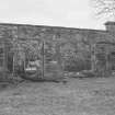
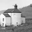
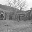
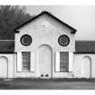
This lodge is situated 2km NE of Inveraray Castle (No. 184) and 45m WNW of the Garron Bridge (No. 268), to which it is linked by an arcaded screen-wall. It stands on the N side of the former military road (No. 264), at the gate of a beech avenue (now truncated by the re-routing of the A83 road) which led to a private approach to the castle, formed in 1775.Robert Mylne examined the site in August of that year, and in December he supplied a set of drawings, which survives, for the lodge and gate. He 'set out the situation of the lodge' the following August, and in January 1777 he gave the 5th Duke 'a long drawing' showing a symmetrical arrangement of screen-walls and lodges, centred on the bridge. Only the W half of the scheme was executed, and that not until 1783-4, while Mylne made 'improvements' to the outbuildings behind the screen-wall in 1785 (en.1).
RCAHMS 1992, visited June 1988
[see RCAHMS 1992 No. 195 for a full description of the lodge and screen walls]


