
Pricing Change
New pricing for orders of material from this site will come into place shortly. Charges for supply of digital images, digitisation on demand, prints and licensing will be altered.
Upcoming Maintenance
Please be advised that this website will undergo scheduled maintenance on the following dates:
Thursday, 9 January: 11:00 AM - 3:00 PM
Thursday, 23 January: 11:00 AM - 3:00 PM
Thursday, 30 January: 11:00 AM - 3:00 PM
During these times, some functionality such as image purchasing may be temporarily unavailable. We apologise for any inconvenience this may cause.
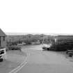
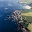
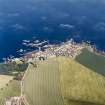
St Abbs, Harbour


Harbour (19th Century)
Site Name St Abbs, Harbour
Classification Harbour (19th Century)
Alternative Name(s) St Abbs Harbour
Canmore ID 128379
Site Number NT96NW 54
NGR NT 92042 67325
NGR Description Centred NT 92042 67325
Datum OSGB36 - NGR
Permalink http://canmore.org.uk/site/128379


- Council Scottish Borders, The
- Parish Coldingham
- Former Region Borders
- Former District Berwickshire
- Former County Berwickshire
NT96NW 54.00 centred 92042 67325
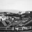
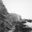
NT96NW 54.01 NT 92053 67317 Lifeboat Station
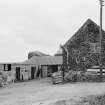
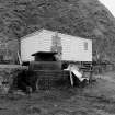
NT96NW 54.02 NT 91961 67292 Gear Stores
Not to be confused with Pettico Wick Harbour ('St Abbs Fishery') at NT 9080 6907, for which see NT96NW 47.
For Fish House at NT 92021 67266, see NT96NW 195.
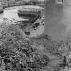
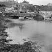
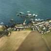
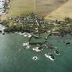
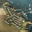
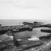
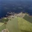
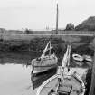
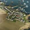
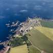
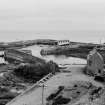
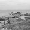
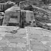
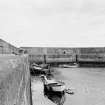
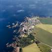
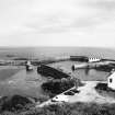
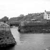
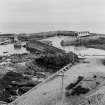
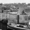
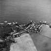
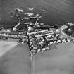
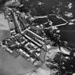
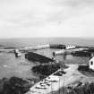
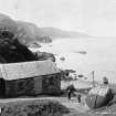
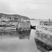
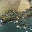
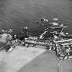
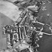
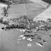
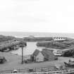
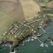
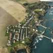
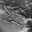
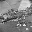
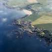
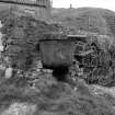
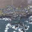
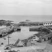
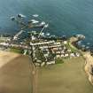
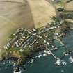
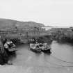
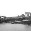
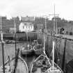
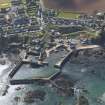
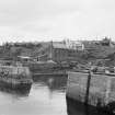
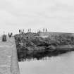
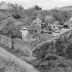
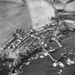
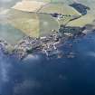
(Location cited as NT 920 673). St Abbs, Berwickshire. No harbour existed in Coldingham parish in 1794 (Stat. Acct), but work was put in hand in 1831 to provide a refuge for fishing-boats, and a developed version of this still stands inside the much larger later works. As now improved and expanded, this original harbour comprises a squarish box, extending only to about a quarter of an acre [0.101ha], inserted in an natural pocket among the littoral rocks, which have been quarried away as necessary or made to serve as foundations. The SW side is formed of a shore-based wharf, partly built and partly rock-cut, the NW side by a pier, originally a breakwater only, and the SE and NE sides by another, which returns at right angles at the E corner. The entrance, 20ft [6.1m] wide, which has chases for booms and is partly rock-cut, is at the N corner, and beyond this a narrow extension of the NE pier runs on for a further 75ft [22.9m]. This is an addition to the work of 1831. The face of the wharf on the SW may be later than the rest as it is of different build.
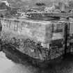
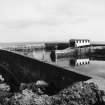
The main interest of the place lies in the date that it provides for the character of masonry employed. The piers are of large, well-dressed, scabbled blocks, set dry and accurately coursed. These vary somewhat in thickness from place to place, and on the seaward faces are in general deeply rusticated. These faces show considerable batter.
A Graham 1971.
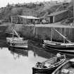
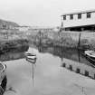
(Location cited as NT 920 673). St Abbs harbour, built 1833 and subsequently enlarged. A harbour of enclosure with an L-plan pier and a straight pier enclosing a roughly rectangular basin. An inner basin is formed by two straight piers. Ancillary features include two net-boiling tubs.
J R Hume 1976.
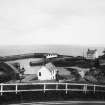
Photographic Survey (September 1961)
Survey of St Abbs harbour and lighthouse, Berwickshire, by the Scottish National Buildings Record in 1961.
Sbc Note (15 April 2016)
Visibility: Standing structure or monument.
Information from Scottish Borders Council

