
Pricing Change
New pricing for orders of material from this site will come into place shortly. Charges for supply of digital images, digitisation on demand, prints and licensing will be altered.
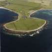
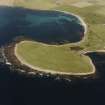
Sanday, Westbrough Steading


Farmstead (Period Unassigned), Threshing Machine (Post Medieval)
Site Name Sanday, Westbrough Steading
Classification Farmstead (Period Unassigned), Threshing Machine (Post Medieval)
Alternative Name(s) Westbrough Steading
Canmore ID 112845
Site Number HY64SE 62
NGR HY 66311 42273
Datum OSGB36 - NGR
Permalink http://canmore.org.uk/site/112845


- Council Orkney Islands
- Parish Cross And Burness
- Former Region Orkney Islands Area
- Former District Orkney
- Former County Orkney
HY64SE 62 66311 42273.
This medium-sized steading of open rectangular plan and incorporating an earlier house, was gutted and used as a store. The buildings have been much altered and added to, the whole being in agricultural use and in good order on the date of visit.
Visited by RCAHMS (GJD), October 1996; NMRS MS 744/129/5 (Scottish Farm Buildings Survey).
RCAHMS and NMS, 1998.

