Bridgend, Kilmichael Bridge
Road Bridge (18th Century)
Site Name Bridgend, Kilmichael Bridge
Classification Road Bridge (18th Century)
Alternative Name(s) Bridgend Bridge; River Add; Kilmichael, Old Bridge; Kilmichael Bridge, Bridgend
Canmore ID 109033
Site Number NR89SE 33
NGR NR 85283 92621
Datum OSGB36 - NGR
Permalink http://canmore.org.uk/site/109033
- Council Argyll And Bute
- Parish Kilmichael Glassary
- Former Region Strathclyde
- Former District Argyll And Bute
- Former County Argyll
NR89SE 33 85283 92621
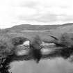
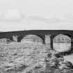
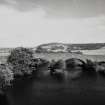
(Location cited as NR 853 926). Kilmichael Bridge, Bridgend, built 1737. A four-span rubble bridge, with two main segmental arches flanked by small flood arches. The cutwaters are triangular. Now bypassed.
J R Hume 1977.
This bridge carries the former line of the A816 public road over the River Add at the S end of Bridgend village.
Information from RCAHMS (RJCM), 29 June 2010.
Field Visit (March 1985)
This bridge, which is now by-passed by the A816 but carries local traffic, crosses the River Add on a NNW-SSE axis about 1km SSW of Kilmichael Glassary. It is built of random rubble-masonry and consists of two main segmental arches, each of approximately 10m span, with a lesser arch of 6.1m span on the S approach and a minor culvert on the N flood-plain. There are triangular splayed cutwaters flanking the central of the three principal arches. The total length is about 45m and the carriageway, which rises to a height of over 5.7m above water-level, measures 3.8m in width within parapets 0.4m thick and 0.9m in maximum height. Above the crown of the W face of the central arch there is a panel inscribed in Roman capitals: BUILT / BY THE SHIRE / 1737.
This bridge was of particular importance because of the cattle-fairs held in the adjacent field W of the river. However, flood-damage required frequent repairs, as in 1749 when the 'mid-pillar' and W 'land stool' (abutment) of the 'Bridge of Add' were repaired (en.1). Despite further work in 1755, the bridge was described as ruinous in 1769, and in 1777 it was decided that a protective barricade should be built upstream of the S end (en.2).
RCAHMS 1992, visited March 1985
Measured Survey (30 January 1989)
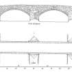
RCAHMS surveyed Bridgend Bridge, Kilmichael Glassary on 30 January 1989 producing a plan and west elevation at a scale of 1:100. The plan and elevation were redrawn in ink and published at a scale of 1:250 (RCAHMS 1992, 505B).


