Pricing Change
New pricing for orders of material from this site will come into place shortly. Charges for supply of digital images, digitisation on demand, prints and licensing will be altered.
Upcoming Maintenance
Please be advised that this website will undergo scheduled maintenance on the following dates:
Thursday, 9 January: 11:00 AM - 3:00 PM
Thursday, 23 January: 11:00 AM - 3:00 PM
Thursday, 30 January: 11:00 AM - 3:00 PM
During these times, some functionality such as image purchasing may be temporarily unavailable. We apologise for any inconvenience this may cause.
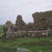
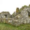
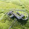
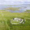
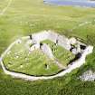
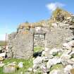
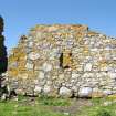
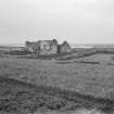
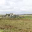
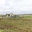
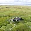
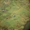
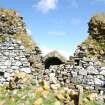
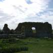
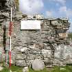
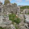
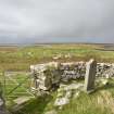
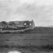
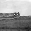
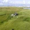
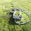
North Uist, Carinish, Teampull Na Trionaid
Burial Ground (Medieval), Church (14th Century), House (16th Century)
Site Name North Uist, Carinish, Teampull Na Trionaid
Classification Burial Ground (Medieval), Church (14th Century), House (16th Century)
Alternative Name(s) Teampull Clann A Phiocair; Temple Of The Trinity; Teampull Na Trianaide; Chapel Of The Macvicars
Canmore ID 10265
Site Number NF86SW 24
NGR NF 81625 60285
Datum OSGB36 - NGR
Permalink http://canmore.org.uk/site/10265
First 100 images shown. See the Collections panel (below) for a link to all digital images.
- Council Western Isles
- Parish North Uist
- Former Region Western Isles Islands Area
- Former District Western Isles
- Former County Inverness-shire
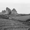
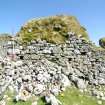
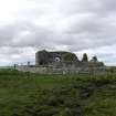
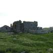
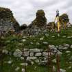
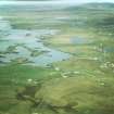
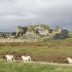
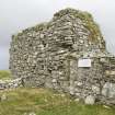
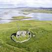
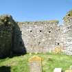
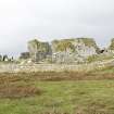
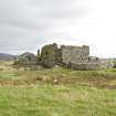
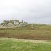
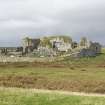
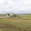
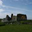
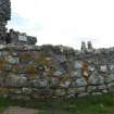
Teampall na Trionaid, uncertain early history but possibly built c.12 00 (on an earlier site) The plundered ruin of an important pre- Reformation church dedicated to the Holy Trinity, beautifully sited on an eminence overlooking the Oitir Mhor. Attributed by The Book of Clan Ranald to the Iona prioress, Beathag, daughter of Somerled, it was probably enlarged in the late 14 th century when Amy MacRuari, divorcee of John, Lord of the Isles, developed it into an important seat of learning. The square-cornered north wall is remarkably well preserved, despite the loss of carved stones and freestone dressings. Its rubble masonry courses are interspersed every foot or so by a distinctive thin layer of pinnings, with putlock holes evident in the western section. The Teampall was still used for public worship in 1728.
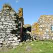
Teampall Clann a' Phiocair, possibly 16th century. Of uncertain original use, but possibly a house, connected to the church by a vaulted passage. Post-Reformation use as a burial place for the notable MacVicar family of scholars explains its name. Semi-circular walled burial enclosure, probably 18th century.
Taken from "Western Seaboard: An Illustrated Architectural Guide", by Mary Miers, 2008. Published by the Rutland Press http://www.rias.org.uk
NF86SW 24 8162 6028
(NF 8162 6028) Teampull na Trionaid (NR) (Ruins of),
Teampull Clann a' Phiocair (NR) (Ruins of)
OS 6" map, Inverness-shire, 2nd ed., (1904)
It seems certain that neither of the twin churches of the Trinity and of the Clan MacVicar, at Carinish, was a parish church.
'It would appear that the former was built from the wood of Columban times into primitive stone; again from Celtic to Gothic style (perhaps by Amie MacRuari c.1350-90) and finally reconstructed during the 16th century into its latter form'. Teampull Clann a'Phiocair, later in origin, probably remained as first erected with little change.
The two chapels are about 5ft apart, and are connected by a passage which is bonded to neither church.
When Beveridge wrote, a substantial amount of the walls still remained, although dilapidated, and both buildings contained burials. To the south was a graveyard still in use.
E Beveridge 1911; F W L Thomas 1890; Visited by OS (D S) 22 July 1956.
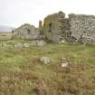
Generally as previously described and planned. The walls of Teampull na Trionaid are 1.0m thick and stand to a height of c. 6.0m except at the SE angle where the east wall is reduced to c. 2.5m and the south wall to c. 0.7m. A modern wall has been built on to the south wall at the west end.
The walls of Teampull Clann a' Phiocair are 0.8m thick. The south, east and west walls are 1.4m, 5.0m, and 3.0m high respectively: the north wall has been recently rebuilt to a height of 1.0m.
The passage connecting the two buildings is now blocked with stone and barely visible.
The burials within the buildings and in the graveyard are mainly modern. Several old head-stones were seen but no dates were discernible.
Visited by OS (WDJ), 1 June 1965.
NF 8162 6028 A desk-based survey and non-invasive site assessment was made, in association with Simpson & Brown Architects, of the ruined church, burial enclosures and extensive surrounding remains and earthworks.
Sponsor: Southern Isles Amenity Trust.
T Addyman 2000.
Scheduled as Teampull na Trionaid (Church of the Holy Trinity) and Teampull Clann a'Phiocair (Chapel of the MacVicars).
Information from Historic Scotland, scheduling document dated 9 March 2005.
Field Visit (19 July 1924)
Teampull na Trionaid, Carinish.
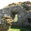
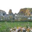
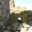
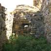
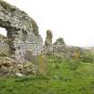
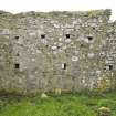
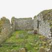
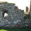
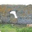
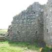
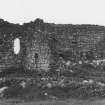
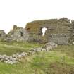
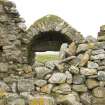
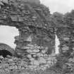
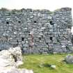
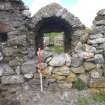
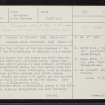
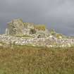
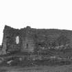
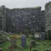
The ruin of this church, which was dedicated to the Holy Trinity, stands on the summit of a knoll on the Carinish promontory. On plan it is an oblong, measuring 21 feet 3 inches from north to south by 61 ½ feet from east to west within walls averaging 3 feet 8 inches thick, which still stand to a height of 17 to 20 feet, save at the south-east angle, which is breached. The interior is encumbered with graves and debris, and is covered with a dense growth of nettles. The walls are built of rubble in lime mortar, brought to courses in the lateral walls, but the west gable, save at the uppermost courses, which resemble those of the lateral walls, is built at random; if there is any significance in this difference in masonry, the lower part of the gable may therefore be earlier than the lateral walls. The east gable is furnished with a rough, spreading ground course. The walls are pierced by a series of beam-holes, of which there are two tiers in the gable and a single tier on the sides; these are possibly wind vents.
In the east wall an aumbry is found 10 feet above the ground; there has been a central window, apparently of considerable size; a lancet fairly complete with deeply-splayed jambs and arched head remains at the east end of the north wall, and traces of a doorway, probably secondary, are found at a gap towards the western end, while eastwards in the same wall there has been a doorway communicating by a vaulted passage with a second structure, apparently a house and not a chapel, though known as Teampull MacVicar (Teampull Clann a' Phiocair). This is subsequent to the church and is an oblong on plan, measuring internally 13 ½ feet from north to south by 23 feet from east to west. The walls average in thickness 2 feet 9 inches. The masonry externally resembles that of the church, but internally many small flags are used, for the most part bedded flat but occasionally on edge. The gables are steeply pitched for a timber roof. The north wall is ruinous and shows no trace of a door. The west gable contains a narrow central window with an aumbry towards the north end; the east gable has a similar window flanked by two aumbries. There IS no sign of an altar seating. The south wall east of the vaulted passage contains a small window. The passage lintelled at the northern end is otherwise covered with a semicircular barrel-vault. It is lit on each side by a small window. An enclosing wall can be traced on the north, returning southward to the north-west angle of the church.
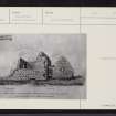
The church appears to date from the 16th century on the evidence of the lancet, which resembles those at Rodil Priory, but the proportions of the structure are in keeping with a 14th-century origin. The house is evidently subsequent and possibly dates from later in the 16th century. (Figs. 104, 105.)
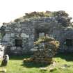
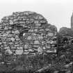
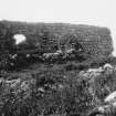
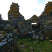
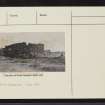
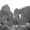
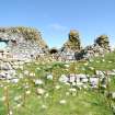
The structures are in a very dilapidated state. (Fig. 106.)
HISTORICAL NOTE. On this church see Introd., p. xx. In July 1389 Godfrey, son of Amie MacRuari, as “lord of Uist”, confirmed a grant by his mother's aunt Christina, daughter of Allan MacRuari, to the monastery of St John the Evangelist in Inchaffray (Insula Missarum), Perthshire, a house of Augustinian Canons, of “the chapel of the Holy Trinity in Uist, the whole land of Carinish (Karynche) and four pennylands in Illeray”, a grant again confirmed by Donald, Lord of the Isles, in 1410 (1). But in the Rental of the Bishopric of the Isles and Abbacy of Icolmkill (c . 1561), “Cairenische” and lands in “Eillera” are listed among the Abbot's lands (2); and in 1575 “Carinche” was held from the Bishop of the Isles by James Macdonald (Gruamach) of Castle Camus (3). In 1601 occurred the battle of Carinish between a raiding company of Harris Macleods and the local Macdonalds, being an episode in a series of mutual raids. The Macdonalds went “to tak a prey of goods out of the precinct of the church of Kil-trynad, wher the people had put all ther goods and cattall, as in a sanctuarie” (4).
Captain Thomas was told that the dressed stones of windows and doors had been “pulled down to make the graves in the floor of the church”. He also cites T. S. Muir, author of Ecclesiological Notes on Some of the Islands, to the following effect: “It would appear that, till about the beginning of the present century, the interior of the greater church was decorated with sculptures similar to those still existing at Rodil, as I was told that one Macpherson, an octogenarian living at Cladach, Carinish, remembers having seen, when a boy, stones in the walls figured with angels, armed men, animals, etc….” (5). He adds a note of information supplied by the late Dr Carmichael: “There was a spire (pinnacle) upon the east gable of Trinity Church, with the figure of a giant (fomhair) with three heads, on the top. This ‘giant with three heads’ was probably a representation of the Trinity. Some say that the ‘giant with three heads’ stood in a niche in the gable, and not on the top. There were several pieces of sculpture, both inside and outside of the church, but these being of freestone were carried away for sharpening stones. It is also said there was an altar of marble or freestone in the church, and that the sides of the doors and windows were of cut freestone, which have been taken out and carried away. There are some bits still remaining” (6). Dr Carmichael is also the source of the note on Teampull Mac Vicar, which runs: “The small chapel ... is called Teampull Chlann a Phiocair, from some families o fthe Macvicars who took possession of it for burying therein. An old man still living, John Macvicar, Balsher, told me lately that he saw the ruin roofed and thatched with heather” (7). Dr Beveridge writes: “It is credibly stated that, during the sixteenth century, Donald Macvicar (known as Am Piocair Mor) held a large portion of North Uist” (8). This “Big Vicar” may have been in possession at the Reformation and seized the church lands, either building or continuing to occupy this house. The census of 1861 shows 98 persons of the name of Mac Vicar in North Uist (9).
RCAHMS 1928, visited 19 July 1924.
OS map ref: North Uist xxxix.
(1) Charters of Inchaffray (S.H.S.), Nos. cxlii-iii. (2) Coll. de Reb. Alb., p. 2. (3) Ibid., p. 10. (4) Sir R. Gordon's Earldom of Sutherland, p. 244. (5) Archaeol. Scot., V., p. 238. (6) Ibid., p. 226 (7) Ibid., p. 228. (8) North Uist, p. 287. (9) Proc. Soc. Ant. Scot., XI., p. 506.
Publication Account (1985)
Teampull na Trionaid is one of the largest pre-Reformation churches in the Western Isles. It is reputed to have been built by Amie MacRurie, first wife of John, Lord of the Isles, and would thus date from the 14th century, though it may on architectural grounds belong to the preceding century. Measuring about 18.5m by 6.5m, the church is now ruinousi most of the south and east walls have fallen, but the north and west walls still stand to a considerable height and give some impression of the size of the building. It was described in the 19th century as having had freestone mouldings around both doors and windows, and carved figures set in the walls, but these had been removed, and the stone used for other purposes. At the west end the walls have a number of square holes in them, possibly used for scaffolding during building, or perhaps to support a gallery.
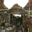
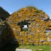
This building is connected with a smaller one to the north by a barrel-vaulted passage, which appears to be almost complete, though it is blocked with rubble, which may have contributed to its preservation. The smaller building, measuring about 8.5m by 4m and known as Teampull Clann a' Bhiocair or MacVicar's chapel, is in better condition, having both gables and the south wall nearly complete. Each wall has a window, neatly built of local stone, and there are aumbries in both end walls.
Teampull na Trionaid is said to have been used as a refuge in 1601 by MacDonalds of North Dist who gathered their stock there for protection against a raiding party ofMacLeods of Skye. The MacLeods were routed at the battle of Carinish not far from the church.
Information from ‘Exploring Scotland’s Heritage: Argyll and the Western Isles’, (1985).
Standing Building Recording (14 June 2011 - 16 June 2011)
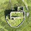
NF 81620 60280 A standing building survey was conducted on the remains of the historically import site of Teampul Na Trionaid (Trinity Chapel) North Uist. The complex includes a building known as the enclosure and the McVicar Chapel on the north side of the church. The survey included full laser survey, photographic survey, topographic survey and gravestone survey.
Information from M Cressey - CFA Archaeology Ltd.
OASIS ID: cfaarcha1-105017
Excavation (2012)
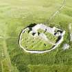
NF 81625 60285 Teampull na Trionaid (Trinity Church) is a medieval monastery and college founded and built in the 14th century and reconstructed in the 16th century. The chapel is reputed to have been enlarged in the late 14th century and remained in use until the early 18th century. The burial ground is enclosed by a curvilinear 18th-century wall. Repairs to the building were carried out in the 19th and 20th centuries.
A topographical and standing building survey, a watching brief during the removal of fallen masonry, and the excavation of three trial trenches, were carried out June – July 2011 in association with a wider programme of conservation work.
A Level 3 standing building survey established that the structural remains consist of two chapels. A large rectangular structure aligned E–W, with a smaller rectangular chapel on its N side. The two chapels are c1.5m apart and connected by a barrel-vaulted passage which is bonded to both buildings. On the S side of the main chapel there is an adjoining structure, known locally as the enclosure, which was constructed in the 18th century. The buildings were laser scanned and elevation drawings and a photographic record produced.
The topographic survey established that the church is located on the 11m OD contour and ground levels are higher inside the church and chapel, reflecting the impact of over 700 years of interments. All of the graves were aligned N–S. Scaled drawings were produced of the complex in relation to the graveyard boundary wall and 5m beyond the wall. An examination of late 19th-century photographs indicates that the site has deteriorated considerably due to stone robbing and continued erosion by the elements, despite stabilisation work carried out in 1994–5.
The watching brief led to the recovery of 42 pieces of moulded stone. A human skull was also recovered and retained for future reburial. Two of the trial trenches (Trenches 1 and 3) excavated next to the main church building identified good quality wall foundations suitable for the intended stabilisation works. Trench 2 excavated next to the S wall of the enclosure on the S side of the main church identified poor quality foundation walls, which had sunk into soft ground, causing the outward collapse of the wall. The excavation of Trench 2 was terminated on the discovery of articulated human skeletons.
The finds recovered were mainly of 19th-century date or a mix of animal and human bone. Apart from 23 fragments, all human remains were either left in situ or reburied in Trench 2. A small group of sherds of probable Middle Iron Age pottery were also recovered. The location of the site on a small natural knoll with good views over the surrounding landscape would have represented an ideal site for early settlement. It is considered probable that the remains of Iron Age settlement are preserved somewhere in the immediate vicinity, although they are very likely to have been significantly disturbed by the later activity.
Archive: CNES SMR and RCAHMS
Funder: Teampull na Trionaid Conservation Trust
Magnus Kirby, CFA Archaeology Ltd
2012


