We use cookies to improve your experience on our site and show you personalised advertising.
Find out more from our privacy notice and cookie policy.
Your optionsPricing Change
New pricing for orders of material from this site will come into place shortly. Charges for supply of digital images, digitisation on demand, prints and licensing will be altered.
Ordnance Survey licence number AC0000807262. All rights reserved.
Canmore Disclaimer.
© Bluesky International Limited 2025.

| Event | Type | Subtype | Notes | Date |
|---|---|---|---|---|
| 558095 | RECORDING | GROUND SURVEY | NO 555 668 (NO56NE 1) An archaeological survey and excavation were conducted at Brown Caterthun between August and October 1995 in response to evidence of substantial rabbit damage to the earthworks enclosing the hilltop. The principal motive for the fieldwork was to assess the extent of rabbit-derived erosion, as a basis for future implementation of ameliorative land management policies. The evaluative excavations have shown that the degree of rabbit (and other) damage to Brown Caterthun hillfort is at least as extensive as surface traces indicate and in many instances the erosion was more severe. A total of eight trenches (Trenches 1-8, Fig 34) with a combined area of c222 sq m, were investigated. [...] | August 1995 |
| 558094 | RECORDING | EARTH RESISTANCE SURVEY | NO 555 668 (NO56NE 1) An archaeological survey and excavation were conducted at Brown Caterthun between August and October 1995 in response to evidence of substantial rabbit damage to the earthworks enclosing the hilltop. The principal motive for the fieldwork was to assess the extent of rabbit-derived erosion, as a basis for future implementation of ameliorative land management policies. The evaluative excavations have shown that the degree of rabbit (and other) damage to Brown Caterthun hillfort is at least as extensive as surface traces indicate and in many instances the erosion was more severe. A total of eight trenches (Trenches 1-8, Fig 34) with a combined area of c222 sq m, were investigated. [...] | August 1995 |
| 558093 | RECORDING | EXCAVATION | NO 555 668 (NO56NE 1) An archaeological survey and excavation were conducted at Brown Caterthun between August and October 1995 in response to evidence of substantial rabbit damage to the earthworks enclosing the hilltop. The principal motive for the fieldwork was to assess the extent of rabbit-derived erosion, as a basis for future implementation of ameliorative land management policies. The evaluative excavations have shown that the degree of rabbit (and other) damage to Brown Caterthun hillfort is at least as extensive as surface traces indicate and in many instances the erosion was more severe. A total of eight trenches (Trenches 1-8, Fig 34) with a combined area of c222 sq m, were investigated. [...] | August 1995 |

Excavation photographs: Film 23 from the 1995 season at Brown Caterthun. A length of heavily disturbed and disfigured Rampart F (where Trench 1 was excavated), from the north-east.
Historic Scotland Archive Project
1995
© Courtesy of HES (Sponsored Excavations)

Excavation photographs: Film 62 from the 1996 season at Brown Caterthun. Trench 20, Enclosure A: entrance within palisade enclosure, from the south.
Historic Scotland Archive Project
6/8/1996
© Courtesy of HES (Sponsored Excavations)

Excavation photographs: Film 66 from the 1996 season at Brown Caterthun. Wall B rear face, Trench 17.
Historic Scotland Archive Project
5/8/1996
© Courtesy of HES (Sponsored Excavations)

Excavation photographs: Film 7 from the 1995 season at Brown Caterthun. Wall B front face, Trench 5.
Historic Scotland Archive Project
11/9/1995
© Courtesy of HES (Sponsored Excavations)

Excavation photographs: Film 21 from the 1995 season at Brown Caterthun. Trench 2, Rampart E: burnt timber deposit 6 from the north-east (outer rampart face to left). Note the rabbit burrow running obliquely through the timbers to the left of the small scale.
Historic Scotland Archive Project
15/9/1995
© Courtesy of HES (Sponsored Excavations)

Excavation photographs: Film 91 from the 1996 season at Brown Caterthun. Trench 15, Rampart E: stone face of rampart and cobble alignment beneath rampart, from the south.
Historic Scotland Archive Project
11/9/1996
© Courtesy of HES (Sponsored Excavations)

Excavation photographs: Film 68 from the 1996 season at Brown Caterthun. Trench 14: Rampart F, cobble layer, buried turf and posthole from the north-west.
Historic Scotland Archive Project
5/8/1996
© Courtesy of HES (Sponsored Excavations)

Excavation photographs: Film 68 from the 1996 season at Brown Caterthun. Trench 14: Rampart F and ditch from the east.
Historic Scotland Archive Project
5/8/1996
© Courtesy of HES (Sponsored Excavations)

Excavation photographs: Film 72 from the 1996 season at Brown Caterthun. Trench 12, Rampart F: ditch terminal south of hte entrance, showing large rock-cut posthole in terminal, from the north.
Historic Scotland Archive Project
7/8/1996
© Courtesy of HES (Sponsored Excavations)

Excavation photographs: Film 56 from the 1996 season at Brown Caterthun. Trench 21: quarry scoop from the north-east. Within the scoop, to the left, the soil is shallow over bedrock; to the right, outside the scoop, the greater depth of soil can be seen in the stepped section. The irregular gully proved to be a natural feature.
Historic Scotland Archive Project
29/7/1996
© Courtesy of HES (Sponsored Excavations)
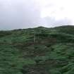
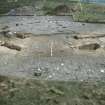
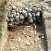
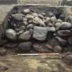
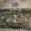
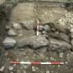
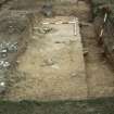
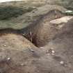
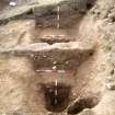
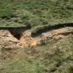

Excavation photographs: Film 55 from the 1996 season at Brown Caterthun. Includes Trench 27 Features 009-11; Trench 4 Features 008; Trench 14 Features 035; Trench 21 quarry scoop; Trench 22 Features 003; Trench 24 Features 002-008; Trench 27. MS 5254/3/3/2 numbering does not match photographic frame numbers.
Archive for excavation at White Caterthun
Excavation archive: Context sheets from the excavation at Brown Caterthun. Includes 1995 Trenches 1-8, 1996 Trenches 9-27 and 1996 Trench 1 and 5a.
© Historic Environment Scotland. Scottish Charity No. SC045925