Scheduled Maintenance
Please be advised that this website will undergo scheduled maintenance on the following dates: •
Tuesday 3rd December 11:00-15:00
During these times, some services may be temporarily unavailable. We apologise for any inconvenience this may cause.
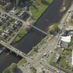
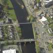
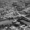
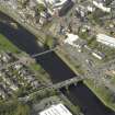
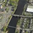
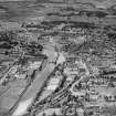
Dumfries, Suspension Bridge
Suspension Bridge (19th Century)
Site Name Dumfries, Suspension Bridge
Classification Suspension Bridge (19th Century)
Alternative Name(s) Whitesands Bridge; Dockhead; Suspension Brae; Mill Green; River Nith
Canmore ID 65510
Site Number NX97NE 108
NGR NX 97259 75703
Datum OSGB36 - NGR
Permalink http://canmore.org.uk/site/65510
- Council Dumfries And Galloway
- Parish Dumfries
- Former Region Dumfries And Galloway
- Former District Nithsdale
- Former County Dumfries-shire
NX97NE 108 97259 75703
Suspension Bridge
(Foot) [NAT]
OS 1:2500 map, 1965.
NMRS REFERENCE:
ENGINEER: C.Willet 1875.
(Undated) information in NMRS.
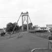
(Location cited as NX 973 757). Suspension footbridge, built 1875 by engineer J Willet. A light lattice-truss span with flat-link chains and iron-rod suspenders. The pylons are of cast iron, consisting of two pairs of Doric columns with entablatures.
J R Hume 1976.
(Suspension bridge of Samual Brown flat link type). Built 1875 by J Willett, engineer and J Abernethy and Co. (contractors). Classical cast-iron pylons, two flat-link chains (2 links wide) on each side, iron rod suspenders and lattice girder span.
J R Hume 1977b.
Suspension bridge from Dockhead to Suspension Brae, by John Willet, 1874-5, reconstructed to the original design using modern methods by W A Fairhurst and Partners, 1985.
J Gifford 1996.
This bridge carries a footpath across the River Nith to the N of St Michael's Bridge (NX97NE 111). It links Dockhead and Mill Green (within Troqueer parish) to the W, with Dockhead (within Dumfries parish) to the E.
The location assigned to this record defines the mispoint of the structure. The available map evidence suggests that it extends from NS c. 97229 75685 to NX c. 97284 75716.
Information from RCAHMS (RJCM), 17 March 2006.
Publication Account (2007)
This bridge at Whitesands over the Nith, originally providing pedestrian access to and from the mills on the
west bank, was designed by John Willet and erected in 1875 by J. Abernethy & Co., Aberdeen, at a cost of about
£1500. The span is 200 ft and the chain-link cables are in pairs, each wrought iron eye-bar link being about 5 ft
between the suspending rods. In cross-section the individual links are of the Telford 1820s Menai Bridge genre
but of 4x34 in. cross-section. The towers each consist of a pair of plain circular cast-iron columns, 17 ft high, bridged at their tops by a heavy ornamental entablature bearing the cable saddles. The columns sit on freestone masonry piers about 10 ft tall. The columns are not braced except for the capping beam and the ornamental arch in the view. The deck is stiffened by lattice girders forming the parapets. The bridge was described at its opening as ‘an airy graceful thing of beauty that might have been conjured into existence by the wand of an eastern magician’. It was refurbished by Whatlings Ltd in 1983 under a contract let by consulting engineers W. A. Fairhurst & Partners.
R Paxton and J Shipway 2007
Reproduced from 'Civil Engineering heritage: Scotland - Lowlands and Borders' with kind permission from Thomas Telford Publishers.


