
Pricing Change
New pricing for orders of material from this site will come into place shortly. Charges for supply of digital images, digitisation on demand, prints and licensing will be altered.
Upcoming Maintenance
Please be advised that this website will undergo scheduled maintenance on the following dates:
Thursday, 9 January: 11:00 AM - 3:00 PM
Thursday, 23 January: 11:00 AM - 3:00 PM
Thursday, 30 January: 11:00 AM - 3:00 PM
During these times, some functionality such as image purchasing may be temporarily unavailable. We apologise for any inconvenience this may cause.
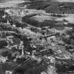
Newton Stewart, Bridge Of Cree


Road Bridge (19th Century)
Site Name Newton Stewart, Bridge Of Cree
Classification Road Bridge (19th Century)
Alternative Name(s) Cree Bridge; River Cree; New Galloway Road
Canmore ID 63512
Site Number NX46NW 85
NGR NX 41154 65653
Datum OSGB36 - NGR
Permalink http://canmore.org.uk/site/63512


- Council Dumfries And Galloway
- Parish Penninghame
- Former Region Dumfries And Galloway
- Former District Wigtown
- Former County Wigtownshire
NX46NW 85 41154 65653
Bridge Of Cree [NAT]
OS 1:10,000 map, 1990.
See also NX46NW 82.
For tollhouse at E end of bridge, see NX46NW 86.
ENGINEER: John Rennie, 1812.
(Undated) information in NMRS.
(Location cited as NX 412 656). Bridge of Cree: this fine, five-arched granite bridge with toll was built to the design of John Rennie in 1813.
I Donnachie 1971.
(Location cited as NX 412 657). Bridge of Cree, built 1813, engineer John Rennie. A five-span masonry bridge, with flat segmental arches and rounded cutwaters extended up to form semi-hexagonal pedestrian refuges.
J R Hume 1976.
Bridge of Cree, by John Rennie, 1812-13. Strong-looking, in hammer-dressed granite ashlar, the parapet walling broached. Four segmental arches; the stout, barely pointed cutwaters rise to form small pedestrian refuges.
J Gifford 1996.
Visited by RCAHMS (MKO), November 1999.
This bridge carries the former line of the A75 (T) public road (now the B 7079, New Galloway Road) over the River Cree (which here forms the boundary between the parishes of Penninghame (to the W) and Minnigaff (to the E) on the E side of Newton Stewart (NX46NW 82).
The location assigned to this record defines the midpoint of the span. The available map evidence suggests that the bridge extends from NX c. 41119 65640 to NX c. 41191 65668.
Information from RCAHMS (RJCM), 22 March 2006.
Project (2007)
This project was undertaken to input site information listed in 'Civil engineering heritage: Scotland - Lowlands and Borders' by R Paxton and J Shipway, 2007.
Publication Account (2007)
This elegant five-span arched masonry bridge over the Cree was designed by Rennie and built from 1812–14.
The inspector was John Hall, the contractor, Kenneth Mathieson and the cost £8234. The outer spans are 38 ft
6 in., the inner spans 45 ft 9 in. and the centre span is 50 ft, all segmental in elevation. The bridge is low over
the water and the centre arch has a rise of only 6 ft 6 in. The width between parapets is 20 ft.
The masonry is of rough-faced granite. Above the pointed cutwaters, semi-octagons of masonry are carried
up to parapet level forming pedestrian refuges. Rennie narrowly escaped death when scaffolding collapsed
while he was making an inspection of the bridge during its construction. The bridge formed part of the Carlisle to Portpatrick turnpike road, but is now bypassed.
Two miles south of the town, adjoining the A714 at Baltersan (NX 4230 6140) is one of the earliest reinforced
concrete grain silos in Scotland built in 1920, now disused. Internally it is 100 ft high and 14 ft diameter
with a battlemented top. There is an outside ladder in a protective external shaft. The walls are 6 in. thick and the concrete was placed in 2 ft lifts. The contractor was James Scott & Son (Aberdeen) Ltd.
R Paxton and J Shipway 2007
Reproduced from 'Civil Engineering heritage: Scotland - Lowlands and Borders' with kind permission from Thomas Telford Publishers.

