Pricing Change
New pricing for orders of material from this site will come into place shortly. Charges for supply of digital images, digitisation on demand, prints and licensing will be altered.
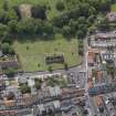
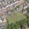
North Berwick, Kirk Ports, Old Parish Church And Churchyard
Burial Ground (Period Unassigned), Church (17th Century), Dovecot (Period Unassigned), Sundial (Period Unassigned)
Site Name North Berwick, Kirk Ports, Old Parish Church And Churchyard
Classification Burial Ground (Period Unassigned), Church (17th Century), Dovecot (Period Unassigned), Sundial (Period Unassigned)
Alternative Name(s) St Andrew's Church; Law Road, Old Parish Church, Graveyard Walls And Monuments
Canmore ID 56598
Site Number NT58NE 2
NGR NT 55342 85229
Datum OSGB36 - NGR
Permalink http://canmore.org.uk/site/56598
- Council East Lothian
- Parish North Berwick
- Former Region Lothian
- Former District East Lothian
- Former County East Lothian
NT58NE 2.00 55342 85229
NT58NE 2.01 NT 553 852 Viking comb; midden
For predecessor church (NT 55402 85555), see NT58NE 3.00.
(NT 5533 8522) St Andrew's Church (NR) (remains of)
OS 6" map (1971)
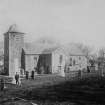
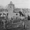
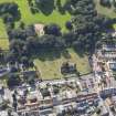
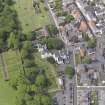
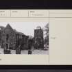
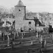
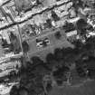
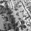
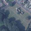
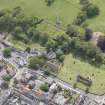
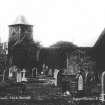
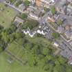
This roofless church was built as a successor to the original parish church of North Berwick (NT58NE 3.00). Building started in 1659, but was not completed until 1664. Situated within a burial ground, it consists of an orientated oblong nave with a central western tower. (This church, in turn, was replaced by the present parish church, built at NT 5458 8529 in 1861.)
RCAHMS 1924, visited 1913; G Hay 1957.
The remains of this church are generally as described.
Visited by OS (SFS) 19 August 1975.
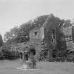
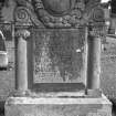
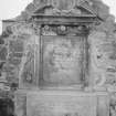
The sundial at the SE angle of this church bears two dates: 1680 (though work started in 1659) and 1770. It is all of purple-brown rubble, but the more regular block-and-pin work and all the white stone dressings belong to the latter date, when the building was evidently re-modelled. The tower attached to the W gable also belongs to this second phase.
C McWilliam 1978.
NMRS REFERENCE
Architect: Sir John Burnet Tait & Lorne 1932/33
EXTERNAL REFERENCE
Scottish Record Office
Pointing of the Kirk and repair of the Manse.
Discharge by William Walker to Ann Aitkinhead for her proportion of stent for the work.
1676 GD110/682
Field Visit (23 July 1913)
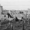
Within the churchyard are the ruins of this structure consisting of an orientated oblong nave with a central western tower. The church resembles that of the neighbouring parish of Preston kirk and was altered and enlarged about the same time, viz: - 1770; but the original building appears from the Kirk Session records, to have been begun in May 1659; on the southeast corner is the date 1660. Operations were delayed at first by a difference of opinion as to whether the old kirk, still structurally in good condition, should be repaired or a new one erected. But by 1656 the old kirk was in ‘totall ruine and decay’, and the new building on a new site had to be undertaken, which, owing to financial difficulties with the heritors was not completed till 1664. Cf. The Auld Kirks of North Berwick, by D. B. Swan.
RCAHMS 1924, visited 23 July 1913.
Photographic Survey (March 1961)
Survey of The Lodge and North Berwick Old Parish Church in North Berwick, East Lothian, by Kitty Cruft, Scottish National Buildings Record, in 1961.
Note (26 October 2006)
Collection item EL 6684, a copy of a historic photograph, shows flight holes set an infilled arched window in the south wall of the tower, suggesting that it was once used as a doocot.
Volunteer, RCAHMS, 26 October 2006.
Measured Survey (25 May 2007 - 18 July 2007)
NT 5544 8520 An archaeological survey was undertaken between 25 May and 18 July 2007 in connection with a
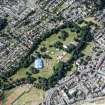
programme of works in the Lodge Grounds. This work was requested by East Lothian Council prior to the restoration of the Lodge Grounds. The archaeological survey comprised recording the southern boundary wall of St Andrew's kirkyard and the entrance walls of a tunnel structure located to the E of the kirkyard. Each wall was recorded by rectified photography supported by a short written description.
Archive to be deposited with RCAHMS. Report deposited with East Lothian SMR and RCAHMS.
Funder: Derek Carter Associates.
Candy Hatherley and Roz Gillis, 2007.
Watching Brief (25 May 2007 - 18 July 2007)
A watching brief was carried out during the excavation of two foundation trenches along the kirkyard wall. Two sherds of late 14th- to 16th-century Rhenish-style pottery were recovered from these trenches.
Archive to be deposited with RCAHMS. Report deposited with East Lothian SMR and RCAHMS.
Funder: Derek Carter Associates.
Standing Building Recording (7 June 2010 - 28 October 2010)
AOC Archaeology were commissioned by the East Lothian Council to undertake an historic building recording survey of St Andrews Kirk, North Berwick, prior to the removal of the tower roof, which is in a state of decay and is being removed for health and safety reasons. Built as a cross-shaped church between 1658 and 1664, a square bell-tower was added to the west gable in 1770, accompanied with some selected rebuilding of the main church fabric. It was abandoned in 1878 and has been left to ruin ever since the heritors of the 'new' church auctioned the interior and roof materials in the 1880s. The north and south transepts have now gone (replaced with family burial plots) as has the roof and interior of the main church. The roof of the bell-tower is soon to be removed (the tower is scaffolded) and although some timber floors within are still present, its original timber stair no longer exists. The church is a Category B Listed building (HB No 30749, designated 1971) and a Scheduled Ancient Monument. The historic building survey included a detailed Level 2/3 survey of the entirety of the church, which included a photographic record, written and drawn (floor plan and sections) survey of the kirk and tower, with concentration on the tower, with additional floor plans of the upper levels and internal elevations of the tower.
Information from Oasis (aocarcha1-89679) 7 June 2012


