Pricing Change
New pricing for orders of material from this site will come into place shortly. Charges for supply of digital images, digitisation on demand, prints and licensing will be altered.
Castle Fraser
Barmkin (16th Century)(Possible), Country House (15th Century), Tower House (16th Century)
Site Name Castle Fraser
Classification Barmkin (16th Century)(Possible), Country House (15th Century), Tower House (16th Century)
Alternative Name(s) Castle Fraser Estate; Muchal-in-mar; Muchalls-in-mar
Canmore ID 18722
Site Number NJ71SW 6
NGR NJ 72276 12557
Datum OSGB36 - NGR
Permalink http://canmore.org.uk/site/18722
First 100 images shown. See the Collections panel (below) for a link to all digital images.
- Council Aberdeenshire
- Parish Cluny
- Former Region Grampian
- Former District Gordon
- Former County Aberdeenshire
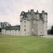
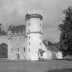
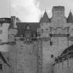
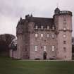
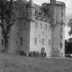
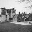
Castle Fraser, from 15th century; c.1576, Thomas Leiper; 1614, James Leiper; 1617-18, I (John) Bell; 1795, (?)James Byers. The trio of Aberdeenshire finest master-masons has produced an almost perfect Z-plan massing of blocks and turrets combined with an inspired elaboration of upperworks; Fraser is near the peak of Renaissance Aberdeenshire, passing quickly from tower (the earliest work on the bottom of the main block) to palace - complete with U-plan courtyard and laich biggins - and furnished with a colossal asymmetrical bedroom stack of six storeys which yet contrives to balance the whole. As currently presented, far too much rubble is exposed to appreciate the full beauty of the dressed stone, particularly the immense heraldic frontispiece slung high and mighty on the original front and the 'Arma Christi', below and to the right. True, there were many 18th- and 19th-century depredations, including the loss of the ceilings, but the interior retains enough, particularly the high, airy hall (with laird's lug) to savour. Fine library by John Smith, 1820, from long gallery.
Taken from "Aberdeenshire: Donside and Strathbogie - An Illustrated Architectural Guide", by Ian Shepherd, 2006. Published by the Rutland Press http://www.rias.org.uk
NJ71SW 6.00 72276 12557
(NJ 7227 1255) Castle Fraser (NR)
OS 6" map, (1959)
NJ71SW 6.01 NJ 72029 12446 Stable Block
NJ71SW 6.02 NJ 71840 12457 West Lodge and Gate Piers
NJ71SW 6.03 NJ 72677 11765 South Lodge, Gate Piers, Kennels and Well
NJ71SW 6.04 NJ 71968 13561 North Lodge and Gate Piers
NJ71SW 6.05 NJ 72336 12701 Walled Garden and Sundial
NJ71SW 6.06 Cancelled. Duplicate site. See NJ71SW 6.16
NJ71SW 6.07 NJ 72521 12739 Gardener's Cottage
NJ71SW 6.08 NJ 72401 12047 Bristow Cottage
NJ71SW 6.09 NJ 72820 12830 Walkend Cottage
NJ71SW 6.10 NJ 71375 12216 West Mains Farmhouse; Farmsteading
NJ71SW 6.11 NJ 7146 1231 West Mains Cottages
NJ71SW 6.12 NJ 7244 1211 Monument
NJ71SW 6.13 NJ 71749 11862 Obelisk
NJ71SW 6.14 NJ 716 127 Whin-mill
NJ71SW 6.15 NJ 7195 1240 Swimming Pool
NJ71SW 6.16 NJ 72059 12320 The Neuk, Factor's House
NJ71SW 6.17 NJ 72332 12581 Sundial
For 'John Bell' commemorative stone (NJ 7212 1270), see NJ71SW 5. For agricultural remains and miscellaneous features within Castle Fraser policies, see NJ71SW 22-8 and 31. For recumbent stone circle and standing stones (NJ 7150 1253 and 7174 1250 respectively) within the policies, see NJ71SW 3 and NJ71SW 4. For gravel pit (NJ 7272 1211) within the policies, seee NJ71SW 130.
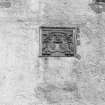
Fraser Castle was built on the 'Z' plan in 1617 by master-mason I Bell (whose dated name plate is on the north face of the building) on the site of an earlier 'L' shaped building, part of which remains in the lower stones of the western half of the central block. This earlier building was of the time of the sixth laird Michael (d. 1588).
O Hill 1953.
Castle Fraser, from 15th century; c.1576, Thomas Leiper; 1614, James Leiper, 1617-18, I (John) Bell; 1795, (?) James Byers. The trio of Aberdeenshire finest master-masons has produced an almost perfect Z-plan massing of blocks and turrets combined with an inspired elaboration of upperworks; Fraser is near the peak of Renaissance Aberdeenshire, passing quickly from tower (the earliest work on the bottom of the main block) to palace - complete with U-plan courtyard and laich biggins - and furnished with a colossal asymmetrical bedroom stack of six storeys which yet contrives to balance the whole. As currently presented, far too much rubble is exposed to appreciate the full beauty of the dressed stone, particularly the immense heraldic frontispiece slung high and mighty on the original front and the Arma Christi, below and to the right. True, there were many 18th- and 19th-century depredations, including the loss of the ceilings, but the interior retains enough, particularly the high, airy hall (with laird's lug) to savour. Fine library by John Smith, 1820, from long gallery.
I Shepherd 1994.
NJ 725 125 A survey of topographic features and tree types was carried out within the boundaries of the NTS property of Castle Fraser. The aim was to identify and record all remaining features relating to the designed landscape and to provide a GIS survey of all major trees.
This survey showed that fragmentary patches of cultivation and enclosure could still be seen within planted areas but that elsewhere recent cultivation has obliterated all traces of landscape features. This work was carried out in partnership with Peter MacGowan, Landscape Architects.
Sponsor: National Trust for Scotland
AOC (Scotland) Ltd 1996
NJ 723 126 The laying of a new water main to the castle and stables necessitated a watching brief on the work through the designed landscape. Several features were uncovered, including a cobbled pathway and several stone-lined drains. Occasional chance finds were made, including a spear-like iron implement and several pieces of post-medieval pottery.
Sponsor: National Trust for Scotland
D Hind 1998.
NJ 715 125 A watching brief was undertaken in January 2003 over excavations necessary for the repair of a power cable. Although no significant features were exposed, the excavation revealed 0.5m of made ground below the present gravelled surface.
Archive to be deposited in the NMRS.
Sponsor: NTS.
T Addyman 2003
NJ 715 125 A small section of drain capstones from an E-W aligned drain, probably 18th century, composed of large granite flags, was exposed during the erection of a marquee within the courtyard area at Castle Fraser in January 2003. The capstones were overlain by a mortar-rich matrix, most likely related to the demolition of a building in the early 1950s.
Archive to be deposited in NTS SMR.
Sponsor: NTS.
S M Fraser 2003
A major rewiring of the castle (NJ71SW 6) required historic building recording of features exposed below floorboards
and behind existing wall linings, etc. This principally involved work to the main tower, where early floor structures were examined and recorded at most levels. Some early painted plaster on-the-hard interior schemes were identified,
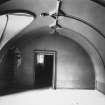
either whitewashed or yellow ochre. Examination of the roof space above the existing dining room revealed evidence for a timber (plank) barrel-vaulted ceiling, some of the armatures remaining in situ, and with silhouette evidence further preserved in wallplaster to the N and S. Monitoring works included a brief exercise in the existing kitchen
(NW range, S end, ground floor), where a new flue liner was installed.
Archive to be deposited in NMRS.
Sponsor: NTS.
NJ 7227 1255 With on-going monitoring during services installation in 2006 more of the Castle Fraser structure has been subject to detailed recording, most recently the mid-parts of the Michael Tower and the upper level of the NW wing. Examination of roof structures generally has confirmed the former presence of galleries within the upper level of each wing. In the NE wing a timber barrel-vaulted chamber ran the entire length of the range, an arrangement clearly oriented so as to coincide with an Ewards view over a sequence of formal gardens in that direction. The NW wing contained a shorter gallery, also with wooden barrel-vaulted ceiling, in its Southern part. At its N end was a separate chamber with attic room above.
A very detailed assessment of a series of three 'Appraisals of Prejudice' of c 1655 was made. These recorded damage to the castle, apparently a sacking, affecting metalwork, woodwork and glazing. Using these documents it was possible to plot the arrangement and function of all the rooms throughout the 17th-century castle. Among other features the presence of the two galleries was confirmed, as was the location of the stable (present tea room), brewhouse, bakehouse and girnell house (lower level of NW wing). Gate lodges and a chapel were also itemised, apparently separate structures that are no longer extant.
Two further inventories of 1720 and 1722 provided important cross-correlation with the earlier documents as well as important evidence for the extent and nature of a major reorganisation of the accommodation within the castle at the beginning of the 18th century, work that included the subdivision of both galleries.
We looked for consideration of possible evidence for a former independent chapel building at Castle Fraser. There are ex situ carved stones at a wellhead within the policies, within the walled garden and in the form of a masonry bellcote, now surmounting one of the early 19th-century gate lodges to the castle courtyard. The latter is identical to a group of similar early 17th-century bellcotes in the vicinity and, in common with work of this period within the castle, should perhaps be associated with the Bel family of masons. However, we could not determine with certainty whether these features originated at Castle Fraser or at a predecessor parish church at Cluny. Carved stones built into the exterior of the N wall of the walled garden were judged to relate to an intramural heated wall flue system.
Sponsor: NTS.
T Addyman and S Fraser, 2006.
NMRS REFERENCE:
Architects: J. Bell, 1617. adds to building of 1576
John Paterson c. 1794 - scheme for hall and vestibule not executed. Stable Court executed.
William Burn c.1819? not executed
Dr William Kelly. Restorations. 1930s
Walker & Duncan. Alts to East wing. 1950.
R.S. Lorimer 1927 (not carried out).
R.S Lorimer commissioned to renovate but not carried out.
Mrs Smiley (Castle Fraser) has original set of drawings dated 1927 a dyeline set (coloured) exists in Stuart Matthew Collection purchased by NMRS 1980.
NMRS Printroom
W Schomberg Scott Photograph Collection Acc no 1997/39
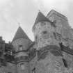
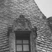
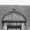
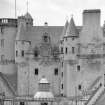
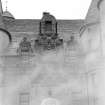
Detail of turrets
EXTERNAL REFERENCE:
Plans:
RIBA - Wm Burn. Proposed alts. perspective sketch. c.1819?
RIBA - J.J. Joass. Perspective sketch & plan.
Photographic Survey (1956)
Photographs taken during the National Trust Summer School in 1956 by the Scottish National Buildings Record.
Photographic Survey (September 1961)
Photographic survey of Castle Fraser, Aberdeenshire, by the Scottish National Buildings Record/Ministry of Works in September 1961.
Publication Account (1986)
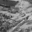
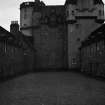
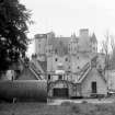
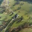
As a traveller of old, the modem visitor approaches Castle Fraser from the north, down a gentle tree-lined slope, so that the castle reveals itself gradually, turrets first. It is thus really only when the visitor is standing on the level ground beside the castle, which now soars above him, that the full scale of the building is appreciated. The five main building campaigns can be discerned by viewing the castle from the south-west (the angle of the colour photograph).
The earliest part of the structure is the remains of the rectangular tower that was probably built in the middle of the 15th century by Thomas Fraser. This was a smaller version of the Tower of Drum (no. 31), 11.9m by 9.9m; it is now represented by the eastern two thirds of the ground and first floors of the central block on the south side. The entrance to this tower can be seen in the north wall of the hall on the first floor, immediately west of the blocked recess in the middle of the wall. In 1565, the fifth laird, Michael Fraser, and the mason Thomas Leiper (who was later to work at Tolquhon, no. 26) began to build a square tower at the north-western corner of the old block (this is the Michael Tower, the westernmost harled tower) and a round tower at the south-east corner, thus creating a modest Z-plan manor house. Both towers were taken to the level of the crown of the hall vault, ie the third floor. The entrance to this building would also have been at first-floor level, and is represented by the blocked recess in the centre of the north wall of the hall.
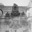
In the three decades before 1618, under the guidance of John Bell, one of the famous dynasty of north-east master masons, the manor house was transformed by Andrew Fraser. The west gable of the original central block was demolished and rebuilt 3.1m to the west. (The join is visible in the hall. while the exterior of the new west wall has been stepped in twice to clear the south windows of the Michael Tower, the south-east corner of which was demolished.) Two storeys were added to the Michael Tower and no fewer than four to the Round Tower, while the central block was also heightened. At the fourth-floor level a pronounced corbel table was built right round the building, stepping down at the new two-storeyed rounds and containing exuberant false stone cannon and cable moulding. On the north side a 'sumptuous frontispiece' containing the Fraser arms below the Royal arms was set in a richly carved frame; it may have been carved by the mason who did the Huntly doorpiece (no. 27). Originally gilded, it is a confident assertion of baronial splendour.
After 1618, Andrew Fraser, by now Lord Fraser, canied out further building; a kitchen with room above (the present Dining Room) was built against the north-east corner of the main block and then two wings of laich biggins were built running north from the castle to form the present courtyard.
Little was done to the castle in the 160 years between Lord Fraser's death in 1636 and Miss Elyza Fraser's inheritance of it. It is likely that her only alteration was the insertion of the present heavy, classical entrance in the middle of the south front (see no. 41). However, he impact of her great-nephew, Col Charles Mackenzie Fraser was altogether more far reaching. From 1814 he began 57 years of change which destroyed most of the early interiors; mercifully, the patient work of the earlier 20th century owners removed most of his additions, apart from the present library, created by John Smith of Aberdeen.
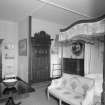
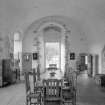
Of the interiors, the Laigh Hall has its fme 15th century vault, the High Hall is much altered but preserves the old entrances, while the oratory and Pliest's or Bailiffs room in the Michael Tower preserve something of the feel of the 17th century.
Information from ‘Exploring Scotland’s Heritage: Grampian’, (1986).
Field Visit (May 1996 - May 1996)
B001 Castle Fraser Listed Cat. A.
'Z-plan' or '3-stepped plan' Tower House, with additional square tower at the north-east corner (Michael Tower) and a round tower at the south-east. Begun c.1575 by the 6th Laird, Michael Fraser, and finished by the 7th Laird in 1633, it incorporates an earlier (15th C) rectangular tower house. The latter phases of building involved master masons John Bell and James Leiper. The 5-6 storey main block is in exposed granite rubble; towers, turrets and outbuildings harled; pitched, slated roofs with conical roofs on turrets. The round tower has flat roof with balustrades and is used a viewing platform. Two low service wings extend on the north side forming a courtyard which makes an impressive composition, with a large armorial panel high up on the north facade over a former entrance. The main entrance is now on south side. Two small gatehouses with a linking archway were added by Col. Charles Mackenzie-Fraser.
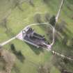
The Castle form the focus of the whole landscape composition, both in its formal components and its 'natural style' improvements. Vistas along the Broad Walk, the West Avenue and the remains of older part of East Avenue all terminate with the Castle. The North and South Drives both take sweeping approaches, in which views of the Castle are all important. From the spaces between these lines, the Castle is seen in its imposing bulk, within its immediate setting of trees on either side.
The Castle also is significant as the main viewing point of the landscape. The principal rooms, main entrance and general aspect of the Castle are to the south across the parkland to Miss Bristow's Wood. As Section 6 will show, the surviving planting design and condition of trees does not at present do justice to the magnificence of the Castle.
The Round Tower provides an excellent viewing platform of the landscape in all directions (although even from here Bennachie cannot be seen, contrary to some 19th century pictures of the Castle). The elevated position allows the topographic setting of the Castle and its designed landscape to be appreciated.
(CAF96 B001) Information from (BNM) March 2014
Publication Account (1996)
As a traveller of old, the modern visitor approaches Castle Fraser from the north, down a gentle treelined slope, so that the castle reveals itself gradually, turrets first. It is thus really only when the visitor is standing on the level ground beside the castle, which now soars above him, that the full scale and splendour of the building are appreciated. The massing is awesome, the detail entrancing. The five main building campaigns can be discerned by viewing the castle from the south-west (the angle of the colour photograph).
The earliest part of the structure is the remains of the rectangular tower that was probably built in the middle of the 15th century by Thomas Fraser. This was a smaller version of the Tower of Drum (no. 31), 11.9m by 9.9m; it is now represented by the eastern two thirds of the ground and first floors of the central block on the south side. The entrance to this tower can be seen in the north wall of the hall on the first floor, immediately west of the blocked recess in the middle of the wall. In 1565, the fifth laird, Michael Fraser, and the mason Thomas Leiper (who was later to work at Tolquhon, no. 26) began to build a square tower at the north-western corner of the old block (this is the Michael Tower, the westernmost harled tower) and a round tower at the south-east corner, thus creating a modest Z-plan manor house. Both towers were taken to the level of the crown of the hall vault, ie the third floor. The entrance to this building would also have been at first-floor level, and is represented by the blocked recess in the centre of the north wall of the hall.
In the three decades before 1618, under the guidance of John Bell , one of the famous dynasty of north-east master masons, the manor house was transformed by Andrew Fraser. The west gable of the original central block was demolished and rebuilt 3.1m to the west. (The join is visible in the hall, while the exterior of the new west wall has been stepped in twice to clear the south windows of the Michael Tower, the south-east corner of which was demolished.) Two storeys were added to the Michael Tower and no fewer than four to the Round Tower, while the central block was also heightened. At the fourth-floor level a pronounced corbel table was built right round the building, stepping down at the new two-storeyed rounds and containing exuberant false stone cannon and cable moulding. On the north side a 'sumptuous frontispiece' containing the Fraser arms below the Royal arms was set in a richly carved frame; it may have been carved by the mason who did the Huntly doorpiece (no. 27). Originally gilded, it is a confident assertion of baronial splendour.
After 1618, Andrew Fraser, by now Lord Fraser, carried out further building; a kitchen with room above (the present Dining Room) was built against the north-east corner of the main block and then two wings of laich biggins were built running north from the castle to form the present courtyard.
Little was done to the castle in the 160 years between Lord Fraser's death in 1636 and Miss Elyza Fraser's inheritance of it. It is likely that her only alteration was the insertion of the present heavy, classical entrance in the middle of the south front (see no. 41). However, the impact of her greatnephew, Col Charles Mackenzie Fraser was altogether more far reaching. From 1814 he began 57 years of change which destroyed most of the early interiors; mercifully, the patient work of the earlier 20th century owners removed most of his additions, apart from the library, created from the long gallery by John Smith of Aberdeen.
Of the interiors, the Laigh Hall has its fine 15th century vault, the High Hall is much altered but preserves the old entrances, while the oratory and Priest's or Bailiff's room in the Michael Tower preserve something of the feel of the 17th century.
Information from ‘Exploring Scotland’s Heritage: Aberdeen and North-East Scotland’, (1996).
Geophysical Survey (24 August 2010 - 28 August 2010)
NJ 72276 12557 The NTS environs project aims to gain a better understanding of the potential survival of historic garden features and potential structural features to help inform future management plans. A resistance survey was undertaken, at 0.5 x 0.5m intervals over a c1ha area to the E of Castle Fraser, to map potential garden features and structural remains, in the area of the former privy garden and the site of the potential chapel.
The survey undertaken 24–28 August 2010 failed to identify any anomalies clearly associated with the former privy garden or chapel. Although some weak trends were apparent in the data, the results were dominated by responses from earlier ridge and furrow cultivation. The results suggest that the garden had been largely removed during landscaping. A follow-up excavation was undertaken by Murray Archaeological Services.
Archive: Rose Geophysical Consultants
Funder: The National Trust for Scotland
Susan Ovenden – Rose Geophysical Consultants
Excavation (30 August 2010 - 6 September 2010)
An excavation was undertaken to assess the degree of survival of elements of the 17th century privy garden which is shown on an estate plan of 1788 extending E from the E wing of the castle. Documentary evidence indicates that the garden was systematically dismantled in 1796 when the present walled garden was constructed. A geophysical survey was undertaken by Rose Geophysical Consultants prior to excavation. Both the geophysical survey and the excavation revealed extensive rig and furrow which appeared to predate the 17th century garden. The N boundary of the garden and its orientation and layout were confirmed but its dismantling had been thorough and few structural details remained. Traces of paths, beds and planting lines were recovered, associated with 17th century pottery and clay tobacco pipes.
Information from Oasis (mas1-113725) 23 January 2012
Excavation (30 August 2010 - 6 September 2010)
NJ 72276 12557 An excavation was undertaken 30 August–6 September 2010 to assess the degree of survival of elements of the 17th-century privy garden, which is shown on an estate plan of 1788 extending E from the E wing of the castle. Documentary evidence indicates that the garden was systematically dismantled in 1796 when the present walled garden was constructed. A geophysical survey was undertaken by Rose Geophysical Consultants prior to excavation.
Both the geophysical survey and the excavation revealed extensive rig and furrow which appeared to predate the 17th-century garden. The N boundary of the garden and its orientation and layout were confirmed, but its dismantling had been thorough and few structural details remained. Traces of paths, beds and planting lines were located, associated with 17th-century pottery and clay tobacco pipes.
Reports: Aberdeenshire SMR, RCAHMS and The National Trust for Scotland
Funder: The National Trust for Scotland
HK Murray – Murray Archaeological Services Ltd
Watching Brief (4 November 2010)
NJ 72309 12581 A watching brief was undertaken on 4 November 2010 during the excavation of two test pits.
The pits which were dug to locate a blocked drain in the courtyard at Castle Fraser revealed one face of a clay bonded stone wall, possibly the foundations of a structure shown on the 1st Edition OS map of 1864.
Reports: Aberdeenshire SMR and RCAHMS
Funder: The National Trust for Scotland
HK Murray – Murray Archaeological Services Ltd
Observation (4 November 2010)
Observation of two test pits dug to remedy a blocked drain in the courtyard at Castle Fraser revealed one face of a clay bonded stone wall, possibly the foundations of a structure shown on the 1st OS map of 1864.
Information from Oasis (mas1-113769) 18 July 2012
Watching Brief (14 March 2011 - 18 March 2011)
Prior to repaving in the courtyard at Castle Fraser excavation revealed the foundations of a late 18th and 19th century stair block that had been demolished in 1950. Comparison to documentary sources has enabled greater understanding of the construction of the block.
Reports: Aberdeenshire Council SMR, the National Trust for Scotland and RCAHMS
Funder: The National Trust for Scotland
Murray Archaeological Services 2011
Information also reported in Oasis (mas1-113779) 23 January 2012
Archaeological Evaluation (13 September 2011 - 14 September 2011)
As part of a project to renew lightening conductors at Castle Fraser, small trenches for seven of the conductors were archaeologically excavated around the perimeter of the building. Two to the E of the castle revealed garden earth and planting holes associated with the former 17th century Privy Garden and a 19th century flower border. Two to the S side of the castle revealed stone-built drains, possibly of late 18th century date. The final three trenches in the courtyard revealed details of buildings of 19th century date.
Reports: Aberdeenshire Council SMR, the National Trust for Scotland and RCAHMS
Funder: The National Trust for Scotland
Murray Archaeological Services Ltd 2011
Information also reported in Oasis (mas1-113828) 23 January 2012
Archaeological Evaluation (17 September 2014)
NJ 7230 1258 A blockage in a pipe between a septic tank in the lawn E of Castle Fraser and the field to the SE of the castle required a trench for a drain to be cut across a low banked linear feature to the S of the drive. A test pit was dug by hand on 17 September 2014 to evaluate and record the nature of the feature which appears to have been a stone culvert, possibly
identified as a culvert shown on an 1846 estate map taking water to a former lake.
Archive: The National Trust for Scotland (intended). Report and photographs: Aberdeenshire SMR and The National Trust for Scotland
Funder: The National Trust for Scotland
HK Murray – Murray Archaeological Services Ltd
(Source: DES)
Watching Brief (28 April 2015 - 3 June 2015)
NJ 72270 12550 A watching brief was carried out, 28 April – 3 June 2015, during earthworks associated with driveway repairs at Castle Fraser. A drainage trench S of the castle revealed a stone wall 900mm wide and extending 2.5m NE/ SW across the trench at NJ 72290 12530. The wall does not appear on 18th-century estate maps and may be of medieval or post-medieval date. A small sherd of post-medieval pottery was found while cleaning the wall. A second wall was found N of the castle at NJ 72282 12609. It was 800mm wide and 400mm in surviving height and appeared to have been a revetting wall, possibly of 18th-century date.
Archive: The National Trust for Scotland. Report: Aberdeenshire SMR and the National Trust of Scotland
Funder: The National Trust for Scotland
Hilary and Charlie Murray - Murray Archaeological Services
(Source: DES, Volume 16)
Watching Brief (14 November 2017 - 23 January 2018)
NJ 7227 1255 A watching brief was undertaken, 1 November 2017 – 23 January 2018, on drainage works around the footprint of Castle Fraser. Much of the area had been disturbed by earlier drainage and service trenches. However, a buried ground surface was noted extending in front of the S façade of the castle, but with a gap, interpreted as a pathway in line with the central S doorway. A small number of finds in this layer are not closely datable but fit well with a late 18th-century date.
Archive: Aberdeenshire HER, NTS and NRHE
Funder: National Trust for Scotland
Hilary Murray and Charlie Murray – Murray Archaeological
Services Ltd
(Source: DES, Volume 19)
OASIS ID: mas1-335096
Excavation (13 October 2017 - 16 October 2017)
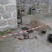
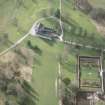
NJ 72276 12557 A public dig was carried out, 13–16 October 2017, on the lawn in front of Castle Fraser. The excavation consisted of twenty-seven 1 x 1m test trenches with the aim of identifying structural remains previously uncovered in part during driveway repairs. The excavation included the participation of over 200 members of the public of all ages and uncovered the remains of a potential 16th-century Barmkin structure.
Funder: National Trust for Scotland
Daniel Rhodes – National Trust for Scotland
(Source: DES, Volume 18)
Excavation (2018)
NJ 72276 12557 A public dig was carried out in 2018 on the lawn
in front of Castle Fraser. The excavation consisted of twentyseven
1 x 1m test trenches with the aim of identifying structural
remains previously uncovered in part during driveway repairs.
The excavation included the participation of over 240 members
of the public of all ages and continued to uncover the remains
of a potential 16th-century barmkin structure.
Archive: National Trust for Scotland
Funder: National Trust for Scotland
Daniel Rhodes – National Trust for Scotland
(Source: DES, Volume 19)
Excavation (14 August 2019 - 23 August 2019)
NJ 72276 12557 Between 14-23 August 2019 a public dig was carried out on the lawn in front of Castle Fraser (Canmore ID: 18722). The excavation consisted of 27 test trenches with the aim of identifying structural remains previously uncovered in part during driveway repairs. The excavation included the participation of over 200 members of the public of all ages and continued to uncover the remains of a potential 16th-century barmkin structure. A linear paved area and wall were also uncovered which may represent the remains of the medieval driveway.
Archive: NTS
Funder: NTS
Daniel Rhodes – The National Trust for Scotland (NTS)
(Source: DES Vol 20)
Excavation (5 September 2022 - 11 September 2022)
Daniel Rhodes – The National Trust for Scotland
NJ 72276 12557 A volunteer dig was carried out on the lawn to the S of Castle Fraser. The excavation targeted structural remains previously uncovered in part during driveway repairs and previous public excavations.
The dig uncovered the remains of two substantial walls running roughly parallel. The more substantial eastern wall may have been revetement and artefacts suggest it was demolished sometime in the 17th century. The wall to the W was stratigraphically later but with no direct dating evidence.
Archive: The National Trust for Scotland Funder: The National Trust for Scotland
(Source DES Volume 23)
Standing Building Recording (2022)
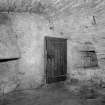
NJ 72270 12550 In 2022, The National Trust for Scotland removed an area of plaster in the Great Hall at Castle Fraser, to examine a damp issue on the inner face of the N wall. This revealed two blocked openings, which were recorded before it was re-plastered. One was the inner arch of a first floor doorway that had been the main entrance to the Hall from the courtyard until c1794–99, when it was replaced by the new S entrance to the castle. Directly W of this blocked entrance, there was another blocked archway. This does not appear on the external face of the wall and it may perhaps have been an alcove for the storage of plate. A small aumbry had been built within the blocking of the alcove.
Archive: NRHE and Aberdeenshire HER Funder: The National Trust for Scotland
Hilary and Charlie Murray – Murray Archaeological Services
(Source DES Volume 23)
Watching Brief (20 February 2024 - 22 February 2024)
NJ 72276 12557 (Centred) Cameron Archaeology conducted a watching brief over groundbreaking works for the installation of cable ducting.
Twelve trenches were excavated between the West Lodge and Gardener’s Cottage. Deposits of building rubble were located beneath driveways and grassed areas though none could be ascribed the demolition of structures in situ. Three ceramic drains were exposed in the courtyard between the Stables and W Stable Block and a further 3 drains were located in other trenches. The foundation of a drystone wall was found ENE of the Walled Garden which may correspond to a feature depicted on the 1st edition OS map.
Information from M. Simon - Cameron Archaeology.
OASIS ID: camerona1-524132


