North Uist, Clettraval
Chambered Cairn (Neolithic), Cist (Bronze Age), Cremation (Bronze Age), Cup Marked Stone (Prehistoric), Inhumation(S) (Neolithic), Bead (Jet)(Bronze Age), Beaker (Early Bronze Age), Scraper (Tool) (Flint)(Neolithic) - (Bronze Age), Unidentified Pottery (Pottery)(Neolithic)
Site Name North Uist, Clettraval
Classification Chambered Cairn (Neolithic), Cist (Bronze Age), Cremation (Bronze Age), Cup Marked Stone (Prehistoric), Inhumation(S) (Neolithic), Bead (Jet)(Bronze Age), Beaker (Early Bronze Age), Scraper (Tool) (Flint)(Neolithic) - (Bronze Age), Unidentified Pottery (Pottery)(Neolithic)
Canmore ID 10106
Site Number NF77SW 15
NGR NF 74998 71369
Datum OSGB36 - NGR
Permalink http://canmore.org.uk/site/10106
- Council Western Isles
- Parish North Uist
- Former Region Western Isles Islands Area
- Former District Western Isles
- Former County Inverness-shire
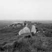
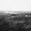
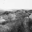
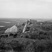
Chambered Cairn, Clettraval 4th-3rd millennia bc Neolithic tomb of a rectangular form associated with the Clyde area, but virtually unique in the Hebrides. Originally wedge-shaped with a compartmented chamber, this 'long cairn' has been much robbed, although most of the large slabs supporting the chamber walls survive. To its west, the site of an Iron Age wheelhouse.
Taken from "Western Seaboard: An Illustrated Architectural Guide", by Mary Miers, 2008. Published by the Rutland Press http://www.rias.org.uk
NF77SW 15 7499 7135.
A Clyde-type, chambered long cairn, wedge-shaped, 95ft (29m) long E-W with, at the E end, an impressive facade, mainly orthostatic, through which the chamber, c. 34 1/2 ft (10.5m) long, was entered and in front of which was a paved forecourt. A kerb consisting of massive blocks, averaging 2 1/2ft (0.7m) high can be traced in stretches. The cairn was severely damaged and robbed for the building of an iron age aisled round-house (NF77SW 24) which was inserted into its W end. The site was excavated by Scott in the 1930s and 1940s; finds from the cairn, now in NMAS, include beaker sherds.
E Beveridge 1911; RCAHMS 1928;W L Scott 1935; 1947; A S Henshall 1972.
This chambered cairn is so mutilated that only the chamber and passage are surveyable.
Visited by OS 17 June 1965.
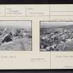
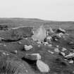
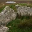
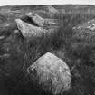
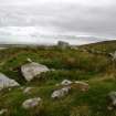
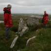
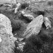
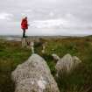
This chambered cairn is situated on the leading edge of a terrace in peat moorland and is largely as planned and described by Henshall. The cairn material has been heavily robbed for the construction of an Iron Age round house that overlies its W end (NF77SW 24). At its E end, the orthostats of its once impressive facade have fallen and lie displaced, those on the S originally forming a near continuous line of six slabs reducing in height towards the outer edge of the cairn. The chamber, entered from the E, comprises five compartments and is set on a slight curve, though it is not central to the surviving cairn material.
Visited by RCAHMS (ARG, SPH) 31 August 2009
Field Visit (9 September 1914)
Segmented Cairn (ruined), South Clettraval.
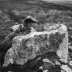
About 400 yards south-east of the summit of South Clettraval and about 450 yards north-west of the chambered cairn (No. 234; NF77SE 14), at an elevation of about 400 feet above sea level, is a fragment of a segmented cairn, the stones no doubt having been utilised in the construction of the dun (No. 178; NF77SW 24), which encroaches on the western side of the cairn. The whole of the mound has disappeared with the exception of a slight heap lying to the south of the megalithic long chamber which was covered by the cairn and which has partly survived. Of this chamber and the entrance passage the western end slab, a stone 5 feet 2 inches in length, 3 feet in height, and 10 inches in thickness, and four of the slabs on the south side remain in situ, the south-western corner of the chamber being undisturbed; the side slabs reading from the west measure 8 feet6 inches, 5 feet 5 inches, 4 feet 4 inches and 5 feet 6 inches in length respectively, the extreme slabs being 3 feet and 2 feet 9 inches in height. The chamber and passage, which run east-south-east and west-north-west, have been 30 feet in length, and, judging from the slab at the west end, the former has been about 5 feet in breadth at that part. Parallel to the most easterly side slab, and 2 feet to the north of it, the edge of a slab just appears above ground, possibly giving the width of the passage near its entrance. To the south is a displaced stone of considerable size.
RCAHMS 1928, visited 9 September 1914.
OS map: North Uist xxxiv (unnoted).
Field Visit (17 June 1965)
This chambered cairn is so mutilated that only the chamber and passage are surveyable.
Visited by OS 17 June 1965.
Desk Based Assessment (1965)
A Clyde-type, chambered long cairn, wedge-shaped, 95ft (29m) long E-W with, at the E end, an impressive facade, mainly orthostatic, through which the chamber, c. 34 1/2 ft (10.5m) long, was entered and in front of which was a paved forecourt. A kerb consisting of massive blocks, averaging 2 1/2ft (0.7m) high can be traced in stretches. The cairn was severely damaged and robbed for the building of an iron age aisled round-house (NF77SW 24) which was inserted into its W end. The site was excavated by Scott in the 1930s and 1940s; finds from the cairn, now in NMAS, include beaker sherds.
E Beveridge 1911; RCAHMS 1928;W L Scott 1935; 1947; A S Henshall 1972.
Field Visit (April 2008)
NF 7499 7135 During the course of a field visit by members of the Society in April 2008 it was noted that a cup-marked stone was lying loose near the base of the S side of the cairn. The stone measured c0.25 x 0.25m and the pecked cup mark was 75mm in diameter. The stone was left as found and the Western Isles archaeologist notified.
Funder: BEVARS
Diana Coles (BEVARS), 2008
Field Visit (31 August 2009)
This chambered cairn is situated on the leading edge of a terrace in peat moorland and is largely as planned and described by Henshall. The cairn material has been heavily robbed for the construction of an Iron Age round house that overlies its W end (NF77SW 24). At its E end, the orthostats of its once impressive facade have fallen and lie displaced, those on the S originally forming a near continuous line of six slabs reducing in height towards the outer edge of the cairn. The chamber, entered from the E, comprises five compartments and is set on a slight curve, though it is not central to the surviving cairn material.
Visited by RCAHMS (ARG,SPH) 31 August 2009
Measured Survey (16 October 2012 - 17 October 2012)
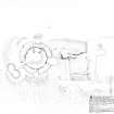
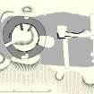
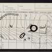
RCAHMS surveyed the chambered cairn and wheelhouse at South Clettraval between 16-17 September 2012 with plane-table and alidade producing a plan at a scale of 1:250. The survey drawing was used as the basis of an illustration redrawn in vector graphics software.
Note (2020)
South Clettraval #1
This burial site in Western Isles was a focus for funerary practices in the Neolithic/Bronze Age period, between 4000 BC and 2001 BC.
Prehistoric Grave Goods project site ID: 60098
CANMORE ID: 10106
Total no. graves with grave goods: 2
Total no. people with grave goods: 5
Total no. grave goods: 8
Prehistoric Grave Goods project Grave ID: 60034
Grave type: Chamber
Burial type(s): Inhumation, Inhumation, Inhumation, Inhumation
Grave good: Pot; Materials used: Pottery; Current museum location: National Museum of Scotland
Grave good: Assemblage; Materials used: Quartz/Quartzite; Current museum location: Unknown
Grave good: Pebble; Materials used: Pumice; Current museum location: Unknown
Prehistoric Grave Goods project Grave ID: 74119
Grave type: Cist
Burial type(s): Cremation
Grave good: Pot; Materials used: Pottery; Current museum location: Unknown
Grave good: Pot; Materials used: Pottery; Current museum location: Unknown
Grave good: Bead(s); Materials used: Jet/Lignite/Shale/Coal [Jet]; Current museum location: Unknown
Grave good: Scraper; Materials used: Chert / Flint [Flint]; Current museum location: Unknown
Grave good: Blade; Materials used: Chert / Flint [Flint]; Current museum location: Unknown
Further details, the full project database and downloads of project publications can be found here: https://doi.org/10.5284/1052206
An accessible visualisation of the database can be found here: http://blogs.reading.ac.uk/grave-goods/map/


