Following the launch of trove.scot in February 2025 we are now planning the retiral of some of our webservices. Canmore will be switched off on 24th June 2025. Information about the closure can be found on the HES website: Retiral of HES web services | Historic Environment Scotland
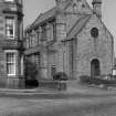
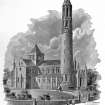
Dunfermline, East Port, St Margaret's Roman Catholic Church
Church (19th Century), Vestry (20th Century)
Site Name Dunfermline, East Port, St Margaret's Roman Catholic Church
Classification Church (19th Century), Vestry (20th Century)
Alternative Name(s) Holyrood Place
Canmore ID 94321
Site Number NT08NE 355
NGR NT 09544 87579
Datum OSGB36 - NGR
Permalink http://canmore.org.uk/site/94321
- Council Fife
- Parish Dunfermline
- Former Region Fife
- Former District Dunfermline
- Former County Fife
NT08NE 355 09546 87576
St Margaret's RC Church [NAT]
OS (GIS) MasterMap, November 2008.
Architect: Sir Robert Rowand Anderson 1894-6 (not finished to original design) - additions
Thornton Shiells 1871-73
(Undated) information in NMRS.
Photographic Survey (1955)
Photographs of buildings in Dunfermline, Fife, by the Scottish National Buildings Record in 1955.
Trial Trench (April 2003)
In a follow-up to the geophysical survey previously undertaken (DES 2001, 69-70), two trial trenches were excavated in April 2003 in a gap between the planted garden area to the W of the 19th-century courtyard wall at the rear of the castle. What appeared to be natural subsoil, a reddy-orange clay, was located 1.2m below the surface. Although the depth reached was limited, there was no clear evidence for the infilled castle ditch at this point, and it either lies closer to the castle or further W. Worked sandstone blocks may have derived from the medieval castle, but the ground was levelled in the 19th century and the area used as tennis courts. The finds from both trenches reflect this and include much 19th and 20th-century material, although there are a few sherds of medieval green-glazed oxidised ware.


