
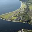
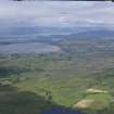
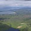
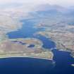
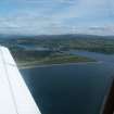
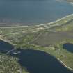
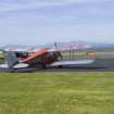
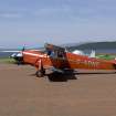
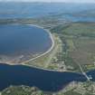
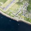
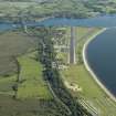
Connel Airfield


Airfield (20th Century)
Site Name Connel Airfield
Classification Airfield (20th Century)
Alternative Name(s) Oban, North Connel; Connel Ferry; Oban Airport
Canmore ID 92718
Site Number NM93NW 37
NGR NM 9050 3500
NGR Description Centred NM 9050 3500
Datum OSGB36 - NGR
Permalink http://canmore.org.uk/site/92718


- Council Argyll And Bute
- Parish Ardchattan And Muckairn (Argyll And Bute)
- Former Region Strathclyde
- Former District Argyll And Bute
- Former County Argyll
NM93NW 37 centred 9050 3500
For ancilliary camps and buildings see NM93SW 53.00
NM93SW
(Also falls on sheet NM93SW)
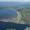
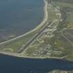
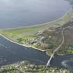
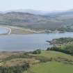
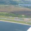
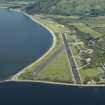
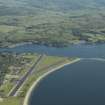
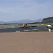
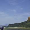
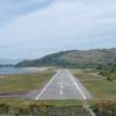
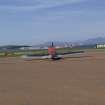
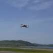
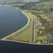
Consists of two intersecting runways due to its geographical location. In 1967, the site was purchased by Oban Council and is also used for glider launching. Some wartime buildings survive and a few concrete bases remain.
D J Smith 1983; B Quarrie 1987
This World War II airfield is situated on the W side of the A 828 (T) at North Connel. The runway and several other buildings are extant.
J Guy 2001; NMRS 810/11, Part 1, 27-9
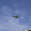
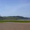
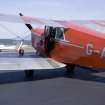
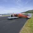
This airfield remains in regular use for gliding and light aircraft movements under the title Oban Airport. There is little significant hangarage but there is a group of huts; one of the runways appears to see little use.
Visited by RCAHMS (RJCM), 6 July 2002.
NM 905 350 A desk-based assessment and walk over survey to determine the extent of archaeologically significant remains that may be impacted upon by the forthcoming renewal of North Connel Airfield (NM93NW 37) was undertaken in December 2005. Before these works the only known archaeology within the development area was the military aerodrome itself.
The works identified the known elements of the military aerodrome (runways, roads, structures etc), confirmed their current condition and considered how destructive the process of building the aerodrome was to the potential for currently unlocated archaeology. An extensive area of sand extraction from the raised beach was also recorded.
No extant structures or structure locations associated with elements of the military aerodrome will be impacted upon by the proposed development. Some portions of original roadway are likely to be lost.
Report to WoSAS and archive to NMRS.
Sponsor: Argyll and Bute Council (Transportation and Infrastructure).
Douglas Gordon, 2006.

