
Following the launch of trove.scot in February 2025 we are now planning the retiral of some of our webservices. Canmore will be switched off on 24th June 2025. Information about the closure can be found on the HES website: Retiral of HES web services | Historic Environment Scotland
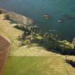
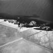
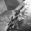
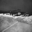
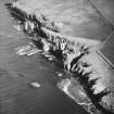
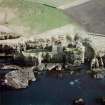
Castle Haven


Dyke (Period Unassigned)
Site Name Castle Haven
Classification Dyke (Period Unassigned)
Alternative Name(s) Wic 143
Canmore ID 9161
Site Number ND35SE 30
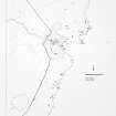
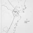
NGR ND 3789 5493
Datum OSGB36 - NGR
Permalink http://canmore.org.uk/site/9161


- Council Highland
- Parish Wick
- Former Region Highland
- Former District Caithness
- Former County Caithness
ND35SE 30 3789 5493.
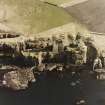
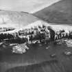
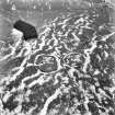
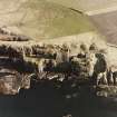
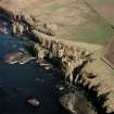
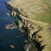
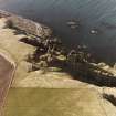
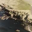
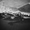
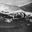
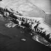
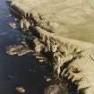
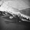
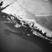
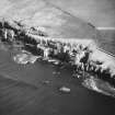
ND 3787 5490. A grass-covered wall, 8m long, with an entrance 2.4m wide, crosses the promontory at Castle Haven, 45m from its end. It may be associated with Castles Sinclair and Girnigoe (ND35SE 15).
C E Batey 1981.
The wall at ND 3789 5493 is as described by Miss Batey. It would appear to be an old barrier, probably to keep stock from the promontory.
Visited by OS (J B) 22 July 1982.
Project (1980 - 1982)
Field Visit (1981)
ND 3787 5490. A grass-covered wall, 8m long, with an entrance 2.4m wide, crosses the promontory at Castle Haven, 45m from its end. It may be associated with Castles Sinclair and Girnigoe (ND35SE 15).
C E Batey 1981.
Field Visit (22 July 1982)
The wall at ND 3789 5493 is as described by Miss Batey. It would appear to be an old barrier, probably to keep stock from the promontory.
Visited by OS (J B) 22 July 1982.

