
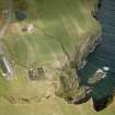
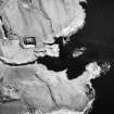
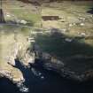
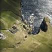
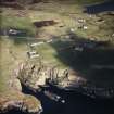
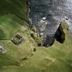
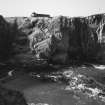
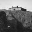
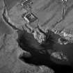
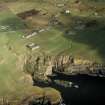
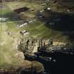
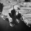
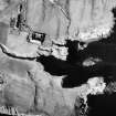
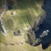
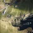
Whaligoe, Square Of Whaligoe, Curing Yard And House


Curing Yard (Period Unassigned), House (Period Unassigned)
Site Name Whaligoe, Square Of Whaligoe, Curing Yard And House
Classification Curing Yard (Period Unassigned), House (Period Unassigned)
Canmore ID 9083
Site Number ND34SW 73
NGR ND 32039 40312
Datum OSGB36 - NGR
Permalink http://canmore.org.uk/site/9083


- Council Highland
- Parish Wick
- Former Region Highland
- Former District Caithness
- Former County Caithness
ND34SW 73 32039 40312
See also ND34SW 119.
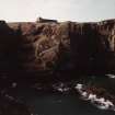
For Whaligoe Harbour and Steps (adjacent to E), see ND34SW 121.00.

