
Alness, Royal Air Force Seaplane Base


Seaplane Base (20th Century)
Site Name Alness, Royal Air Force Seaplane Base
Classification Seaplane Base (20th Century)
Alternative Name(s) Raf Alness; Invergordon; Cromarty Firth
Canmore ID 90512
Site Number NH66NE 52
NGR NH 65120 67900
NGR Description Centred
Datum OSGB36 - NGR
Permalink http://canmore.org.uk/site/90512


- Council Highland
- Parish Alness
- Former Region Highland
- Former District Ross And Cromarty
- Former County Ross And Cromarty
NH66NE 52.00 centred 6512 6790
NH66NE 52.01 NH 65681 68864 Firing Range
Part of the site falls on map sheet NH66NW.
Not to be confused with the World War I seaplane and flying boat base on the Cromarty Forth (centred NH 7885 6767, at The Links, Cromarty), for which see NH76NE 295.
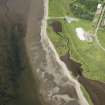
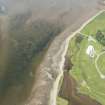
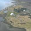
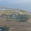
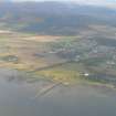
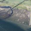
Alness is the sole wartime flying boat base still used by the RAF (1983), but of course only marine craft can be seen here now, and that from a distance, as it is not very accessible. The former decontamination centre is close to Alness town and a few other dispersed buildings also survive, along with the concrete floors of dozens of nissen huts.
The station, which dates back to the pre-war period, was known first as Invergordon, but, in its early days, it is doubtful if it was anything more than a mooring area with a slipway (NH 6497 6775) for beaching the aircraft.
D J Smith 1983.
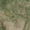
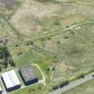
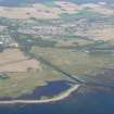
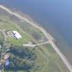
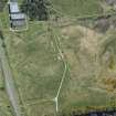
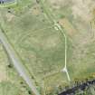
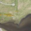
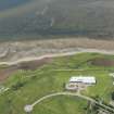
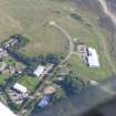
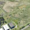
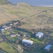
Alness seaplane base is situated immediately to the S of a new stretch of the A9 trunk road to the S of Alness town. Little remains, apart from one Bellman type hangar, two motor transport buildings and several accommodation huts. The bases of the large seaplane hangars can be easily identified as can most of the taxiways. There are also several small brick-built blast shelters strategically located around the base. At what was the former entrance, two small anti-tank pimples survive alongside a small garage or fire tender building. A small landing craft can also be seen in the central accommodation area mounted on wooden blocks. One light anti-aircraft position could be located in the SW part of the base consisting of a concrete base surrounded by a circular earthen bank.
During February and March of 1997 most of the surviving buildings were cleared to allow trenches to be dug for service pipes as part of the re-development of the site.
Visited by RCAHMS (DE) January/March 1997
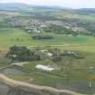
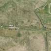
Slipway, some of the roads and one or two small buildings are all that survives.
J Guy 2000; NMRS MS 810/10, Vol.2, 112.
Note (8 February 2022)
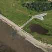
The seaplane base extends to E as far as Dalmore distillery. The pillbox Study Group report a number of extant blast shelters on the E bank of the Alness River. This part of the seaplane base contained a number of small ammunition and bomb stores, various huts and blast shelters and what may be a fuel store. Most of these features are still visible on aerial photography and depicted on current editions of OS maps with eleven blast shelters shown.
Information from Pillbox Study Group and HES (AKK) 8 February 2022

