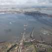
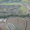
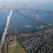
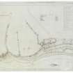
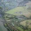
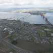
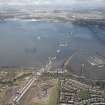
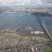
South Queensferry, Port Edgar Harbour
Harbour (20th Century), Naval Establishment (First World War), Naval Establishment (20th Century)
Site Name South Queensferry, Port Edgar Harbour
Classification Harbour (20th Century), Naval Establishment (First World War), Naval Establishment (20th Century)
Alternative Name(s) Hms Columbine; Hms Hopetoun; Hms Lochinvar; Queensferry Narrows; Inner Forth Estuary; Upper Firth Of Forth
Canmore ID 90058
Site Number NT17NW 181
NGR NT 1229 7863
NGR Description Centred NT 1229 7863
Datum OSGB36 - NGR
Permalink http://canmore.org.uk/site/90058
- Council Edinburgh, City Of
- Parish Dalmeny
- Former Region Lothian
- Former District City Of Edinburgh
- Former County West Lothian
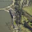
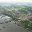
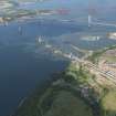
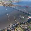
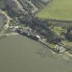
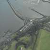
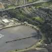
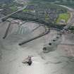
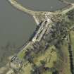
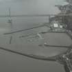
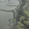
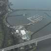
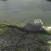
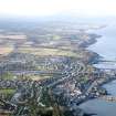
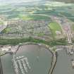
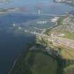
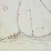
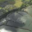
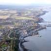
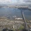
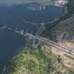
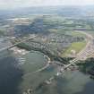
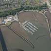
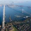
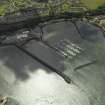
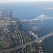
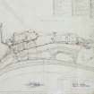
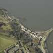
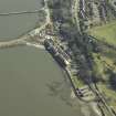
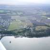
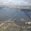
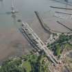
Having made enquiries about buying Port Edgar harbour as early as 1911, Admiralty bought the port in 1916 to develop it as a base for Torpedo Boat Destroyers. Originally planned to accommodate up to 52 destroyers, in the end 66 could be berthed. The Admiralty's work included dredging the harbour and completing the east breakwater, which the harbour's previous owners, the North British Railway Company, had not done. The base was commissioned in December 1917, but the partly-completed base had probably been in use before then.
The majority of the buildings that survive in what is now Port Edgar Marina are probably of First World War date, although the base was again used in the Second World War.
Information from HS/RCAHMS World War One Audit Project (GJB) 3 October 2013.
NT17NW 181.00 centred 1229 7863
For associated major establishment of HM Dockyard, Rosyth (NT 09 82) and list of other naval establishments in the area, see NT08SE 41.00.
Not to be confused with HMS Lochinvar at Granton Harbour, for which see NT27NW 28.00.
For coastal artillery, anti-aircraft and anti-submarine defences around the dockyard and the Forth Rail Bridge (NT17NW 70), see under individual entries as classified under 'Defence; Military...'.
NT17NW 181.01 Centred NT 1217 7866 Structure (Rope-splicing table)
NT17NW 181.02 NT 12189 78687 Capstan; Slipway
NT17NW 181.03 NT 12118 78989 Crane
NT17NW 181.04 From NT 1195 7918 to NT 1175 7875 Breakwater (West)
NT17NW 181.05 From NT 1218 7915 to NT 1234 7874 Breakwater (East)
NT17NW 181.06 From NT 1194 7886 to NT 1188 7863 Pier (West)
NT17NW 181.07 From NT 1210 7901 to NT 1215 7869 Pier; Slipway; Capstan (East and pontoons)
NT17NW 181.08 Centred NT 11665 78720 Barracks
NT17NW 181.09 Centred NT 12369 78659 Workshop; Magazine
NT17NW 181.10 Centred NT 11486 78742 Barracks (Officers)
NT17NW 181.11 NT 11523 78739 Air-raid shelter
NT17NW 181.12 NT 11697 78694 Guardroom; Jail
NT17NW 181.13 NT 11759 78711 Church; Chapel
NT17NW 181.14 NT 12125 78584 Electricity Generating Station
NT17NW 181.15 NT 12094 78575 Training Establishment
NT17NW 181.16 Centred NT 12283 78679 Workshops
NT17NW 181.17 NT 12314 78621 and NT 12348 78614 Workshops
NT17NW 181.18 Centred NT 12235 78683 Huts (wooden)
NT17NW 181.19 NT 12204 78693 Workshop; Aircraft Hangar
NT17NW 181.20 NT 12205 78632 Office
NT17NW 181.21 NT 12207 78603 Cottage
NT17NW 181.22 NT 12359 78575 Police Station; Guardroom
NT17NW 181.23 NT 12165 78813 Workshop (Loop Shed)
NT17NW 181.24 Centred NT 11662 8694 Stores
NT17NW 181.25 Centred NT 12259 78628 Building; Huts
NT17NW 181.26 NT 11733 78727 and NT 11731 78713 Boiler House; Garage
NT17NW 181.27 Centred NT 11743 78695 Gym; Rifle Range; Store
NT17NW 181.28 NT 11594 78729 Hospital
NT17NW 181.29 NT 11816 78666 and NT 11847 78646 Hut; Mast
NT17NW 181.30 c.NT 1214 7862 Memorial
NT17NW 181.31 NT 12221 78621 Air-raid shelter
NT17NW 213 NT 12595 78524 Building (Flotilla Club)
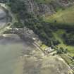
Port Edgar: 'A middling sized freestone pier, in very good repair. It was erected in 1810 by the Queensferry Passage Trustees at the expense of £4763-13s-10d and is 378 feet in length. The ledge of rock on which the pier was built was naturally suited for a landing place and to the circumstance of Edgar Aitheling (heir to the Confessor) landing here it derives its name. On 15th August 1822 King George IV embarked here after paying a visit to the Earl of Hopetoun.
Ordnance Survey Name Book, 1855
Port Edgar [NAT]
OS 1:10,560 map, Linlithgowshire, [new series], iv.8, 1916.
Port Edgar (Water Sports Centre) [NAT]
OS 1:10,000 map, 1984.
1916 Admiralty acquires Port Edgar and adjacent land for development as a torpedo boat destroyer (TBD) depot to complement Rosyth dockyard (NT08SE 41.00)
1917 Port Edgar commissioned as HMS Columbine: 66 destroyers accommodated in pens.
1919 Mutiny among destroyers of First Flotilla at Port Edgar on grounds of conditions of service in North Russia.
1924-6 Captain (later Admiral of the Fleet) A B Cunningham in command at Port Edgar
1928-38 Port Edgar closed: local concern at loss of jobs.
1939 Port Edgar re-activated as HMS Lochinvar
1943 Port Edgar re-named HMS Hopetoun and enters service as Combined Operations Training Centre in preparation for Normandy landings. Name HMS Lochinvar and role of minesweeping training transferred to Granton Harbour (NT27NW 28.00).
1946 Port Edgar resumes name HMS Lochinvar: provides base and co-ordination facilities for post-war mine clearance.
1948 Port Edgar becomes minesweeping Trials and Experimentation Establishment.
1958 Fishery Protection Squadron moves to Port Edgar from the Humber
1960 Port Edgar becomes responsible for all minesweeping training.
1962 Visit to Port Edgar by HM King Olav of Norway
1975 Port Edgar closes with opening of new Fleet Base within Rosyth complex (NT08SE 41.00)
1978 Lothian Regional Council purchase site for use as marina.
1988 Algerine Association memorial ('cairn') erected.
'Sinbad' 2002.
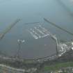
This is a large working harbour and marina within stone walls which are well maintained.
Site recorded by GUARD during the Coastal Assessment Survey for Historic Scotland, 'The Firth of Forth from Dunbar to the Coast of Fife' 19th February 1996.
Former fishing harbour converted and rebuilt into a destroyer base immediately before the First World War. Originally wooden piers and jetties were used housing about 36 detsroyers. 'Oil fuel, electric power and fresh woater were laid on' (Cunningham 1951) with extensive workshops, an electricity power station, barracks, for both officers and ratings, drill areas and canteens and messing halls.
In area, including the harbour, the base totals about 40.70 hectares.
Information from RCAHMS (DE), November 2006
Project (March 2013 - September 2013)
A project to characterise the quantity and quality of the Scottish resource of known surviving remains of the First World War. Carried out in partnership between Historic Scotland and RCAHMS.


