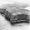
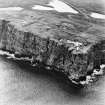
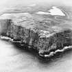
Dunnet Head Lighthouse
Gate Pier (Period Unassigned), Lighthouse (19th Century), Wall (Period Unassigned)
Site Name Dunnet Head Lighthouse
Classification Gate Pier (Period Unassigned), Lighthouse (19th Century), Wall (Period Unassigned)
Alternative Name(s) Easter Head; Dunnethead Lighthouse; Dunnet Head Lighthouse, Boundary Wall And Gate-piers
Canmore ID 8863
Site Number ND27NW 5
NGR ND 20273 76775
Datum OSGB36 - NGR
Permalink http://canmore.org.uk/site/8863
- Council Highland
- Parish Dunnet
- Former Region Highland
- Former District Caithness
- Former County Caithness
ND27NW 5.00 20273 76775
Dunnethead Lighthouse [NAT]
OS 1:10,000 map, 1975.
ND27NW 5.01 ND 20270 76756 Western Keepers House
ND27NW 5.02 ND 20301 76754 Eastern Keepers House
ND27NW 5.03 ND 20267 76808 Foghorn
EXTERNAL REFERENCE
Scottish Records Office
The Commissioners announce their intention to build 3 new lighthouses, Dunnet Head, Barra Head and S. side of Lismore. Letter from C. Cunningham says the commissioners have resolved to delay decision on Chickenhead (Stornoway).
1829 GD 46/17/77
(Undated) unformation in NMRS.
(Location cited as ND 203 768). Dunnet Head Lighthouse, established 1831, engineer Robert Stevenson. A simplified standard lighthouse, with a short circular tower in a semicircular base, with a corbelled parapet, and a circular domed diamond-paned lantern. The keepers' houses are plain rectangular buildings. There are two directable foghorns.
J R Hume 1976.
Dunnet Head lighthouse occupies the most northerly point of mainland Scotland and was built by Robert Stevenson in 1831, the contractor being James Smith of Inverness. The optical system was changed to lenses in 1852.
R W Munro 1979; K Allardyce and E M Hood 1986.
The lighthouse is painted white and well maintained.
Dunnet Head Lighthouse is depicted on the 1st edition of the OS 6-inch (and 25-inch) map (Caithness, 1876, sheet 1) as four roofed buildings with three enclosures, a garden and a flagstaff. By the date of the 2nd edition of 1907 (ibid) a 'fog siren' had been added (NC27NW 5.03).
The Object Name Book of the Ordnance Survey describes this group as "The lighthouse, which was erected in 1832, is, at one part not much more than 50 feet from the edge of the precipice. During a heavy storm from the west, the enormous billows, as they dash against the rugged face of the cliff, throw up the spray as high as the light of the building, often mingled with stones which occasionally break the glass". "And such is the prodigious force of the wind and the sea united upon the headland, that the very rock itself seems to tumble: while the lighthouse shakes from top to bottom, as if it were affected by an earthquake". The light which is a fixed one is " seen at the distance of 23 miles. The height of the lantern above the highest spring tides is 346 feet".
This lighthouse was erected at a great expense by the Commissioners for Northern Lights- A small harbour or rather pier has been built by them at Brough for landing their stores, and a well made road connects it with the lighthouse.
There are a few acres of arable land and a garden belonging to the lighthouse [G Hobson] (ONB 1873).
The lighthouse continues to be maintained by the Northern Lighthouse Board and is now remotely controlled. It is not known whether the keepers cottages are occupied. The pier at Brough still exists (ND27SW 29).
Information from RCAHMS (DE), December 2007
Publication Account (1995)
One of the six lighthouses designed and built by Robert Stevenson with his son Alan between 1830 and 1833, and the most no rtherly lighthouse on the mainland of Scotland. Here a short circular tower stands on a semicircular base, with a parapet corbelled out below the light, and a circular, diamond-paned lantern with a domed top. Beside the tower are the low, white-washed blocks of the keepers' houses. A feature of the Stevenson family's work for the Northern Lighthouse Board was the attention they paid to the welfare of the lightkeepers, as well their engineering skills in providing the best possible lights. These were sometimes constructed on the most inaccessible rocks, such as the Pentland Skerries where two tall towers and a keeper's cottage were completed in 1794. Every year, the member of the family who was Engineer to the Board made a trip round Scotland to visit all the lights, even those on remote rocks or islands. Sir WaIter Scott sailed on the Lighthouse Yacht in 1814 and kept a journal of his voyage, with vivid descriptions of Cape Wrath, the dangerous currents in the 'rentland Firth, and landing on the Pentland Skerries.
Information from ‘Exploring Scotland’s Heritage: The Highlands’, (1995).


