Pricing Change
New pricing for orders of material from this site will come into place shortly. Charges for supply of digital images, digitisation on demand, prints and licensing will be altered.
Forres Airfield
Airfield (20th Century)
Site Name Forres Airfield
Classification Airfield (20th Century)
Alternative Name(s) Mundole Cottages; Waterside; Balnageith
Canmore ID 81616
Site Number NJ05NW 97
NGR NJ 020 580
NGR Description Centred NJ 020 580
Datum OSGB36 - NGR
Permalink http://canmore.org.uk/site/81616
- Council Moray
- Parish Forres
- Former Region Grampian
- Former District Moray
- Former County Morayshire
NJ05NW 97.00 centred 020 580
NJ05NW 97.01 NJ 0212 5868 Pillbox
NJ05NW 97.02 NJ 0182 5711 Pillbox
NJ05NW 97.03 NJ 0164 5693 Pillbox
NJ05NW 97.04 NJ 02381 58587 Pillbox
NJ05NW 97.05 NJ 0240 5840 Royal Air Force, Married Quarters
For (Pilmuir) cropmarks (centred NJ 020 583) within the area of the airfield, see NJ05NW 35.
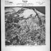
Forres or Mundole was a grass runway satellite. A short concrete strip was built in 1960. Most of the original buildings have been demolished and modern houses have encroached on to the site.
D J Smith 1983.
Aircraft hardstands are still depicted on latest OS map (OS 1:10,000 1984) to the S of Mundole Cottages.
J Guy 1992; NMRS, MS/810/1 (1992).


