|
Manuscripts |
MS 1007/3 |
Mairi Logie |
Fort William to Inverness. An assessment of the 18th century military roads which lie within the Highland Council boundaries. |
1997 |
Item Level |
|
 |
On-line Digital Images |
DP 111929 |
RCAHMS Aerial Photography Digital |
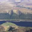
General oblique aerial view of the remains of the Fort William-Fort Augustus-Inverness military road, at the N end of Loch Lochy, and the forestry on the side of the Great Glen, taken from the NW. |
1/5/2011 |
Item Level |
|
 |
On-line Digital Images |
DP 111930 |
RCAHMS Aerial Photography Digital |
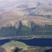
General oblique aerial view of the remains of the Fort William-Fort Augustus-Inverness military road, at the N end of Loch Lochy, and the forestry on the side of the Great Glen, taken from the NW. |
1/5/2011 |
Item Level |
|
 |
On-line Digital Images |
DP 342774 |
Papers of James Sloan Bone, landscape historian, Inverness, Highland, Scotland |
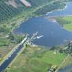
Close up aerial view of Laggan Locks at Loch Lochy on the Caledonian Canal, looking SSW. |
2/6/2012 |
Item Level |
|
 |
On-line Digital Images |
DP 342775 |
Papers of James Sloan Bone, landscape historian, Inverness, Highland, Scotland |
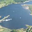
Close up aerial view of Laggan Locks, at Loch Lochy on the Caledonian Canal, looking SSW. |
2/6/2012 |
Item Level |
|
|
All Other |
551 166/1/1 |
Records of the Ordnance Survey, Southampton, Hampshire, England |
Archaeological site card index ('495' cards) |
1947 |
Sub-Group Level |
|