
Dunragit


Pit(S) (Period Unknown), Round Barrow(S) (Prehistoric)(Possible)
Site Name Dunragit
Classification Pit(S) (Period Unknown), Round Barrow(S) (Prehistoric)(Possible)
Canmore ID 79379
Site Number NX15NE 69.05
NGR NX 15114 57412
NGR Description Centre
Datum OSGB36 - NGR
Permalink http://canmore.org.uk/site/79379


- Council Dumfries And Galloway
- Parish Old Luce
- Former Region Dumfries And Galloway
- Former District Wigtown
- Former County Wigtownshire
NX15NE 69.05 150 574
See NX15NE 69.00 and NX15NW 76.00
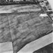
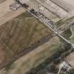
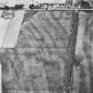
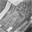
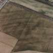
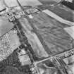
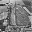
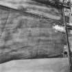
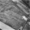
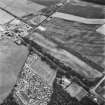
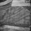
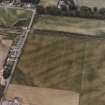
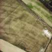
Aerial Photographic Transcription (10 September 1992 - 16 December 1992)
An aerial transcription was produced from oblique aerial photographs. Information from Historic Environment Scotland (BM) 31 March 2017.
Aerial Photographic Interpretation (16 December 2021)
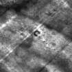
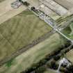
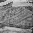
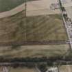
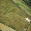
A round barrow and a possible second example have been recorded as cropmarking on oblique aerial photographs (RCAHMSAP 1992) on level ground immediately E of the Dunragit timber enclosure (NX15NW 76.1 and 76.2). The first barrow (NX 15064 57430) measures about 4m in diameter within a ditch about 0.5m broad; the second lies about 25m SE and comprises a U-plan ditch (open to the N and measuring about 5m across overall) with a possible pit at the centre. Two large pits about 14m apart are situated about 31m E of the possible second barrow.
Information from HES Archaeological Survey (K. Millican) 16 December 2021.
Note (4 March 2022)
The location, classification and period of this site have been reviewed and changed from CROPMARK(S) (PERIOD UNKNOWN), PIT(S) (PERIOD UNASSIGNED), RING DITCH(S) (PERIOD UNASSIGNED).

