
Lower Pitcalzean


Enclosure (Period Unassigned)
Site Name Lower Pitcalzean
Classification Enclosure (Period Unassigned)
Canmore ID 73926
Site Number NH87SW 24
NGR NH 800 708
Datum OSGB36 - NGR
Permalink http://canmore.org.uk/site/73926


- Council Highland
- Parish Nigg (Ross And Cromarty)
- Former Region Highland
- Former District Ross And Cromarty
- Former County Ross And Cromarty
NH87SW 24 800 708.
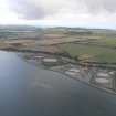
Air photography has revealed a circular penannular ditch or possible pit circle with a central pit. It measures c10m in diameter and is c120m S of the bend in the minor road from Nigg to Lower Pitcalzean. (See Archive for details.)
Information from J Harden 1989.

