
Pricing Change
New pricing for orders of material from this site will come into place shortly. Charges for supply of digital images, digitisation on demand, prints and licensing will be altered.
Learable


Enclosure(S) (Medieval) - (Post Medieval)
Site Name Learable
Classification Enclosure(S) (Medieval) - (Post Medieval)
Canmore ID 72409
Site Number NC82SE 20.12
NGR NC 89515 23605
Datum OSGB36 - NGR
Permalink http://canmore.org.uk/site/72409


- Council Highland
- Parish Kildonan
- Former Region Highland
- Former District Sutherland
- Former County Sutherland
Field Visit (6 May 1991)
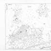
NC82SE 20.12 8950 2360.
The main rectilinear enclosure, which is situated in the middle of the rig of the township (NC82SE 20.02), is remarkable for several large clearance heaps dumped along its limits. It measures 20m from NW to SE by 17m transversely and is terraced into the slope to a depth of about 0.5m. At the N corner of the enclosure, there is a triangular area, reduced slightly below the rest of the enclosure. A high terrace, about 1m in height, defines the lower or NE edge of the enclosure, at the base of which a few facing stones are visible. Parallel to it there is a much slighter terrace, defining a narrow platform some 3m in breadth.
At the SE end of this platform on the E corner of the enclosure, there is another terraced enclosure, heavily encumbered with clearance, which extends for some 20m to the E and measures some 15m from N to S. A 2m thick clearance dyke runs off from the SW corner of the main enclosure along the line of a terrace for 50m. (KILD91 319)
Visited by RCAHMS (PJD) 6 May 1991.

