
Learable


Enclosure (Medieval), Round Ended Building(S) (Medieval)
Site Name Learable
Classification Enclosure (Medieval), Round Ended Building(S) (Medieval)
Canmore ID 72406
Site Number NC82SE 20.09
NGR NC 8938 2362
Datum OSGB36 - NGR
Permalink http://canmore.org.uk/site/72406


- Council Highland
- Parish Kildonan
- Former Region Highland
- Former District Sutherland
- Former County Sutherland
Field Visit (5 June 1991)
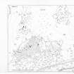
NC82SE 20.09 8938 2362.
There are two round-ended buildings and fragments of an enclosure situated immediately W of the ring-dyke and immediately S of a kiln-barn (NC82SE 20.01).
The better preserved of the two buildings, which is crossed at its E end by the ring-dyke and overlies the NE corner of the second building, measures 18m from ENE to WSW by 5.2m at its widest towards the E end. The line of the wall is visible as a step 1m across around the inside of the scarp of the platform. It has a pronounced scoop and its W end is levelled into the slope.
The second building measures 14m from ENE to WSW by 5m transversely within a low bank 0.25m in height and is levelled into the slope on the W. The enclosure is defined by a low bank, which runs NNW from the W end of the second building for about 20m, before turning NE to run downhill to stop just short of the ring-dyke. What may be a fence-line is marked by a shallow groove and upcast that cuts through this bank in a straight line from N to S.
(KILD91 418-9)
Visited by RCAHMS (PJD) 5 June 1991.

