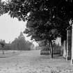
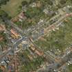
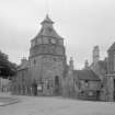
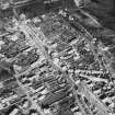
Crail, Marketgate, Tolbooth And Town Hall
Tolbooth (16th Century), Town Hall (19th Century)
Site Name Crail, Marketgate, Tolbooth And Town Hall
Classification Tolbooth (16th Century), Town Hall (19th Century)
Canmore ID 70942
Site Number NO60NW 11
NGR NO 61315 07773
Datum OSGB36 - NGR
Permalink http://canmore.org.uk/site/70942
- Council Fife
- Parish Crail
- Former Region Fife
- Former District North East Fife
- Former County Fife
NO60NW 11 61315 07773
(NO 6131 0777) Town Hall (NAT)
OS 25" map (1914)
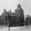
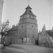
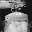
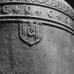
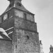
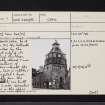
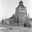
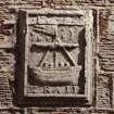
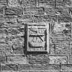
The tolbooth, Crail. As it existed in 1517, the tolbooth is represented by the lower part only of its tower, which has been considerably altered and now has no features of particular interest. The masonry here is rubble and a 12th century capital and base, presumably from the church (60 NW 2) are built into the S side. Circular windows in the upper part were inserted in 1776. In the E extension of the building, dating from 1814, there is an armorial panel bearing the date 160(2) and the name of the town. The steeple contains a bell cast in 1520.
RCAHMS 1933
Crail tolbooth. The town hall at Crail combines a tower or tolbooth with a more modern municipal building. The former has been much altered and converted into a belfray. Listed by MacGibbon and Ross in their fourth period (1542-1700).
D MacGibbon and T Ross 1892
As described by RCAHMS.
Visited by OS (WDJ) 27 August 1963
A date of 1517 has been claimed for the lower part of the tower but it may equally correspond with the tolbooth construction authorised in 1598. The upper stages of the tower and the pagoda-like belfray date from 1776; and the adjacent two storey council chamber block of 1814 probably replaces a predecessor.
G Stell 1982
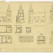
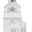
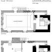
NMRS measured drawing FID/72/1 c.1950 (copy).
(Undated) information in NMRS.
NO60NW 11 NO 61315 07773
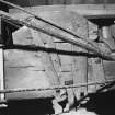
Collection item SMO/C/6/1 probably relates to the Masonic Chair of The Lodge St Andrews, Crail which is housed in the Town Hall, Crail. (AC 22 July 2002).
Field Visit (20 June 1927)
The Tolbooth.
The tolbooth as it existed in 1517 is represented only by the lower part of its tower, which has been considerably altered and has now no features of particular interest. The masonry here is rubble, and a 12th-century capital and base, presumably from the church (cf. NO60NW 2), are built into the south side. The circular windows in the upperpart were inserted in 1776. In the eastern extension of the building, which dates from 1814, there has been inserted a panel bearing the device of the burgh as represented on the Common Seal, a ship with a pennon at the masthead, and a crescent moon and six stars. The top of the panel shows the date 160[2], and the name of the town appears at the foot.
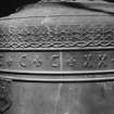
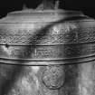
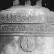
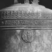
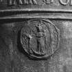
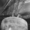
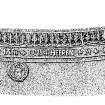
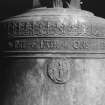
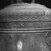
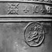
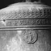
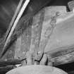
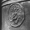
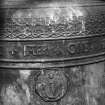
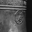
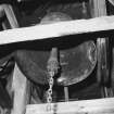
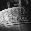
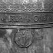
BELL. In the steeple hangs a bell of Dutch origin, measuring 1 foot 11 inches in height and 2 feet 2 inches in diameter at skirt. The canons are complete, but a segment is missing from the sound-bow. The crown is high and bears three annular fillets. On the shoulder a crest-work borders the inscription, each word being separated by a fleur-de-lys, IC BEN GHEGOTEN INT IAER ONS HEEREN MCCCCCXX ("I was cast in the year of our Lord 1520"). Beneath the inscription are medallions, one containing a shield bearing a bordure and three pallets and, on an inescutcheon at fess, a design which is not clear. The other medallions bear representations of the Virgin and Child, and of a Childbearing a Cross on its right shoulder.
SUNDIAL. There is a plain angular dial on the south-east angle of the tower.
RCAHMS 1933, visited 20 June 1927.
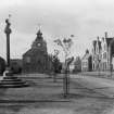
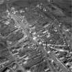
Photographic Survey (1950)
Photographic survey likely by the Ministry of Works c1950.
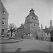
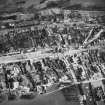
Photographic Survey (1956)
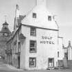
Photographs of buildings in Crail, Fife, by the Scottish National Buildings Record in 1956.
Publication Account (1981)
One of the earliest notices of the tolbooth at Crail occurs in 1517 (Rogers, 1877, 26). The tolbooth as it existed in 1517 is represented only by the lowest part of its tower which has been considerably altered (RCAM, 1933, 64). Extensive alterations were carried out on the tolbooth after November 1598 when the town council ordered the sum of 1000 merks to be 'for bigging of ane towbuth' (Beveridge, 1893, 270). The circular windows in the upper part were added in 1776 and the eastern extension dates from 1814 (RCAM, 1933, 64).
Information from ‘Historic Crail: The Archaeological Implications of Development’ (1981)
Publication Account (1996)
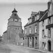
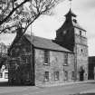
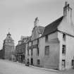
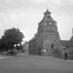
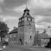
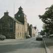
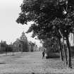
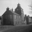
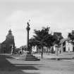
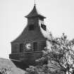
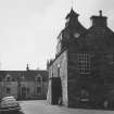
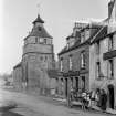
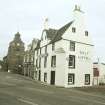
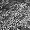
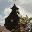
Crail Tolbooth is situated on an island site at the SW end of Marketgate, which originally formed a broad market-place. The rectangular main block, 11.8m in length by 7.9m, is two-storeyed and has a gabled and slated roof. The steeple, situated at the SW end, is 6.2m square and has five storeys, with a distinctive pagoda-like spire 18.3m in overall height.
Although a date of 1517 has been claimed for the rubblebuilt lower portion of the steeple, this part of the building may equally correspond with the 'bigging off ane towbuth' ordered by the burgh council in 1598. To supplement local funds the council applied in 1607 for assistance from the Convention of Royal Burghs. An armorial panel dated 160[-], now built into the NW wall of the main block, may mark the completion of a substantial portion of the building.
Minor alterations were carried out in the mid 18th century, induding the insertion of a doorway in the SE front. This was subsequently obstructed by a forestair and reduced to a window, but it retains a lintel inscribed 1754. In 1776 the Council approved the repairing of the spire 'either by right or mason work'. This involved the insertion of ocular windows at the third stage of the steeple, and the rebuilding in sandstone ashlar of the upper two storeys, which are slightly intaken. Theexisting slated spire with its former belfry-openings was probably built at the same time.
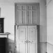
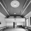
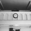
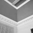
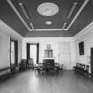
The main block itself, which had become 'old and ruinous' and was of 'limited demensions ', was extensively rebuilt in ashlar in 1814-15, the former date being inscribed on its NE gable. The windows, which have off-set margins, are disposed symmetrically, but those at first-floor level are markedly larger than those below. The SE one in the NE wall has been blocked, probably following litigation with a neighbouring householder which delayed the rebuilding. The council-chamber, which occupies the whole of the first floor, has a coombed ceiling and a SW gallery supported on castiron columns. In the NE wall there is a blocked fireplace with a simple moulded surround.
Although the work carried out in 1776 and 1814 removed much of the early structure, a surviving slit-window between first and second floors at the NE end of the NW face of the steeple may indicate the position of an original staircase. At ground-floor level there has been access from the N angle of the steeple to the main block, at least since 1814, and the original building probably had a doorway in this position.
In 1866 consideration was given to raising the height of the steeple to take the faces of the new clock more visible, but 'the Council did not feel warranted in expending such a sum [£ 180]'. A local architect, John Currie of Elie, was employed in 1887 on alterations which included building a new NW doorway in the steeple and installing a large staircase in its lower storeys. Previously these had been used as cells. Modern fitting out of the ground floor as a library has involved alterations including the insertion of a doorway in the NE end of the SE wall, and a fireplace in the NE wall has been blocked.
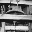
The steeple houses a fine Flemish bell which in 1702 was removed from the parish church in exchange for the smaller town bell of 1614, because of the more central position of the tolbooth. It measures 0.66m in diameter and is inscribed: IC BEN GHEGOTEN INT lAER ONS HEEREN MCCCCCXX ('I was cast in the year of our Lord 1520'), between borders of scrolled decoration. Beneath the inscription there are three medallions, one bearing the arms of Mechelen (Belgium), where the bell was probably cast by Willem van den Ghein. The others show the Saviour as a seated child holding a cross, and the Virgin and Child, an appropriate subject for a bell which originally hung in a church dedicated to St Mary.
A 12th-century scalloped capital and base are built into a lean-to annexe added to the SE wall of the steeple in 1814-15, at a time when the nearby parish church was itself undergoing repairs. There is a plain angular sundial at the E angle of the tower.
Information from ‘Tolbooths and Town-Houses: Civic Architecture in Scotland to 1833’ (1996).


