Windy Edge
Long Cairn (Neolithic)
Site Name Windy Edge
Classification Long Cairn (Neolithic)
Alternative Name(s) Tinnisburn Forest; Windyedge; Whisgills
Canmore ID 67899
Site Number NY48SW 1
NGR NY 42975 83912
NGR Description NY 42940 83920 to NY 43012 83902
Datum OSGB36 - NGR
Permalink http://canmore.org.uk/site/67899
- Council Dumfries And Galloway
- Parish Canonbie
- Former Region Dumfries And Galloway
- Former District Annandale And Eskdale
- Former County Dumfries-shire
NY48SW 1 4295 8391 to 4300 8390.
(Name: NY 4296 8389) Long Cairns (NR)
OS 6" map (1957)
For nearby cairns and standing stone, see NY48SW 6 and NY48SW 7.
A Clyde-type long cairn is situated in an unplanted area near the edge of a Forestry Commission plantation, at 1,000 ft OD. It is about 120 ft long, on average 25 ft wide and 5 ft in maximum height. The width and height are probably greater as the cairn is surrounded by a deep growth of peat and vegetation. Three small, semi-circular shelters have been built by shepherds along the sides of the cairn. The E end of the cairn has probably been truncated as it is erected into a rough wall, part of a circular enclosure 45 ft in diameter, noted by the RCAHMS. This is now obscured to the N and S by trees, but the foundation of its E side may be seen. Four stones of what has been a straight facade remain at the W end of the cairn; the chamber, built of orthostats supplemented by dry-walling, and measuring 21 3/4 ft long, is entered from the centre of the facade.
About 50 ft E of the cairn described above are two mounds of cairn material, probably belonging to one cairn aligned on the same axis as the main cairn. It is greatly robbed and disturbed. It has measured about 72 ft long and roughly 25 ft wide. A few upright stones at the E end indicate that there may have been a chamber or some other structure, but the plan is not evident.
RCAHMS 1920, visited 1920; A S Henshall 1972, visited 1956
NY 4295 8391. The chambered long cairn is as described; it is gradually being encroached upon by vegetation cover.
NY 4300 8390. The spread of cairn material, as stated, is so distrubed that its original form cannot be interpreted from the surviving ground evidence but it was probably once part of the main cairn.
Surveyed at 1:10,000.
Visited by OS (MJF) 1 August 1979.
Scheduled (with NY48SW 7) as 'Whisgills, long cairn and standing stones 2230m W of...'
Information from Historic Scotland, scheduling document dated 23 January 2008.
Field Visit (4 June 1920)
Windy Edge, Long Cairns.
The main constituent of the group is a regular but much disturbed line of heaped stones of fair size, which stretches, over all, for 248 feet from east to west and does not anywhere exceed 5 feet in height. First, from the west, comes a long cairn measuring 115 feet with a breadth varying from 25 to 30 feet, which is rounded at the west end and at the east passes into a circular foundation about 4 feet 6 inches wide where sufficiently preserved. A passage inwards is indicated at the western extremity by slabs set on end, between which it measures 2 feet 8 inches. A surveyors' cairn has been raised above this and blocks further examination. On the north side, however, are the inner halves of two round built chambers, and the same portion of another is obvious, opposite one of these, about half-way along the south side. The latter measures 6 feet 6 inches across the mouth and 5 feet 8 inches from front to back, while the built interior is 4 feet high; it would appear to have been roofed beehive fashion, as there is no sign of large roofing slabs. These chambers were not entered from the inner passage, but apparently directly from the outside of the structure, and may thus be of secondary origin. Some at least must have projected beyond the outer edge of the cairn (cf. RCAHMS 1912, No. 281 [NX26NW 2]). The circular expansion shows no stones larger than the average of those in the cairn proper, but much of the material has been removed. The circle is 45 to 47 feet in diameter, and the interior is marshy.
About 5 feet of clear space intervenes between this structure and that to the east, which seems to consist of two circular heaps, some 30 feet in diameter, connected by a belt of building, on the north of which one chamber is clearly distinguished, while on the south there is a deep bend inwards. This may indicate the position of another chamber enlarged by destruction. An entrance from the east end is suggested by the position of certain upright flat stones.
RCAHMS 1920, visited 4 June 1920.
Field Visit (February 1981)
Windy Edge NY 429 839 NY48SW 1
This ruined Clyde cairn, is aligned WNW-ESE and measures at least 35.5m by 6.5m. There is a flat facade at the WNW end through which the chamber (at least 6.4m in length) is entered.
RCAHMS 1981, visited February 1981
(Stat Acct, xvi, 1795, 85; RCAHMS 1920, pp. 28-30, No. 47; Henshall 1963-72, ii, 420-2)
Measured Survey (29 June 1993)
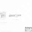
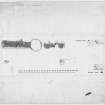
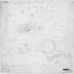
RCAHMS surveyed the long cairn at Windy Edge on 29 June 1993 with plane-table and self-reducing alidade at a scale of 1:125. The plan was redrawn in ink and published at a scale of 1:500 (RCAHMS 1997, Fig. 90).
Field Visit (16 March 1993)
NY48SW 1 4295 8391
This Clyde-type chambered long cairn, which is situated within a clearing in a forestry plantation, is generally as previously described. Most of the visible stone is disposed between two long mounds set on the same axis; probing in the gap between them reveals a stony spread, and it is likely that both originally belonged to a single cairn some 75 metres in length (contra Henshall). The gap in the middle of the cairn has been caused by robbing on a large scale and this is, in part, reflected by old cuttings in the peat around the cairn. The chamber at the W end of the cairn still survives though the eastern of the two septal slabs was not located on the date of visit.
Visited by RCAHMS (JRS, ARW), 16 March 1993.
(A S Henshall 1972).
Listed as long cairn.
RCAHMS 1997.
Laser Scanning (25 March 2016 - 13 April 2016)
NY 4295 8391 (cairn) A survey was undertaken, 25 March – 13 April 2016, of Whisgills Long Cairn and two nearby standing stones in Kershope Forest. The cairn survives as two long piles of stone on an E/W alignment, which may be connected, with overgrown rubble in between, to form one long cairn measuring 75 x 10m at its widest points. Two standing stones, both fallen to some extent, survive to the E and SE of the cairn at the edge of the forestry clearing.
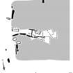
The cairn was laser scanned and photographed to create a comprehensive site plan. Photogrammetry was carried out of the stone with carved initials on the front of the cairn and on the standing stones. 3D visualisations of the stones were created using the photogrammetry models which helped highlight a carved datum point on the furthest N stone.
Archive: NRHE (intended)
Funder: Forestry Commission Scotland
Gemma Hudson and Diana Sproat – AOC Archaeology Group
(Source: DES, Volume 17)
Sbc Note
Visibility: This is an upstanding earthwork or monument.
Information from Scottish Borders Council


