
Scheduled Maintenance
Please be advised that this website will undergo scheduled maintenance on the following dates: •
Tuesday 3rd December 11:00-15:00
During these times, some services may be temporarily unavailable. We apologise for any inconvenience this may cause.
Puddingburn Tower


Earthwork (Period Unassigned), Sheepfold (Period Unassigned), Tower House (Medieval)(Possible)
Site Name Puddingburn Tower
Classification Earthwork (Period Unassigned), Sheepfold (Period Unassigned), Tower House (Medieval)(Possible)
Alternative Name(s) Stanygill Burn; Side
Canmore ID 67874
Site Number NY48NE 5
NGR NY 4548 8578
Datum OSGB36 - NGR
Permalink http://canmore.org.uk/site/67874


- Council Scottish Borders, The
- Parish Castleton
- Former Region Borders
- Former District Roxburgh
- Former County Roxburghshire
NY48NE 5 4548 8577
See also NY48SW 4.
(NY 4548 8577) Earthwork (NR)
OS 6" map (1957)
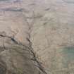
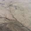
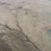
Old House, Stanygill Burn: On a narrow promontory between Black Grain and Dow Sike, at the point where they join Stanygill Burn, there is a sheepfold with two small, rectangular stone structures on its W side. The N and W walls of the more northerly of these show constructional features suggesting they once formed two sides of a small 16th century house. Jeffrey, mentioning a corner of wall "of great thickness and strength" still standing here, calls this "Puddingburn Ha'".
Close by, on the SE, the promontory is crossed by a low eastern bank, without ditch or entrance, which may be contemporary.
RCAHMS 1956, visited 1949; A Jeffrey 1864
Armstrong mentions "Puddingburn Tower" near to Side (NY48NE 6).
W A Armstrong 1960
Field Visit (17 August 1979)
The sheepfold is as described; the 1.2m wide walls contain numerous squared blocks but the supposed 16th century walling cannot be identified. Dr Robson (curator, Hawick Museum) is fairly sure that this is the site of Puddingburn Tower, however, this supposition cannot be verified from ground evidence. There is no trace of a bank on the SE side, however, there are many other sinuous field banks surrounding the sheepfold but none appear to have any special significance.
Visited by OS (MJF) 17 August 1979.
Field Visit (16 April 1996)
The remains of this rectangular tower-house, situated on a promontory at the confluence of the Dow Sike with the Stanygill Burn, have been incorporated within a more recent sheep stell. The surviving portion of the tower wall measures 6.6m from N to S by 5m transversely, is 1.3m thick and stands to a maximum height of 1.5m. What may be the S end wall is marked by a low bank, but there is no trace of the E wall. A splayed window is visible in the N wall. To the SW of the tower there is a curving section of bank, 2.5m in thickness; its function is unknown.
(LID96 319)
Visited by RCAHMS (JBS) 16 April 1996
Sbc Note
Visibility: Upstanding building, which may not be intact.
Information from Scottish Borders Council

